Saint-Max elevation
Saint-Max (Grand Est, Meurthe-et-Moselle), France elevation is 207 meters and Saint-Max elevation in feet is 679 ft above sea level [src 1]. Saint-Max is a populated place (feature code) with elevation that is 33 meters (108 ft) bigger than average city elevation in France.
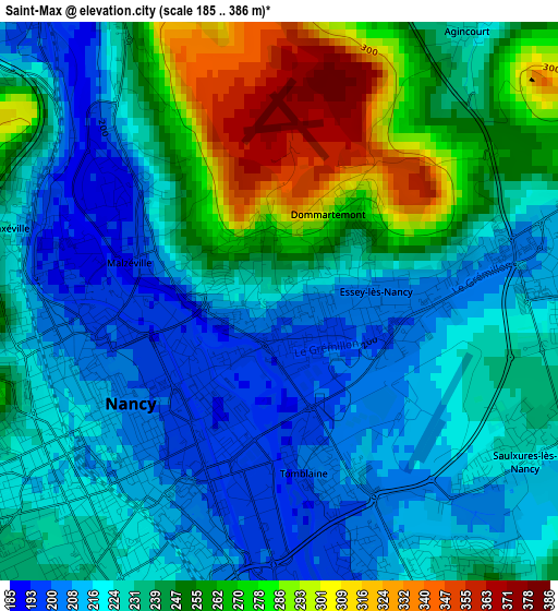
Below is the Elevation map of Saint-Max, which displays elevation range with different colors. Scale of the first map is from 185 to 386 m (607 to 1266 ft) with average elevation of 237 meters (=778 ft) [note 1]
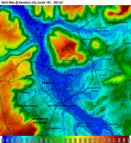
These maps also provides idea of topography and contour of this city, they are displayed at different zoom levels. More info about maps, scale and edge coordinates you can find below images.
| \ | Map #1 | Map #2 | Topo.Map |
| Scale [m] | 185..386 m | 183..402 m | × |
| Scale [ft] | 607..1266 ft | 600..1319 ft | × |
| Average | 237 m = 778 ft | 255.2 m = 837 ft | × |
| Width | 6.45 km = 4 mi | 12.9 km = 8 mi | 206.4 km = 128.3 mi |
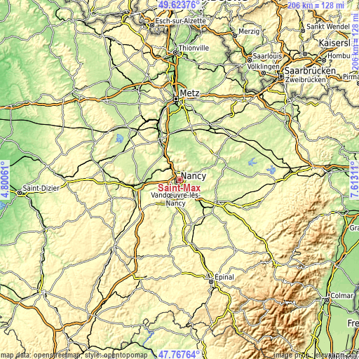
| Height | 6.45 km = 4 mi | 12.9 km = 8 mi | 206.4 km = 128.3 mi |
| ↑Max Latitude | 48.733253° | 48.76223° | 49.62376° |
| Latitude at center | 48.70426° | 48.70426° | 48.70426° |
| ↓Min Latitude | 48.67525° | 48.646224° | 47.76764° |
| ← Min Longitude | 6.162915° | 6.118969° | 4.80061° |
| Longitude center | 6.20686° | 6.20686° | 6.20686° |
| →Max Longitude | 6.250805° | 6.294751° | 7.61311° |
Nearby cities:
Cities around Saint-Max sort by population:
• Nancy elevation 212 m
2.7 km,  216°
216°
• Laxou 240 m
4.8 km,  241°
241°
• Jarville-la-Malgrange 200 m
4.2 km,  184°
184°
• Maxéville 198 m
3.1 km,  288°
288°
• Malzéville 272 m
1.9 km,  298°
298°
• Essey-lès-Nancy 212 m
1.5 km,  86°
86°
• Tomblaine 210 m
2.4 km,  163°
163°
• Champigneulles 193 m
4.7 km,  315°
315°
• Seichamps 244 m
4.2 km,  73°
73°
• Pulnoy 222 m
3.7 km, 91°
• Saulxures-lès-Nancy 224 m
3.2 km,  122°
122°
• Lay-Saint-Christophe 202 m
5.1 km,  352°
352°
Multilingual:
 En español:
Saint-Max elevación 207 m.
 En France:
Saint-Max élévation 207 m.
 Auf Deutsch:
Saint-Max höhe über dem Meeresspiegel ist 207 m.

Sources and notes:
- [note 1] Map square and city borders are not equal. Map elevation data is calculated only from area inside that square.
- [src 1] Elevation data from geonames database provided with same terms of usage.
- [src 2] The elevation map of Saint-Max is generated using elevation data from NASA's 3 arcsec (90m) resolution SRTM data.
- [src 3] Base (background) map © OpenStreetMap contributors tiles are generated by Geofabrik and OpenTopoMap.
Copyright & License:
This Saint-Max Elevation Map is licensed under CC BY-SA. You may reuse any part from this page, if you give a proper credit by linking to this URL:
 More info on terms of use page.