Lavaur elevation
Lavaur (Occitanie, Tarn), France elevation is 148 meters and Lavaur elevation in feet is 486 ft above sea level [src 1]. Lavaur is a populated place (feature code) with elevation that is 26 meters (85 ft) smaller than average city elevation in France.
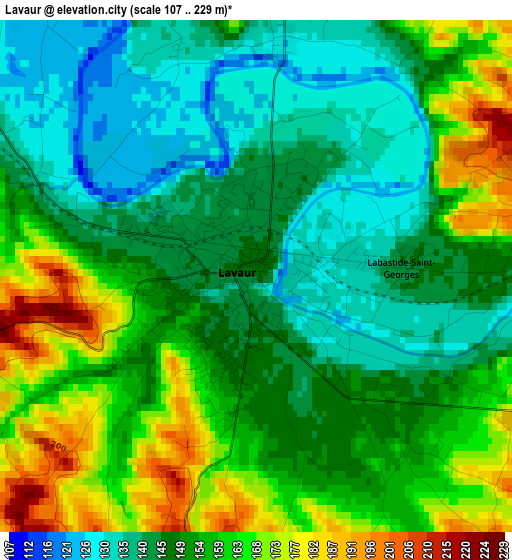
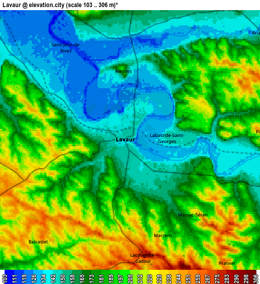
Below is the Elevation map of Lavaur, which displays elevation range with different colors. Scale of the first map is from 107 to 229 m (351 to 751 ft) with average elevation of 152.1 meters (=499 ft) [note 1]
These maps also provides idea of topography and contour of this city, they are displayed at different zoom levels. More info about maps, scale and edge coordinates you can find below images.
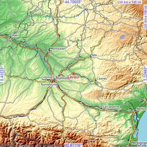
| \ | Map #1 | Map #2 | Topo.Map |
| Scale [m] | 107..229 m | 103..306 m | × |
| Scale [ft] | 351..751 ft | 338..1004 ft | × |
| Average | 152.1 m = 499 ft | 178.1 m = 584 ft | × |
| Width | 7.07 km = 4.4 mi | 14.13 km = 8.8 mi | 226.1 km = 140.5 mi |
| Height | 7.07 km = 4.4 mi | 14.13 km = 8.8 mi | 226.1 km = 140.5 mi |
| ↑Max Latitude | 43.730233° | 43.76198° | 44.70655° |
| Latitude at center | 43.69847° | 43.69847° | 43.69847° |
| ↓Min Latitude | 43.66669° | 43.634893° | 42.67316° |
| ← Min Longitude | 1.774635° | 1.730689° | 0.41233° |
| Longitude center | 1.81858° | 1.81858° | 1.81858° |
| →Max Longitude | 1.862525° | 1.906471° | 3.22483° |
Nearby cities:
Cities around Lavaur sort by population:
• Graulhet elevation 159 m
15.7 km,  61°
61°
• Saint-Sulpice-la-Pointe 115 m
13.7 km,  308°
308°
• Rabastens 129 m
16 km,  331°
331°
• Lisle-sur-Tarn 132 m
17.1 km,  357°
357°
• Montastruc-la-Conseillère 230 m
18.5 km,  277°
277°
• Verfeil 229 m
13.3 km,  250°
250°
• Coufouleux 118 m
15 km, 331°
• Buzet-sur-Tarn 114 m
17.4 km,  301°
301°
• Briatexte 143 m
9.4 km,  50°
50°
• Labastide-Saint-Georges 145 m
2.2 km,  86°
86°
• Giroussens 182 m
7.8 km, 334°
• Saint-Paul-Cap-de-Joux 162 m
13.8 km,  113°
113°
Multilingual:
 En español:
Lavaur elevación 148 m.
 En France:
Lavaur élévation 148 m.


Sources and notes:
- [note 1] Map square and city borders are not equal. Map elevation data is calculated only from area inside that square.
- [src 1] Elevation data from geonames database provided with same terms of usage.
- [src 2] The elevation map of Lavaur is generated using elevation data from NASA's 3 arcsec (90m) resolution SRTM data.
- [src 3] Base (background) map © OpenStreetMap contributors tiles are generated by Geofabrik and OpenTopoMap.
Copyright & License:
This Lavaur Elevation Map is licensed under CC BY-SA. You may reuse any part from this page, if you give a proper credit by linking to this URL:
 More info on terms of use page.