Saint-Sulpice-la-Pointe elevation
Saint-Sulpice-la-Pointe (Occitanie, Tarn), France elevation is 115 meters and Saint-Sulpice-la-Pointe elevation in feet is 377 ft above sea level [src 1]. Saint-Sulpice-la-Pointe is a populated place (feature code) with elevation that is 59 meters (194 ft) smaller than average city elevation in France.
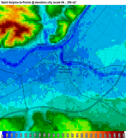
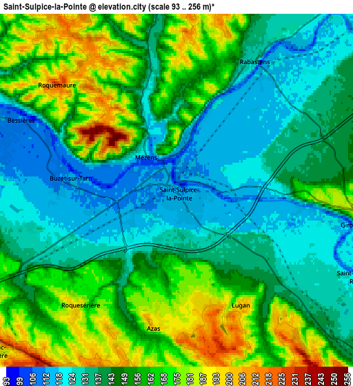
Below is the Elevation map of Saint-Sulpice-la-Pointe, which displays elevation range with different colors. Scale of the first map is from 94 to 256 m (308 to 840 ft) with average elevation of 130.9 meters (=429 ft) [note 1]
These maps also provides idea of topography and contour of this city, they are displayed at different zoom levels. More info about maps, scale and edge coordinates you can find below images.
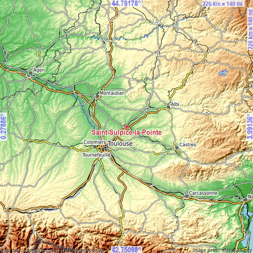
| \ | Map #1 | Map #2 | Topo.Map |
| Scale [m] | 94..256 m | 93..256 m | × |
| Scale [ft] | 308..840 ft | 305..840 ft | × |
| Average | 130.9 m = 429 ft | 149.1 m = 489 ft | × |
| Width | 7.06 km = 4.4 mi | 14.11 km = 8.8 mi | 225.8 km = 140.3 mi |
| Height | 7.06 km = 4.4 mi | 14.11 km = 8.8 mi | 225.8 km = 140.3 mi |
| ↑Max Latitude | 43.806723° | 43.838429° | 44.78178° |
| Latitude at center | 43.775° | 43.775° | 43.775° |
| ↓Min Latitude | 43.74326° | 43.711504° | 42.75098° |
| ← Min Longitude | 1.641165° | 1.597219° | 0.27886° |
| Longitude center | 1.68511° | 1.68511° | 1.68511° |
| →Max Longitude | 1.729055° | 1.773001° | 3.09136° |
Nearby cities:
Cities around Saint-Sulpice-la-Pointe sort by population:
• Rabastens elevation 129 m
6.4 km,  29°
29°
• Lisle-sur-Tarn 132 m
13.3 km,  49°
49°
• Montastruc-la-Conseillère 230 m
9.8 km,  231°
231°
• Verfeil 229 m
13.1 km,  187°
187°
• Bessières 109 m
6.9 km,  292°
292°
• Coufouleux 118 m
5.9 km,  38°
38°
• Buzet-sur-Tarn 114 m
4.2 km,  277°
277°
• Gragnague 148 m
13.2 km,  217°
217°
• Montjoire 216 m
12.2 km,  266°
266°
• Giroussens 182 m
7.4 km,  101°
101°
• Garidech 192 m
12.3 km, 234°
• Paulhac 182 m
10.5 km,  258°
258°
Multilingual:
 En español:
Saint-Sulpice-la-Pointe elevación 115 m.
 En France:
Saint-Sulpice-la-Pointe élévation 115 m.
 Auf Deutsch:
Saint-Sulpice-la-Pointe höhe über dem Meeresspiegel ist 115 m.
 На русском:
Сен-Сюльпис-ла-Пуант высота над уровнем моря 115 м
Sources and notes:
- [note 1] Map square and city borders are not equal. Map elevation data is calculated only from area inside that square.
- [src 1] Elevation data from geonames database provided with same terms of usage.
- [src 2] The elevation map of Saint-Sulpice-la-Pointe is generated using elevation data from NASA's 3 arcsec (90m) resolution SRTM data.
- [src 3] Base (background) map © OpenStreetMap contributors tiles are generated by Geofabrik and OpenTopoMap.
Copyright & License:
This Saint-Sulpice-la-Pointe Elevation Map is licensed under CC BY-SA. You may reuse any part from this page, if you give a proper credit by linking to this URL:
 More info on terms of use page.