Paulhac elevation
Paulhac (Occitanie, Haute-Garonne), France elevation is 182 meters and Paulhac elevation in feet is 597 ft above sea level [src 1]. Paulhac is a populated place (feature code) with elevation that is 8 meters (26 ft) bigger than average city elevation in France.
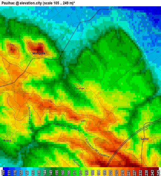
Below is the Elevation map of Paulhac, which displays elevation range with different colors. Scale of the first map is from 105 to 249 m (344 to 817 ft) with average elevation of 170.3 meters (=559 ft) [note 1]
These maps also provides idea of topography and contour of this city, they are displayed at different zoom levels. More info about maps, scale and edge coordinates you can find below images.
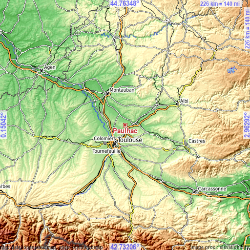
| \ | Map #1 | Topo.Map |
| Scale [m] | 105..249 m | × |
| Scale [ft] | 344..817 ft | × |
| Average | 170.3 m = 559 ft | × |
| Width | 7.06 km = 4.4 mi | 225.9 km = 140.4 mi |
| Height | 7.06 km = 4.4 mi | 225.9 km = 140.4 mi |
| ↑Max Latitude | 43.788123° | 44.76348° |
| Latitude at center | 43.75639° | 43.75639° |
| ↓Min Latitude | 43.72464° | 42.73206° |
| ← Min Longitude | 1.512725° | 0.15042° |
| Longitude center | 1.55667° | 1.55667° |
| →Max Longitude | 1.600615° | 2.96292° |
Nearby cities:
Cities around Paulhac sort by population:
• Castelmaurou elevation 230 m
9 km,  192°
192°
• Montastruc-la-Conseillère 230 m
4.9 km,  146°
146°
• Bessières 109 m
6.2 km,  40°
40°
• Montberon 182 m
7.7 km,  233°
233°
• Lapeyrouse-Fossat 186 m
7.3 km,  210°
210°
• Saint-Loup-Cammas 211 m
8.9 km,  222°
222°
• Buzet-sur-Tarn 114 m
6.7 km,  67°
67°
• Gragnague 148 m
8.7 km,  165°
165°
• Labastide-Saint-Sernin 139 m
7.3 km,  253°
253°
• Vacquiers 187 m
6.5 km,  290°
290°
• Montjoire 216 m
2.3 km,  307°
307°
• Garidech 192 m
5.1 km,  176°
176°
Multilingual:
 En español:
Paulhac elevación 182 m.
 En France:
Paulhac élévation 182 m.


Sources and notes:
- [note 1] Map square and city borders are not equal. Map elevation data is calculated only from area inside that square.
- [src 1] Elevation data from geonames database provided with same terms of usage.
- [src 2] The elevation map of Paulhac is generated using elevation data from NASA's 3 arcsec (90m) resolution SRTM data.
- [src 3] Base (background) map © OpenStreetMap contributors tiles are generated by Geofabrik and OpenTopoMap.
Copyright & License:
This Paulhac Elevation Map is licensed under CC BY-SA. You may reuse any part from this page, if you give a proper credit by linking to this URL:
 More info on terms of use page.