Lavelanet elevation
Lavelanet (Occitanie, Département de l'Ariège), France elevation is 529 meters and Lavelanet elevation in feet is 1736 ft above sea level [src 1]. Lavelanet is a populated place (feature code) with elevation that is 355 meters (1165 ft) bigger than average city elevation in France.
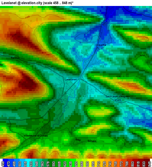
Below is the Elevation map of Lavelanet, which displays elevation range with different colors. Scale of the first map is from 458 to 848 m (1503 to 2782 ft) with average elevation of 612.6 meters (=2010 ft) [note 1]
These maps also provides idea of topography and contour of this city, they are displayed at different zoom levels. More info about maps, scale and edge coordinates you can find below images.
| \ | Map #1 | Map #2 | Topo.Map |
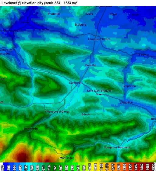
| Scale [m] | 458..848 m | 353..1533 m | × |
| Scale [ft] | 1503..2782 ft | 1158..5030 ft | × |
| Average | 612.6 m = 2010 ft | 631.9 m = 2073 ft | × |
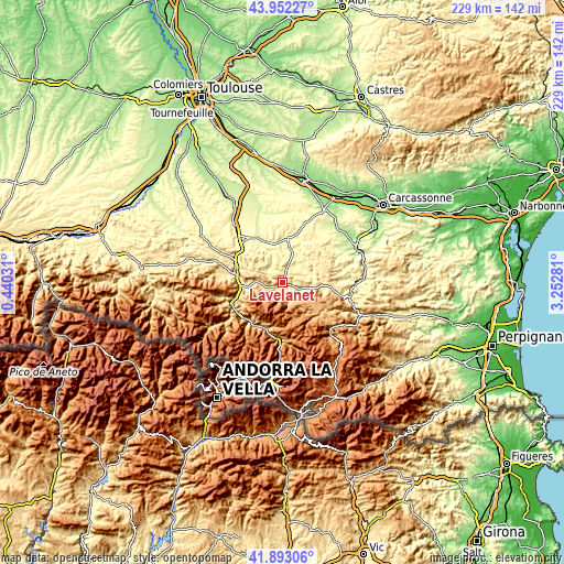
| Width | 7.16 km = 4.4 mi | 14.31 km = 8.9 mi | 229 km = 142.3 mi |
| Height | 7.16 km = 4.4 mi | 14.31 km = 8.9 mi | 229 km = 142.3 mi |
| ↑Max Latitude | 42.963437° | 42.995587° | 43.95227° |
| Latitude at center | 42.93127° | 42.93127° | 42.93127° |
| ↓Min Latitude | 42.899086° | 42.866885° | 41.89306° |
| ← Min Longitude | 1.802615° | 1.758669° | 0.44031° |
| Longitude center | 1.84656° | 1.84656° | 1.84656° |
| →Max Longitude | 1.890505° | 1.934451° | 3.25281° |
Nearby cities:
Cities around Lavelanet sort by population:
• Foix elevation 392 m
19.7 km,  279°
279°
• Tarascon-sur-Ariège 478 m
22 km,  244°
244°
• Mirepoix 310 m
17.5 km,  7°
7°
• Varilhes 339 m
21.8 km,  305°
305°
• Laroque-d’Olmes 454 m
4.4 km,  22°
22°
• Verniolle 323 m
23.2 km,  316°
316°
• Montgaillard 436 m
17.4 km,  270°
270°
• Saint-Paul-de-Jarrat 467 m
15.8 km,  263°
263°
• Chalabre 375 m
14.1 km,  66°
66°
• Bélesta 500 m
7.8 km,  114°
114°
• Villeneuve-d’Olmes 609 m
3.6 km,  218°
218°
• Mercus-Garrabet 485 m
18.7 km,  251°
251°
Multilingual:
 En español:
Lavelanet elevación 529 m.
 En France:
Lavelanet élévation 529 m.
 Auf Deutsch:
Lavelanet höhe über dem Meeresspiegel ist 529 m.

Sources and notes:
- [note 1] Map square and city borders are not equal. Map elevation data is calculated only from area inside that square.
- [src 1] Elevation data from geonames database provided with same terms of usage.
- [src 2] The elevation map of Lavelanet is generated using elevation data from NASA's 3 arcsec (90m) resolution SRTM data.
- [src 3] Base (background) map © OpenStreetMap contributors tiles are generated by Geofabrik and OpenTopoMap.
Copyright & License:
This Lavelanet Elevation Map is licensed under CC BY-SA. You may reuse any part from this page, if you give a proper credit by linking to this URL:
 More info on terms of use page.