Le Bugue elevation
Le Bugue (Nouvelle-Aquitaine, Dordogne), France elevation is 64 meters and Le Bugue elevation in feet is 210 ft above sea level [src 1]. Le Bugue is a populated place (feature code) with elevation that is 110 meters (361 ft) smaller than average city elevation in France.
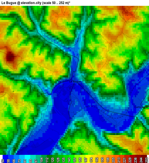
Below is the Elevation map of Le Bugue, which displays elevation range with different colors. Scale of the first map is from 50 to 252 m (164 to 827 ft) with average elevation of 125.2 meters (=411 ft) [note 1]
These maps also provides idea of topography and contour of this city, they are displayed at different zoom levels. More info about maps, scale and edge coordinates you can find below images.
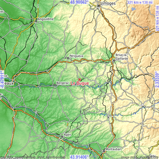
| \ | Map #1 | Topo.Map |
| Scale [m] | 50..252 m | × |
| Scale [ft] | 164..827 ft | × |
| Average | 125.2 m = 411 ft | × |
| Width | 6.92 km = 4.3 mi | 221.4 km = 137.6 mi |
| Height | 6.92 km = 4.3 mi | 221.4 km = 137.6 mi |
| ↑Max Latitude | 44.94958° | 45.90562° |
| Latitude at center | 44.91847° | 44.91847° |
| ↓Min Latitude | 44.887343° | 43.91406° |
| ← Min Longitude | 0.883195° | -0.47911° |
| Longitude center | 0.92714° | 0.92714° |
| →Max Longitude | 0.971085° | 2.33339° |
Nearby cities:
Cities around Le Bugue sort by population:
• Sarlat-la-Canéda elevation 147 m
23 km,  98°
98°
• Boulazac 235 m
26.1 km,  327°
327°
• Montignac 80 m
24.6 km,  48°
48°
• Lalinde 44 m
18 km,  239°
239°
• Le Buisson-de-Cadouin 56 m
7.7 km,  186°
186°
• Saint-Cyprien 69 m
10.5 km,  121°
121°
• Vergt 130 m
20.4 km,  306°
306°
• Rouffignac-Saint-Cernin-de-Reilhac 288 m
15 km,  12°
12°
• Belvès 174 m
17 km,  158°
158°
• Beaumont-du-Périgord 140 m
21 km,  216°
216°
• Cénac-et-Saint-Julien 89 m
25.6 km, 121°
• Domme 211 m
26.1 km, 119°
Multilingual:
 En español:
Le Bugue elevación 64 m.
 En France:
Le Bugue élévation 64 m.


Sources and notes:
- [note 1] Map square and city borders are not equal. Map elevation data is calculated only from area inside that square.
- [src 1] Elevation data from geonames database provided with same terms of usage.
- [src 2] The elevation map of Le Bugue is generated using elevation data from NASA's 3 arcsec (90m) resolution SRTM data.
- [src 3] Base (background) map © OpenStreetMap contributors tiles are generated by Geofabrik and OpenTopoMap.
Copyright & License:
This Le Bugue Elevation Map is licensed under CC BY-SA. You may reuse any part from this page, if you give a proper credit by linking to this URL:
 More info on terms of use page.