Les Chères elevation
Les Chères (Auvergne-Rhône-Alpes, Département du Rhône), France elevation is 202 meters and Les Chères elevation in feet is 663 ft above sea level [src 1]. Les Chères is a populated place (feature code) with elevation that is 28 meters (92 ft) bigger than average city elevation in France.
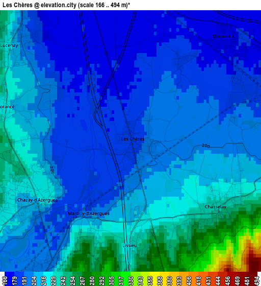
Below is the Elevation map of Les Chères, which displays elevation range with different colors. Scale of the first map is from 166 to 494 m (545 to 1621 ft) with average elevation of 207.9 meters (=682 ft) [note 1]
These maps also provides idea of topography and contour of this city, they are displayed at different zoom levels. More info about maps, scale and edge coordinates you can find below images.
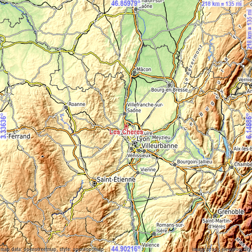
| \ | Map #1 | Topo.Map |
| Scale [m] | 166..494 m | × |
| Scale [ft] | 545..1621 ft | × |
| Average | 207.9 m = 682 ft | × |
| Width | 6.8 km = 4.2 mi | 217.7 km = 135.3 mi |
| Height | 6.8 km = 4.2 mi | 217.7 km = 135.3 mi |
| ↑Max Latitude | 45.920179° | 46.85979° |
| Latitude at center | 45.8896° | 45.8896° |
| ↓Min Latitude | 45.859004° | 44.90216° |
| ← Min Longitude | 4.698665° | 3.33636° |
| Longitude center | 4.74261° | 4.74261° |
| →Max Longitude | 4.786555° | 6.14886° |
Nearby cities:
Cities around Les Chères sort by population:
• Trévoux elevation 245 m
6.3 km,  20°
20°
• Anse 169 m
5.4 km,  340°
340°
• Lissieu 276 m
2.7 km,  180°
180°
• Limonest 409 m
6.3 km,  158°
158°
• Quincieux 176 m
3.8 km,  44°
44°
• Albigny-sur-Saône 171 m
7.5 km,  109°
109°
• Chasselay 280 m
2.9 km,  126°
126°
• Massieux 232 m
7.3 km,  72°
72°
• Lozanne 207 m
6 km,  233°
233°
• Morancé 223 m
3.4 km,  286°
286°
• Lucenay 211 m
4 km,  309°
309°
• Charnay 415 m
5.8 km,  271°
271°
Multilingual:
 En español:
Les Chères elevación 202 m.
 En France:
Les Chères élévation 202 m.
 Auf Deutsch:
Les Chères höhe über dem Meeresspiegel ist 202 m.

Sources and notes:
- [note 1] Map square and city borders are not equal. Map elevation data is calculated only from area inside that square.
- [src 1] Elevation data from geonames database provided with same terms of usage.
- [src 2] The elevation map of Les Chères is generated using elevation data from NASA's 3 arcsec (90m) resolution SRTM data.
- [src 3] Base (background) map © OpenStreetMap contributors tiles are generated by Geofabrik and OpenTopoMap.
Copyright & License:
This Les Chères Elevation Map is licensed under CC BY-SA. You may reuse any part from this page, if you give a proper credit by linking to this URL:
 More info on terms of use page.