Trévoux elevation
Trévoux (Auvergne-Rhône-Alpes, Département de l'Ain), France elevation is 245 meters and Trévoux elevation in feet is 804 ft above sea level [src 1]. Trévoux is a populated place (feature code) with elevation that is 71 meters (233 ft) bigger than average city elevation in France.
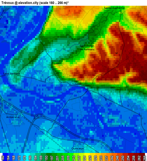
Below is the Elevation map of Trévoux, which displays elevation range with different colors. Scale of the first map is from 160 to 266 m (525 to 873 ft) with average elevation of 191.9 meters (=630 ft) [note 1]
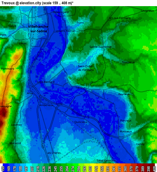
These maps also provides idea of topography and contour of this city, they are displayed at different zoom levels. More info about maps, scale and edge coordinates you can find below images.
| \ | Map #1 | Map #2 | Topo.Map |
| Scale [m] | 160..266 m | 159..408 m | × |
| Scale [ft] | 525..873 ft | 522..1339 ft | × |
| Average | 191.9 m = 630 ft | 217.7 m = 714 ft | × |
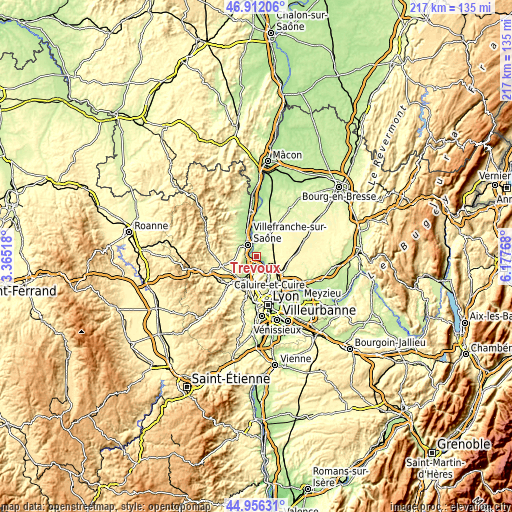
| Width | 6.8 km = 4.2 mi | 13.59 km = 8.4 mi | 217.5 km = 135.1 mi |
| Height | 6.8 km = 4.2 mi | 13.59 km = 8.4 mi | 217.4 km = 135.1 mi |
| ↑Max Latitude | 45.97336° | 46.003893° | 46.91206° |
| Latitude at center | 45.94281° | 45.94281° | 45.94281° |
| ↓Min Latitude | 45.912243° | 45.881659° | 44.95631° |
| ← Min Longitude | 4.727485° | 4.683539° | 3.36518° |
| Longitude center | 4.77143° | 4.77143° | 4.77143° |
| →Max Longitude | 4.815375° | 4.859321° | 6.17768° |
Nearby cities:
Cities around Trévoux sort by population:
• Jassans-Riottier elevation 238 m
4.4 km,  349°
349°
• Anse 169 m
4.1 km,  258°
258°
• Reyrieux 215 m
3.4 km,  103°
103°
• Quincieux 176 m
3.3 km,  172°
172°
• Massieux 232 m
6 km,  127°
127°
• Frans 245 m
5.6 km,  5°
5°
• Misérieux 250 m
4.8 km,  42°
42°
• Pommiers 315 m
6.3 km,  282°
282°
• Saint-Didier-de-Formans 244 m
2.1 km,  27°
27°
• Lucenay 211 m
6.3 km,  237°
237°
• Sainte-Euphémie 222 m
3.8 km, 33°
• Les Chères 202 m
6.3 km,  200°
200°
Multilingual:
 En español:
Trévoux elevación 245 m.
 En France:
Trévoux élévation 245 m.


Sources and notes:
- [note 1] Map square and city borders are not equal. Map elevation data is calculated only from area inside that square.
- [src 1] Elevation data from geonames database provided with same terms of usage.
- [src 2] The elevation map of Trévoux is generated using elevation data from NASA's 3 arcsec (90m) resolution SRTM data.
- [src 3] Base (background) map © OpenStreetMap contributors tiles are generated by Geofabrik and OpenTopoMap.
Copyright & License:
This Trévoux Elevation Map is licensed under CC BY-SA. You may reuse any part from this page, if you give a proper credit by linking to this URL:
 More info on terms of use page.