Le Thillot elevation
Le Thillot (Grand Est, Vosges), France elevation is 485 meters and Le Thillot elevation in feet is 1591 ft above sea level [src 1]. Le Thillot is a populated place (feature code) with elevation that is 311 meters (1020 ft) bigger than average city elevation in France.
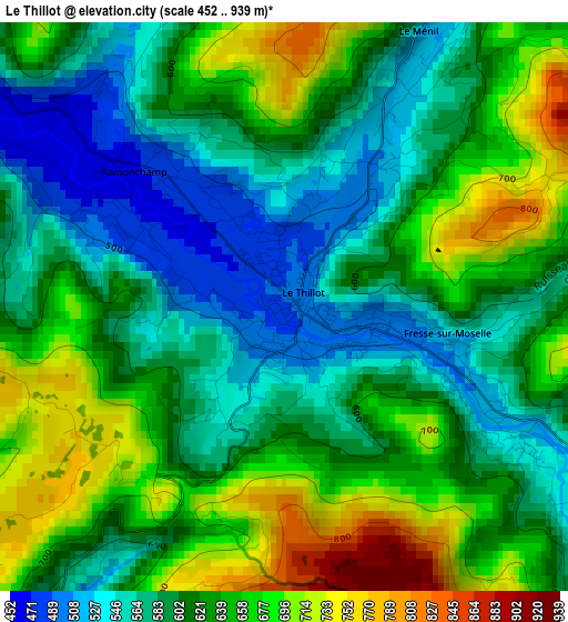
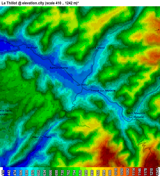
Below is the Elevation map of Le Thillot, which displays elevation range with different colors. Scale of the first map is from 452 to 939 m (1483 to 3081 ft) with average elevation of 620 meters (=2034 ft) [note 1]
These maps also provides idea of topography and contour of this city, they are displayed at different zoom levels. More info about maps, scale and edge coordinates you can find below images.
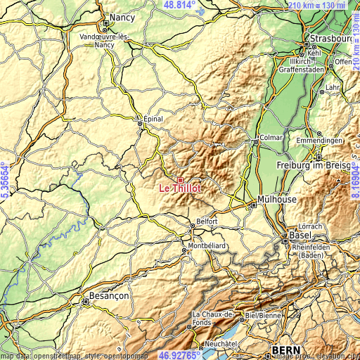
| \ | Map #1 | Map #2 | Topo.Map |
| Scale [m] | 452..939 m | 410..1242 m | × |
| Scale [ft] | 1483..3081 ft | 1345..4075 ft | × |
| Average | 620 m = 2034 ft | 704.3 m = 2311 ft | × |
| Width | 6.55 km = 4.1 mi | 13.11 km = 8.1 mi | 209.7 km = 130.3 mi |
| Height | 6.55 km = 4.1 mi | 13.11 km = 8.1 mi | 209.7 km = 130.3 mi |
| ↑Max Latitude | 47.908875° | 47.938324° | 48.814° |
| Latitude at center | 47.87941° | 47.87941° | 47.87941° |
| ↓Min Latitude | 47.849928° | 47.820429° | 46.92765° |
| ← Min Longitude | 6.718845° | 6.674899° | 5.35654° |
| Longitude center | 6.76279° | 6.76279° | 6.76279° |
| →Max Longitude | 6.806735° | 6.850681° | 8.16904° |
Nearby cities:
Cities around Le Thillot sort by population:
• Cornimont elevation 505 m
10.3 km,  29°
29°
• Vagney 406 m
14.5 km,  346°
346°
• Rupt-sur-Moselle 424 m
8.9 km,  302°
302°
• Saulxures-sur-Moselotte 460 m
7.8 km,  4°
4°
• Fresse-sur-Moselle 512 m
1.8 km,  102°
102°
• Ramonchamp 474 m
2.3 km,  316°
316°
• Bussang 600 m
6.7 km,  85°
85°
• Saint-Maurice-sur-Moselle 553 m
5.2 km,  116°
116°
• Lepuix 509 m
13.8 km,  163°
163°
• Le Ménil 519 m
3.2 km, 27°
• Vecoux 407 m
14.4 km, 319°
• Plancher-les-Mines 495 m
13.2 km,  186°
186°
Multilingual:
 En español:
Le Thillot elevación 485 m.
 En France:
Le Thillot élévation 485 m.
 Auf Deutsch:
Le Thillot höhe über dem Meeresspiegel ist 485 m.

Sources and notes:
- [note 1] Map square and city borders are not equal. Map elevation data is calculated only from area inside that square.
- [src 1] Elevation data from geonames database provided with same terms of usage.
- [src 2] The elevation map of Le Thillot is generated using elevation data from NASA's 3 arcsec (90m) resolution SRTM data.
- [src 3] Base (background) map © OpenStreetMap contributors tiles are generated by Geofabrik and OpenTopoMap.
Copyright & License:
This Le Thillot Elevation Map is licensed under CC BY-SA. You may reuse any part from this page, if you give a proper credit by linking to this URL:
 More info on terms of use page.