Loudéac elevation
Loudéac (Brittany, Département des Côtes-d’Armor), France elevation is 166 meters and Loudéac elevation in feet is 545 ft above sea level [src 1]. Loudéac is a populated place (feature code) with elevation that is 8 meters (26 ft) smaller than average city elevation in France.
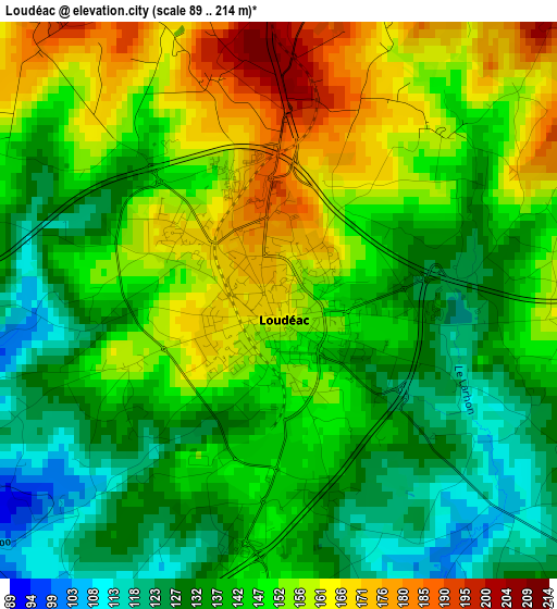
Below is the Elevation map of Loudéac, which displays elevation range with different colors. Scale of the first map is from 89 to 214 m (292 to 702 ft) with average elevation of 145.3 meters (=477 ft) [note 1]
These maps also provides idea of topography and contour of this city, they are displayed at different zoom levels. More info about maps, scale and edge coordinates you can find below images.
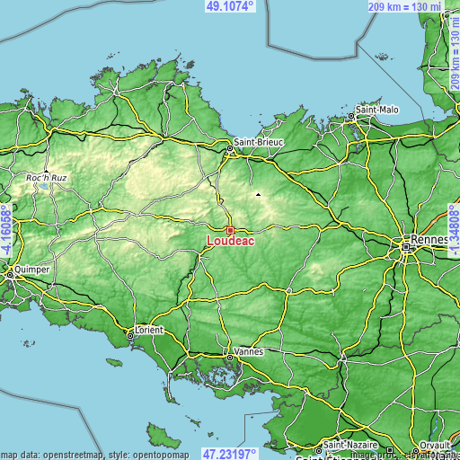
| \ | Map #1 | Map #2 | Topo.Map |
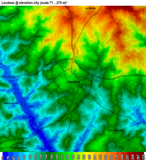
| Scale [m] | 89..214 m | 71..275 m | × |
| Scale [ft] | 292..702 ft | 233..902 ft | × |
| Average | 145.3 m = 477 ft | 150 m = 492 ft | × |
| Width | 6.52 km = 4.1 mi | 13.03 km = 8.1 mi | 208.5 km = 129.6 mi |
| Height | 6.52 km = 4.1 mi | 13.03 km = 8.1 mi | 208.5 km = 129.6 mi |
| ↑Max Latitude | 48.207555° | 48.236833° | 49.1074° |
| Latitude at center | 48.17826° | 48.17826° | 48.17826° |
| ↓Min Latitude | 48.148948° | 48.11962° | 47.23197° |
| ← Min Longitude | -2.798275° | -2.842221° | -4.16058° |
| Longitude center | -2.75433° | -2.75433° | -2.75433° |
| →Max Longitude | -2.710385° | -2.666439° | -1.34808° |
Nearby cities:
Cities around Loudéac sort by population:
• Noyal-Pontivy elevation 137 m
15.7 km,  217°
217°
• Plémet 147 m
11.9 km,  91°
91°
• La Motte 221 m
6.4 km,  14°
14°
• Plouguenast 163 m
12.1 km,  17°
17°
• Plessala 198 m
14.8 km,  42°
42°
• Rohan 67 m
12.2 km,  178°
178°
• Crédin 130 m
16 km, 183°
• Saint-Barnabé 143 m
5.9 km,  141°
141°
• Trévé 161 m
4.7 km,  322°
322°
• Saint-Caradec 93 m
6.9 km,  285°
285°
• Plumieux 131 m
15.2 km,  123°
123°
• Saint-Gonnery 130 m
7.6 km, 218°
Multilingual:
 En español:
Loudéac elevación 166 m.
 En France:
Loudéac élévation 166 m.


Sources and notes:
- [note 1] Map square and city borders are not equal. Map elevation data is calculated only from area inside that square.
- [src 1] Elevation data from geonames database provided with same terms of usage.
- [src 2] The elevation map of Loudéac is generated using elevation data from NASA's 3 arcsec (90m) resolution SRTM data.
- [src 3] Base (background) map © OpenStreetMap contributors tiles are generated by Geofabrik and OpenTopoMap.
Copyright & License:
This Loudéac Elevation Map is licensed under CC BY-SA. You may reuse any part from this page, if you give a proper credit by linking to this URL:
 More info on terms of use page.