Maclas elevation
Maclas (Auvergne-Rhône-Alpes, Département de la Loire), France elevation is 390 meters and Maclas elevation in feet is 1280 ft above sea level [src 1]. Maclas is a populated place (feature code) with elevation that is 216 meters (709 ft) bigger than average city elevation in France.
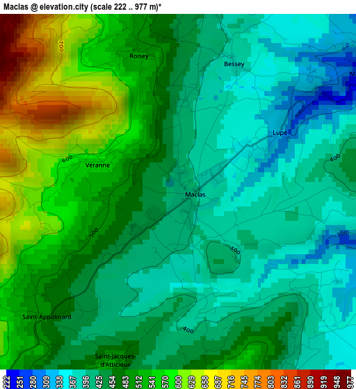
Below is the Elevation map of Maclas, which displays elevation range with different colors. Scale of the first map is from 222 to 977 m (728 to 3205 ft) with average elevation of 465.5 meters (=1527 ft) [note 1]
These maps also provides idea of topography and contour of this city, they are displayed at different zoom levels. More info about maps, scale and edge coordinates you can find below images.
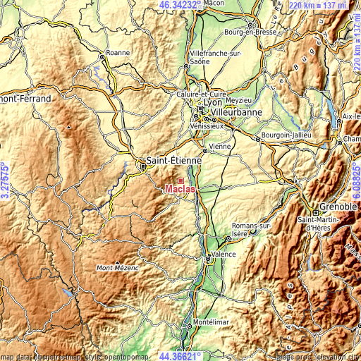
| \ | Map #1 | Topo.Map |
| Scale [m] | 222..977 m | × |
| Scale [ft] | 728..3205 ft | × |
| Average | 465.5 m = 1527 ft | × |
| Width | 6.87 km = 4.3 mi | 219.7 km = 136.5 mi |
| Height | 6.87 km = 4.3 mi | 219.7 km = 136.5 mi |
| ↑Max Latitude | 45.393758° | 46.34232° |
| Latitude at center | 45.36289° | 45.36289° |
| ↓Min Latitude | 45.332005° | 44.36621° |
| ← Min Longitude | 4.638055° | 3.27575° |
| Longitude center | 4.682° | 4.682° |
| →Max Longitude | 4.725945° | 6.08825° |
Nearby cities:
Cities around Maclas sort by population:
• Le Péage-de-Roussillon elevation 170 m
9.1 km,  82°
82°
• Salaise-sur-Sanne 187 m
10.1 km,  97°
97°
• Pélussin 363 m
6.3 km,  1°
1°
• Chavanay 147 m
6.9 km,  29°
29°
• Peaugres 380 m
9.2 km,  156°
156°
• Sablons 136 m
8.6 km,  122°
122°
• Clonas-sur-Varèze 189 m
10.2 km,  56°
56°
• Saint-Pierre-de-Bœuf 222 m
5.3 km,  85°
85°
• Saint-Marcel-lès-Annonay 462 m
9.6 km,  207°
207°
• Serrières 142 m
8.1 km,  128°
128°
• Félines 370 m
6.3 km,  144°
144°
• Saint-Julien-Molin-Molette 546 m
6.9 km,  227°
227°
Multilingual:
 En español:
Maclas elevación 390 m.
 En France:
Maclas élévation 390 m.


Sources and notes:
- [note 1] Map square and city borders are not equal. Map elevation data is calculated only from area inside that square.
- [src 1] Elevation data from geonames database provided with same terms of usage.
- [src 2] The elevation map of Maclas is generated using elevation data from NASA's 3 arcsec (90m) resolution SRTM data.
- [src 3] Base (background) map © OpenStreetMap contributors tiles are generated by Geofabrik and OpenTopoMap.
Copyright & License:
This Maclas Elevation Map is licensed under CC BY-SA. You may reuse any part from this page, if you give a proper credit by linking to this URL:
 More info on terms of use page.