Mehun-sur-Yèvre elevation
Mehun-sur-Yèvre (Centre, Cher), France elevation is 123 meters and Mehun-sur-Yèvre elevation in feet is 404 ft above sea level [src 1]. Mehun-sur-Yèvre is a populated place (feature code) with elevation that is 51 meters (167 ft) smaller than average city elevation in France.
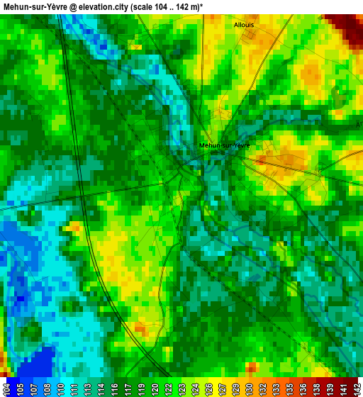
Below is the Elevation map of Mehun-sur-Yèvre, which displays elevation range with different colors. Scale of the first map is from 104 to 142 m (341 to 466 ft) with average elevation of 118.5 meters (=389 ft) [note 1]
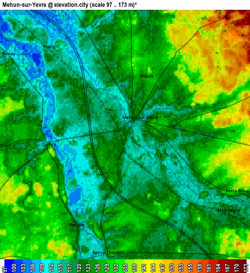
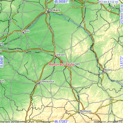
These maps also provides idea of topography and contour of this city, they are displayed at different zoom levels. More info about maps, scale and edge coordinates you can find below images.
| \ | Map #1 | Map #2 | Topo.Map |
| Scale [m] | 104..142 m | 97..173 m | × |
| Scale [ft] | 341..466 ft | 318..568 ft | × |
| Average | 118.5 m = 389 ft | 124.9 m = 410 ft | × |
| Width | 6.65 km = 4.1 mi | 13.3 km = 8.3 mi | 212.7 km = 132.2 mi |
| Height | 6.65 km = 4.1 mi | 13.3 km = 8.3 mi | 212.7 km = 132.2 mi |
| ↑Max Latitude | 47.167705° | 47.197573° | 48.08581° |
| Latitude at center | 47.13782° | 47.13782° | 47.13782° |
| ↓Min Latitude | 47.107918° | 47.078° | 46.17263° |
| ← Min Longitude | 2.167105° | 2.123159° | 0.8048° |
| Longitude center | 2.21105° | 2.21105° | 2.21105° |
| →Max Longitude | 2.254995° | 2.298941° | 3.6173° |
Nearby cities:
Cities around Mehun-sur-Yèvre sort by population:
• Bourges elevation 144 m
15.5 km,  112°
112°
• Vierzon 103 m
14.3 km,  310°
310°
• Saint-Doulchard 138 m
11.3 km, 109°
• Saint-Florent-sur-Cher 145 m
16.1 km,  169°
169°
• La Chapelle-Saint-Ursin 149 m
12 km,  134°
134°
• Méreau 105 m
12.4 km,  282°
282°
• Foëcy 116 m
5.6 km,  319°
319°
• Reuilly 126 m
14 km,  245°
245°
• Marmagne 121 m
6.9 km, 127°
• Vignoux-sur-Barangeon 109 m
7.6 km,  337°
337°
• Saint-Éloy-de-Gy 157 m
10.1 km,  78°
78°
• Vasselay 171 m
13.7 km, 81°
Multilingual:
 En español:
Mehun-sur-Yèvre elevación 123 m.
 En France:
Mehun-sur-Yèvre élévation 123 m.
 Auf Deutsch:
Mehun-sur-Yèvre höhe über dem Meeresspiegel ist 123 m.

Sources and notes:
- [note 1] Map square and city borders are not equal. Map elevation data is calculated only from area inside that square.
- [src 1] Elevation data from geonames database provided with same terms of usage.
- [src 2] The elevation map of Mehun-sur-Yèvre is generated using elevation data from NASA's 3 arcsec (90m) resolution SRTM data.
- [src 3] Base (background) map © OpenStreetMap contributors tiles are generated by Geofabrik and OpenTopoMap.
Copyright & License:
This Mehun-sur-Yèvre Elevation Map is licensed under CC BY-SA. You may reuse any part from this page, if you give a proper credit by linking to this URL:
 More info on terms of use page.