Menucourt elevation
Menucourt (Île-de-France, Département du Val-d’Oise), France elevation is 102 meters and Menucourt elevation in feet is 335 ft above sea level [src 1]. Menucourt is a populated place (feature code) with elevation that is 72 meters (236 ft) smaller than average city elevation in France.
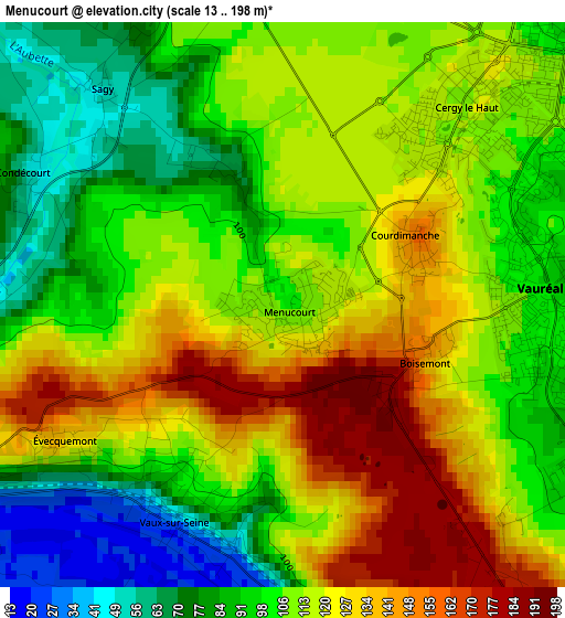
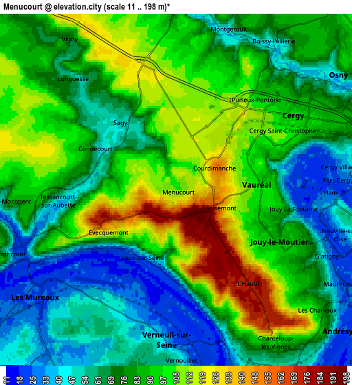
Below is the Elevation map of Menucourt, which displays elevation range with different colors. Scale of the first map is from 13 to 198 m (43 to 650 ft) with average elevation of 109.3 meters (=359 ft) [note 1]
These maps also provides idea of topography and contour of this city, they are displayed at different zoom levels. More info about maps, scale and edge coordinates you can find below images.
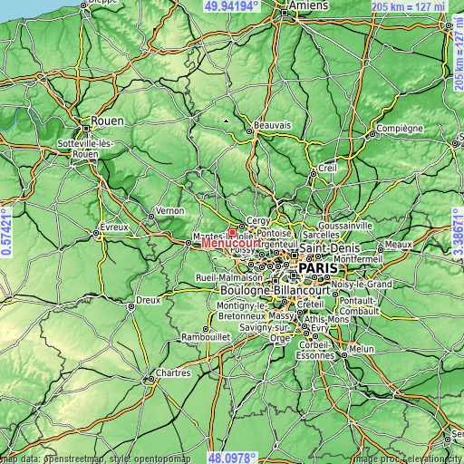
| \ | Map #1 | Map #2 | Topo.Map |
| Scale [m] | 13..198 m | 11..198 m | × |
| Scale [ft] | 43..650 ft | 36..650 ft | × |
| Average | 109.3 m = 359 ft | 80.9 m = 265 ft | × |
| Width | 6.41 km = 4 mi | 12.82 km = 8 mi | 205 km = 127.4 mi |
| Height | 6.41 km = 4 mi | 12.82 km = 8 mi | 205 km = 127.4 mi |
| ↑Max Latitude | 49.057216° | 49.086005° | 49.94194° |
| Latitude at center | 49.02841° | 49.02841° | 49.02841° |
| ↓Min Latitude | 48.999587° | 48.970748° | 48.0978° |
| ← Min Longitude | 1.936515° | 1.892569° | 0.57421° |
| Longitude center | 1.98046° | 1.98046° | 1.98046° |
| →Max Longitude | 2.024405° | 2.068351° | 3.38671° |
Nearby cities:
Cities around Menucourt sort by population:
• Les Mureaux elevation 25 m
6.6 km,  231°
231°
• Vauréal 41 m
3.9 km,  81°
81°
• Jouy-le-Moutier 88 m
4.8 km,  114°
114°
• Verneuil-sur-Seine 60 m
6.2 km,  190°
190°
• Triel-sur-Seine 51 m
5.9 km,  160°
160°
• Vernouillet 52 m
6.3 km,  179°
179°
• Meulan-en-Yvelines 28 m
5.9 km,  246°
246°
• Courdimanche 156 m
1.7 km,  63°
63°
• Vaux-sur-Seine 117 m
1.9 km,  204°
204°
• Hardricourt 61 m
6.7 km, 250°
• Neuville-sur-Oise 48 m
6.4 km,  101°
101°
• Sagy 51 m
3.2 km,  319°
319°
Multilingual:
 En español:
Menucourt elevación 102 m.
 En France:
Menucourt élévation 102 m.
 Auf Deutsch:
Menucourt höhe über dem Meeresspiegel ist 102 m.

Sources and notes:
- [note 1] Map square and city borders are not equal. Map elevation data is calculated only from area inside that square.
- [src 1] Elevation data from geonames database provided with same terms of usage.
- [src 2] The elevation map of Menucourt is generated using elevation data from NASA's 3 arcsec (90m) resolution SRTM data.
- [src 3] Base (background) map © OpenStreetMap contributors tiles are generated by Geofabrik and OpenTopoMap.
Copyright & License:
This Menucourt Elevation Map is licensed under CC BY-SA. You may reuse any part from this page, if you give a proper credit by linking to this URL:
 More info on terms of use page.