Monein elevation
Monein (Nouvelle-Aquitaine, Département des Pyrénées-Atlantiques), France elevation is 136 meters and Monein elevation in feet is 446 ft above sea level [src 1]. Monein is a populated place (feature code) with elevation that is 38 meters (125 ft) smaller than average city elevation in France.
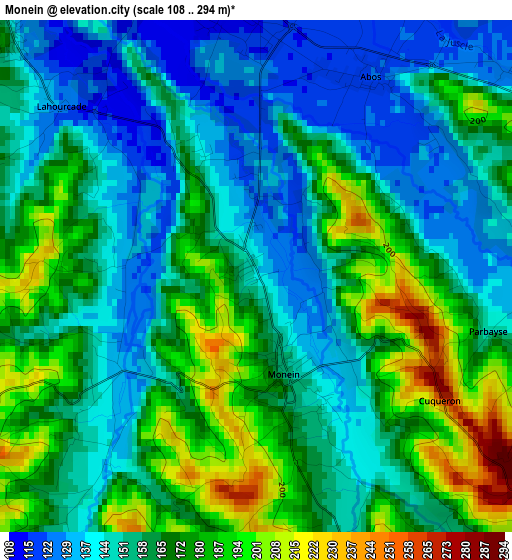
Below is the Elevation map of Monein, which displays elevation range with different colors. Scale of the first map is from 108 to 294 m (354 to 965 ft) with average elevation of 161.9 meters (=531 ft) [note 1]
These maps also provides idea of topography and contour of this city, they are displayed at different zoom levels. More info about maps, scale and edge coordinates you can find below images.
| \ | Map #1 | Map #2 | Topo.Map |
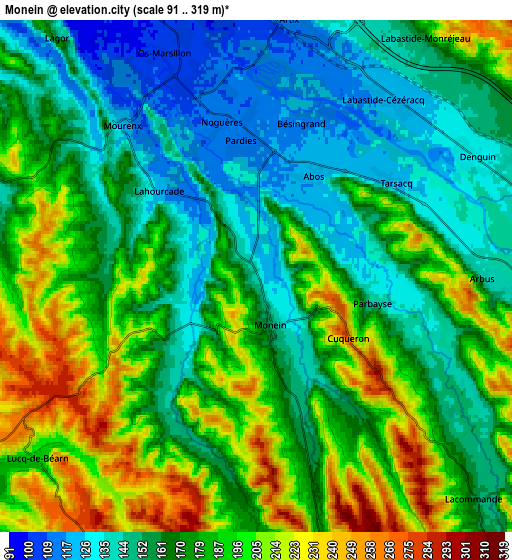
| Scale [m] | 108..294 m | 91..319 m | × |
| Scale [ft] | 354..965 ft | 299..1047 ft | × |
| Average | 161.9 m = 531 ft | 174.5 m = 573 ft | × |
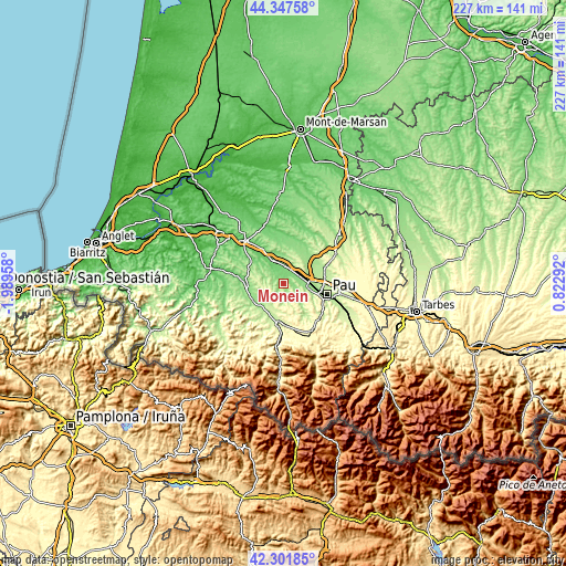
| Width | 7.11 km = 4.4 mi | 14.22 km = 8.8 mi | 227.5 km = 141.4 mi |
| Height | 7.11 km = 4.4 mi | 14.22 km = 8.8 mi | 227.5 km = 141.4 mi |
| ↑Max Latitude | 43.365286° | 43.397226° | 44.34758° |
| Latitude at center | 43.33333° | 43.33333° | 43.33333° |
| ↓Min Latitude | 43.301357° | 43.269367° | 42.30185° |
| ← Min Longitude | -0.627275° | -0.671221° | -1.98958° |
| Longitude center | -0.58333° | -0.58333° | -0.58333° |
| →Max Longitude | -0.539385° | -0.495439° | 0.82292° |
Nearby cities:
Cities around Monein sort by population:
• Lescar elevation 188 m
13.5 km,  90°
90°
• Mourenx 111 m
5.7 km,  346°
346°
• Artix 112 m
7.1 km,  7°
7°
• Poey-de-Lescar 147 m
9.6 km,  78°
78°
• Lasseube 186 m
13.8 km,  143°
143°
• Denguin 135 m
7.7 km,  61°
61°
• Lagor 114 m
7.7 km,  315°
315°
• Artiguelouve 165 m
9.6 km,  101°
101°
• Ledeuix 223 m
13.2 km,  191°
191°
• Arbus 139 m
6.7 km, 90°
• Mont 115 m
12.4 km,  334°
334°
• Lucq-de-Béarn 242 m
7.7 km,  241°
241°
Multilingual:
 En español:
Monein elevación 136 m.
 En France:
Monein élévation 136 m.


Sources and notes:
- [note 1] Map square and city borders are not equal. Map elevation data is calculated only from area inside that square.
- [src 1] Elevation data from geonames database provided with same terms of usage.
- [src 2] The elevation map of Monein is generated using elevation data from NASA's 3 arcsec (90m) resolution SRTM data.
- [src 3] Base (background) map © OpenStreetMap contributors tiles are generated by Geofabrik and OpenTopoMap.
Copyright & License:
This Monein Elevation Map is licensed under CC BY-SA. You may reuse any part from this page, if you give a proper credit by linking to this URL:
 More info on terms of use page.