Lescar elevation
Lescar (Nouvelle-Aquitaine, Département des Pyrénées-Atlantiques), France elevation is 188 meters and Lescar elevation in feet is 617 ft above sea level [src 1]. Lescar is a populated place (feature code) with elevation that is 14 meters (46 ft) bigger than average city elevation in France.
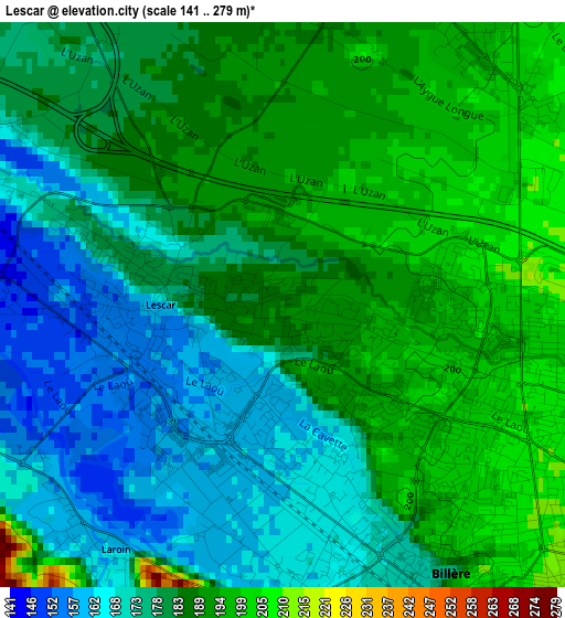
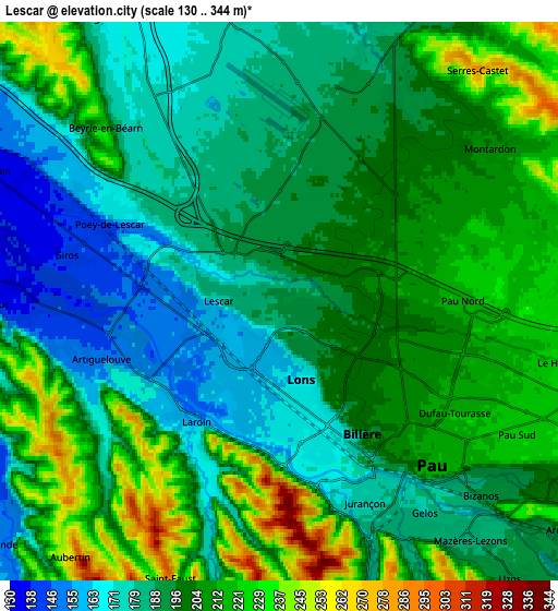
Below is the Elevation map of Lescar, which displays elevation range with different colors. Scale of the first map is from 141 to 279 m (463 to 915 ft) with average elevation of 182.5 meters (=599 ft) [note 1]
These maps also provides idea of topography and contour of this city, they are displayed at different zoom levels. More info about maps, scale and edge coordinates you can find below images.
| \ | Map #1 | Map #2 | Topo.Map |
| Scale [m] | 141..279 m | 130..344 m | × |
| Scale [ft] | 463..915 ft | 427..1129 ft | × |
| Average | 182.5 m = 599 ft | 198.3 m = 651 ft | × |
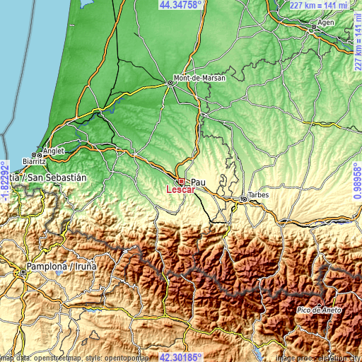
| Width | 7.11 km = 4.4 mi | 14.22 km = 8.8 mi | 227.5 km = 141.4 mi |
| Height | 7.11 km = 4.4 mi | 14.22 km = 8.8 mi | 227.5 km = 141.4 mi |
| ↑Max Latitude | 43.365286° | 43.397226° | 44.34758° |
| Latitude at center | 43.33333° | 43.33333° | 43.33333° |
| ↓Min Latitude | 43.301357° | 43.269367° | 42.30185° |
| ← Min Longitude | -0.460615° | -0.504561° | -1.82292° |
| Longitude center | -0.41667° | -0.41667° | -0.41667° |
| →Max Longitude | -0.372725° | -0.328779° | 0.98958° |
Nearby cities:
Cities around Lescar sort by population:
• Pau elevation 216 m
5.5 km,  132°
132°
• Billère 170 m
3.9 km,  160°
160°
• Lons 196 m
2.3 km,  143°
143°
• Jurançon 178 m
5.6 km,  154°
154°
• Bizanos 186 m
7.7 km, 135°
• Gelos 185 m
6.9 km, 143°
• Serres-Castet 224 m
7.7 km,  44°
44°
• Montardon 208 m
6.5 km,  55°
55°
• Poey-de-Lescar 147 m
4.4 km,  294°
294°
• Artiguelouve 165 m
4.4 km,  245°
245°
• Uzein 173 m
7.5 km,  349°
349°
• Arbus 139 m
6.7 km,  270°
270°
Multilingual:
 En español:
Lescar elevación 188 m.
 En France:
Lescar élévation 188 m.


Sources and notes:
- [note 1] Map square and city borders are not equal. Map elevation data is calculated only from area inside that square.
- [src 1] Elevation data from geonames database provided with same terms of usage.
- [src 2] The elevation map of Lescar is generated using elevation data from NASA's 3 arcsec (90m) resolution SRTM data.
- [src 3] Base (background) map © OpenStreetMap contributors tiles are generated by Geofabrik and OpenTopoMap.
Copyright & License:
This Lescar Elevation Map is licensed under CC BY-SA. You may reuse any part from this page, if you give a proper credit by linking to this URL:
 More info on terms of use page.