Montbron elevation
Montbron (Nouvelle-Aquitaine, Charente), France elevation is 142 meters and Montbron elevation in feet is 466 ft above sea level [src 1]. Montbron is a populated place (feature code) with elevation that is 32 meters (105 ft) smaller than average city elevation in France.
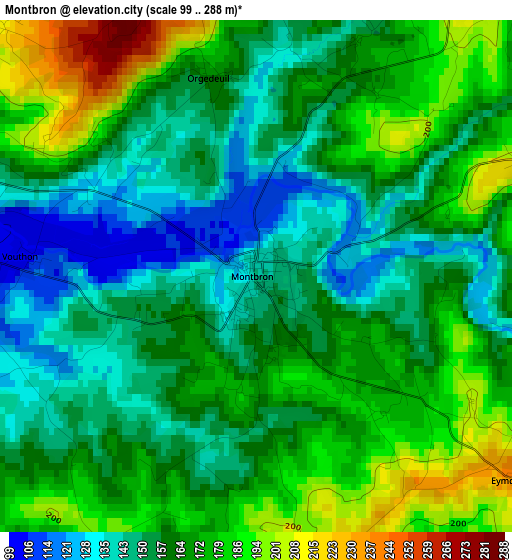
Below is the Elevation map of Montbron, which displays elevation range with different colors. Scale of the first map is from 99 to 288 m (325 to 945 ft) with average elevation of 163.4 meters (=536 ft) [note 1]
These maps also provides idea of topography and contour of this city, they are displayed at different zoom levels. More info about maps, scale and edge coordinates you can find below images.
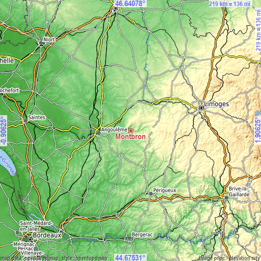
| \ | Map #1 | Topo.Map |
| Scale [m] | 99..288 m | × |
| Scale [ft] | 325..945 ft | × |
| Average | 163.4 m = 536 ft | × |
| Width | 6.83 km = 4.2 mi | 218.5 km = 135.8 mi |
| Height | 6.83 km = 4.2 mi | 218.5 km = 135.8 mi |
| ↑Max Latitude | 45.697372° | 46.64078° |
| Latitude at center | 45.66667° | 45.66667° |
| ↓Min Latitude | 45.635951° | 44.67531° |
| ← Min Longitude | 0.456055° | -0.90625° |
| Longitude center | 0.5° | 0.5° |
| →Max Longitude | 0.543945° | 1.90625° |
Nearby cities:
Cities around Montbron sort by population:
• Nontron elevation 214 m
19.8 km,  140°
140°
• La Rochefoucauld 83 m
12.1 km,  312°
312°
• Chasseneuil-sur-Bonnieure 115 m
17.1 km,  346°
346°
• Mornac 125 m
18.2 km,  275°
275°
• Rivières 94 m
14.4 km, 311°
• Garat 72 m
18.5 km,  258°
258°
• Chazelles 96 m
10.5 km, 258°
• Piégut-Pluviers 289 m
15.6 km,  108°
108°
• Taponnat-Fleurignac 111 m
14.3 km,  330°
330°
• Saint-Mathieu 324 m
20.6 km,  77°
77°
• Touvre 51 m
19.4 km,  270°
270°
• Saint-Projet-Saint-Constant 78 m
14.3 km,  298°
298°
Multilingual:
 En español:
Montbron elevación 142 m.
 En France:
Montbron élévation 142 m.
 Auf Deutsch:
Montbron höhe über dem Meeresspiegel ist 142 m.

Sources and notes:
- [note 1] Map square and city borders are not equal. Map elevation data is calculated only from area inside that square.
- [src 1] Elevation data from geonames database provided with same terms of usage.
- [src 2] The elevation map of Montbron is generated using elevation data from NASA's 3 arcsec (90m) resolution SRTM data.
- [src 3] Base (background) map © OpenStreetMap contributors tiles are generated by Geofabrik and OpenTopoMap.
Copyright & License:
This Montbron Elevation Map is licensed under CC BY-SA. You may reuse any part from this page, if you give a proper credit by linking to this URL:
 More info on terms of use page.