Montmirail elevation
Montmirail (Grand Est, Marne), France elevation is 190 meters and Montmirail elevation in feet is 623 ft above sea level [src 1]. Montmirail is a populated place (feature code) with elevation that is 16 meters (52 ft) bigger than average city elevation in France.
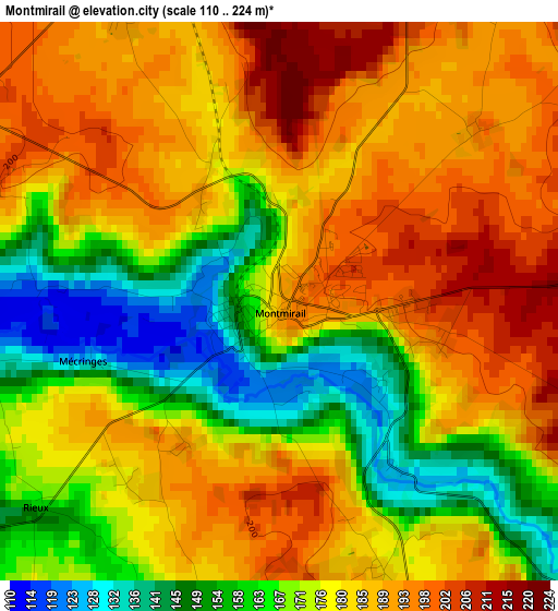
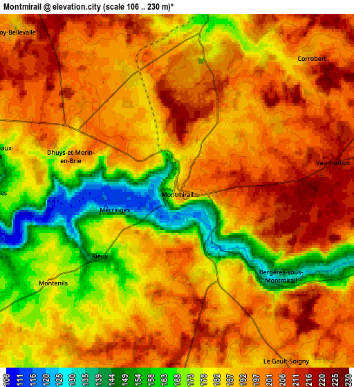
Below is the Elevation map of Montmirail, which displays elevation range with different colors. Scale of the first map is from 110 to 224 m (361 to 735 ft) with average elevation of 177.8 meters (=583 ft) [note 1]
These maps also provides idea of topography and contour of this city, they are displayed at different zoom levels. More info about maps, scale and edge coordinates you can find below images.
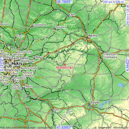
| \ | Map #1 | Map #2 | Topo.Map |
| Scale [m] | 110..224 m | 106..230 m | × |
| Scale [ft] | 361..735 ft | 348..755 ft | × |
| Average | 177.8 m = 583 ft | 188.5 m = 618 ft | × |
| Width | 6.43 km = 4 mi | 12.86 km = 8 mi | 205.7 km = 127.8 mi |
| Height | 6.43 km = 4 mi | 12.86 km = 8 mi | 205.7 km = 127.8 mi |
| ↑Max Latitude | 48.901036° | 48.929916° | 49.78855° |
| Latitude at center | 48.87214° | 48.87214° | 48.87214° |
| ↓Min Latitude | 48.843227° | 48.814297° | 47.93863° |
| ← Min Longitude | 3.494025° | 3.450079° | 2.13172° |
| Longitude center | 3.53797° | 3.53797° | 3.53797° |
| →Max Longitude | 3.581915° | 3.625861° | 4.94422° |
Nearby cities:
Cities around Montmirail sort by population:
• La Ferté-Gaucher elevation 119 m
19.6 km,  239°
239°
• Essômes-sur-Marne 63 m
21.1 km,  325°
325°
• Nogent-l’Artaud 66 m
18.9 km,  303°
303°
• Esternay 158 m
15.6 km,  173°
173°
• Chézy-sur-Marne 63 m
18 km,  316°
316°
• Étampes-sur-Marne 78 m
20.1 km, 334°
• Crézancy 77 m
19.7 km,  354°
354°
• Brasles 70 m
21.1 km,  338°
338°
• Villeneuve-sur-Bellot 90 m
14.4 km,  265°
265°
• Nesles-la-Montagne 132 m
18.3 km, 333°
• Chierry 80 m
20.2 km, 336°
• Nogentel 66 m
18.9 km, 328°
Multilingual:
 En español:
Montmirail elevación 190 m.
 En France:
Montmirail élévation 190 m.
 Auf Deutsch:
Montmirail höhe über dem Meeresspiegel ist 190 m.

Sources and notes:
- [note 1] Map square and city borders are not equal. Map elevation data is calculated only from area inside that square.
- [src 1] Elevation data from geonames database provided with same terms of usage.
- [src 2] The elevation map of Montmirail is generated using elevation data from NASA's 3 arcsec (90m) resolution SRTM data.
- [src 3] Base (background) map © OpenStreetMap contributors tiles are generated by Geofabrik and OpenTopoMap.
Copyright & License:
This Montmirail Elevation Map is licensed under CC BY-SA. You may reuse any part from this page, if you give a proper credit by linking to this URL:
 More info on terms of use page.