Nemours elevation
Nemours (Île-de-France, Seine-et-Marne), France elevation is 57 meters and Nemours elevation in feet is 187 ft above sea level [src 1]. Nemours is a populated place (feature code) with elevation that is 117 meters (384 ft) smaller than average city elevation in France.
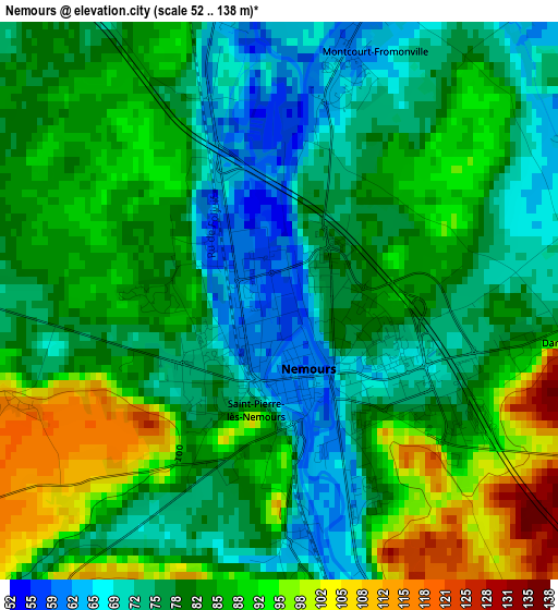
Below is the Elevation map of Nemours, which displays elevation range with different colors. Scale of the first map is from 52 to 138 m (171 to 453 ft) with average elevation of 81.9 meters (=269 ft) [note 1]
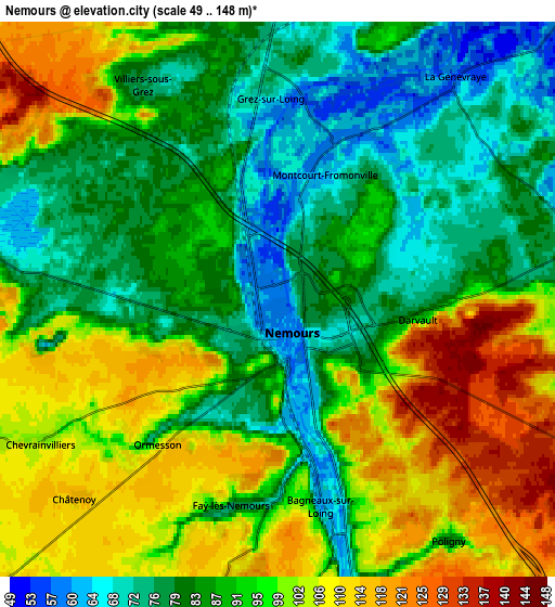
These maps also provides idea of topography and contour of this city, they are displayed at different zoom levels. More info about maps, scale and edge coordinates you can find below images.
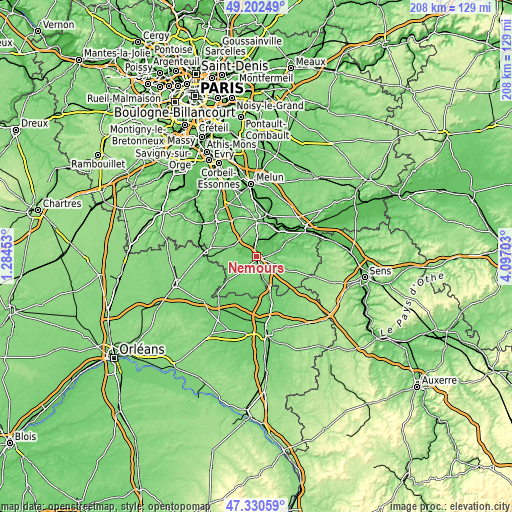
| \ | Map #1 | Map #2 | Topo.Map |
| Scale [m] | 52..138 m | 49..148 m | × |
| Scale [ft] | 171..453 ft | 161..486 ft | × |
| Average | 81.9 m = 269 ft | 91.7 m = 301 ft | × |
| Width | 6.5 km = 4 mi | 13.01 km = 8.1 mi | 208.1 km = 129.3 mi |
| Height | 6.5 km = 4 mi | 13.01 km = 8.1 mi | 208.1 km = 129.3 mi |
| ↑Max Latitude | 48.30435° | 48.333573° | 49.20249° |
| Latitude at center | 48.27511° | 48.27511° | 48.27511° |
| ↓Min Latitude | 48.245854° | 48.21658° | 47.33059° |
| ← Min Longitude | 2.646835° | 2.602889° | 1.28453° |
| Longitude center | 2.69078° | 2.69078° | 2.69078° |
| →Max Longitude | 2.734725° | 2.778671° | 4.09703° |
Nearby cities:
Cities around Nemours sort by population:
• Saint-Pierre-lès-Nemours elevation 76 m
1.2 km,  223°
223°
• Souppes-sur-Loing 69 m
10.8 km,  162°
162°
• Veneux-les-Sablons 78 m
13.9 km,  33°
33°
• Château-Landon 100 m
14.2 km,  177°
177°
• Bourron-Marlotte 78 m
7.3 km,  5°
5°
• La Chapelle-la-Reine 122 m
10 km,  298°
298°
• Écuelles 52 m
13.3 km,  47°
47°
• Montigny-sur-Loing 68 m
7.8 km, 30°
• Montcourt-Fromonville 58 m
3.7 km,  16°
16°
• Bagneaux-sur-Loing 63 m
4.8 km,  165°
165°
• Grez-sur-Loing 71 m
4.7 km,  357°
357°
• Achères-la-Forêt 119 m
12.5 km,  314°
314°
Multilingual:
 En español:
Nemours elevación 57 m.
 En France:
Nemours élévation 57 m.


Sources and notes:
- [note 1] Map square and city borders are not equal. Map elevation data is calculated only from area inside that square.
- [src 1] Elevation data from geonames database provided with same terms of usage.
- [src 2] The elevation map of Nemours is generated using elevation data from NASA's 3 arcsec (90m) resolution SRTM data.
- [src 3] Base (background) map © OpenStreetMap contributors tiles are generated by Geofabrik and OpenTopoMap.
Copyright & License:
This Nemours Elevation Map is licensed under CC BY-SA. You may reuse any part from this page, if you give a proper credit by linking to this URL:
 More info on terms of use page.