Souppes-sur-Loing elevation
Souppes-sur-Loing (Île-de-France, Seine-et-Marne), France elevation is 69 meters and Souppes-sur-Loing elevation in feet is 226 ft above sea level [src 1]. Souppes-sur-Loing is a populated place (feature code) with elevation that is 105 meters (344 ft) smaller than average city elevation in France.
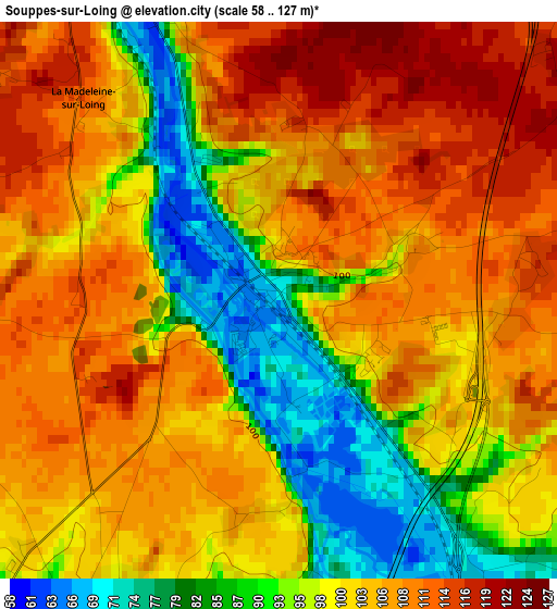
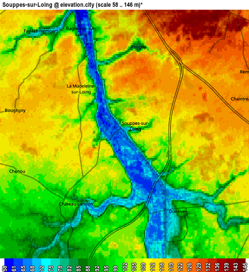
Below is the Elevation map of Souppes-sur-Loing, which displays elevation range with different colors. Scale of the first map is from 58 to 127 m (190 to 417 ft) with average elevation of 101.1 meters (=332 ft) [note 1]
These maps also provides idea of topography and contour of this city, they are displayed at different zoom levels. More info about maps, scale and edge coordinates you can find below images.
| \ | Map #1 | Map #2 | Topo.Map |
| Scale [m] | 58..127 m | 58..146 m | × |
| Scale [ft] | 190..417 ft | 190..479 ft | × |
| Average | 101.1 m = 332 ft | 105.2 m = 345 ft | × |
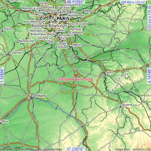
| Width | 6.52 km = 4.1 mi | 13.03 km = 8.1 mi | 208.5 km = 129.6 mi |
| Height | 6.52 km = 4.1 mi | 13.03 km = 8.1 mi | 208.5 km = 129.6 mi |
| ↑Max Latitude | 48.212262° | 48.241538° | 49.11203° |
| Latitude at center | 48.18297° | 48.18297° | 48.18297° |
| ↓Min Latitude | 48.153661° | 48.124335° | 47.23676° |
| ← Min Longitude | 2.691265° | 2.647319° | 1.32896° |
| Longitude center | 2.73521° | 2.73521° | 2.73521° |
| →Max Longitude | 2.779155° | 2.823101° | 4.14146° |
Nearby cities:
Cities around Souppes-sur-Loing sort by population:
• Nemours elevation 57 m
10.8 km,  342°
342°
• Saint-Pierre-lès-Nemours 76 m
10.2 km, 336°
• Château-Landon 100 m
4.9 km,  215°
215°
• Dordives 71 m
5.1 km,  151°
151°
• Montcourt-Fromonville 58 m
13.9 km,  350°
350°
• Cepoy 94 m
15 km,  179°
179°
• Égreville 123 m
10.2 km,  94°
94°
• Bagneaux-sur-Loing 63 m
6 km, 339°
• Fontenay-sur-Loing 89 m
9.3 km,  161°
161°
• Lorrez-le-Bocage-Préaux 107 m
13.4 km,  65°
65°
• Grez-sur-Loing 71 m
15.4 km, 346°
• Nargis 84 m
8.1 km,  169°
169°
Multilingual:
 En español:
Souppes-sur-Loing elevación 69 m.
 En France:
Souppes-sur-Loing élévation 69 m.
 Auf Deutsch:
Souppes-sur-Loing höhe über dem Meeresspiegel ist 69 m.

Sources and notes:
- [note 1] Map square and city borders are not equal. Map elevation data is calculated only from area inside that square.
- [src 1] Elevation data from geonames database provided with same terms of usage.
- [src 2] The elevation map of Souppes-sur-Loing is generated using elevation data from NASA's 3 arcsec (90m) resolution SRTM data.
- [src 3] Base (background) map © OpenStreetMap contributors tiles are generated by Geofabrik and OpenTopoMap.
Copyright & License:
This Souppes-sur-Loing Elevation Map is licensed under CC BY-SA. You may reuse any part from this page, if you give a proper credit by linking to this URL:
 More info on terms of use page.