Olonzac elevation
Olonzac (Occitanie, Département de l'Hérault), France elevation is 53 meters and Olonzac elevation in feet is 174 ft above sea level [src 1]. Olonzac is a populated place (feature code) with elevation that is 121 meters (397 ft) smaller than average city elevation in France.
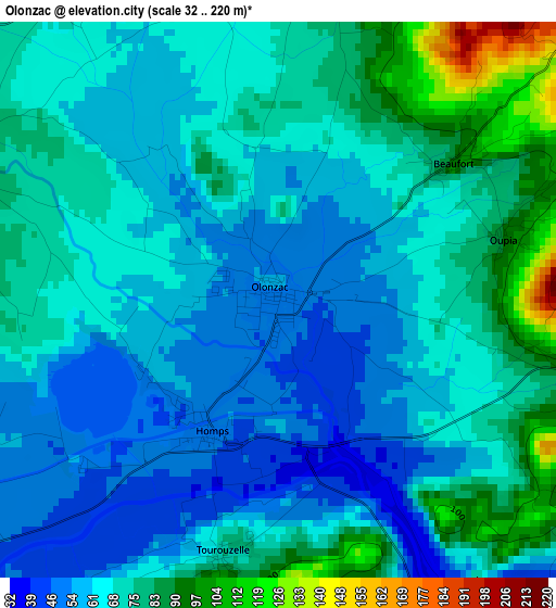
Below is the Elevation map of Olonzac, which displays elevation range with different colors. Scale of the first map is from 32 to 220 m (105 to 722 ft) with average elevation of 68 meters (=223 ft) [note 1]
These maps also provides idea of topography and contour of this city, they are displayed at different zoom levels. More info about maps, scale and edge coordinates you can find below images.
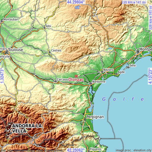
| \ | Map #1 | Topo.Map |
| Scale [m] | 32..220 m | × |
| Scale [ft] | 105..722 ft | × |
| Average | 68 m = 223 ft | × |
| Width | 7.11 km = 4.4 mi | 227.7 km = 141.5 mi |
| Height | 7.11 km = 4.4 mi | 227.6 km = 141.4 mi |
| ↑Max Latitude | 43.314923° | 44.29804° |
| Latitude at center | 43.28294° | 43.28294° |
| ↓Min Latitude | 43.25094° | 42.25062° |
| ← Min Longitude | 2.687035° | 1.32473° |
| Longitude center | 2.73098° | 2.73098° |
| →Max Longitude | 2.774925° | 4.13723° |
Nearby cities:
Cities around Olonzac sort by population:
• Lézignan-Corbières elevation 49 m
9.8 km,  165°
165°
• Rieux-Minervois 121 m
11.7 km,  269°
269°
• Saint-Nazaire-d’Aude 26 m
13.9 km,  107°
107°
• Canet 27 m
11.3 km,  123°
123°
• Ornaisons 41 m
14.3 km,  143°
143°
• Ginestas 69 m
11.4 km,  99°
99°
• Puicheric 64 m
10.8 km,  232°
232°
• Azille 90 m
5.8 km,  263°
263°
• Pépieux 89 m
4.5 km,  291°
291°
• Ferrals-les-Corbières 68 m
14.8 km,  179°
179°
• Peyriac-Minervois 138 m
13.4 km, 273°
• Bize-Minervois 59 m
12 km,  71°
71°
Multilingual:
 En español:
Olonzac elevación 53 m.
 En France:
Olonzac élévation 53 m.


Sources and notes:
- [note 1] Map square and city borders are not equal. Map elevation data is calculated only from area inside that square.
- [src 1] Elevation data from geonames database provided with same terms of usage.
- [src 2] The elevation map of Olonzac is generated using elevation data from NASA's 3 arcsec (90m) resolution SRTM data.
- [src 3] Base (background) map © OpenStreetMap contributors tiles are generated by Geofabrik and OpenTopoMap.
Copyright & License:
This Olonzac Elevation Map is licensed under CC BY-SA. You may reuse any part from this page, if you give a proper credit by linking to this URL:
 More info on terms of use page.