Osny elevation
Osny (Île-de-France, Département du Val-d’Oise), France elevation is 91 meters and Osny elevation in feet is 299 ft above sea level [src 1]. Osny is a populated place (feature code) with elevation that is 83 meters (272 ft) smaller than average city elevation in France.
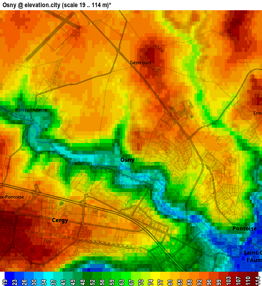
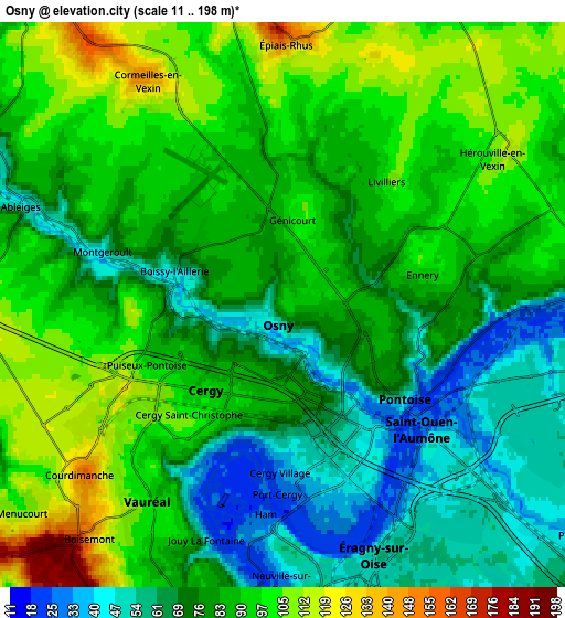
Below is the Elevation map of Osny, which displays elevation range with different colors. Scale of the first map is from 19 to 114 m (62 to 374 ft) with average elevation of 77.2 meters (=253 ft) [note 1]
These maps also provides idea of topography and contour of this city, they are displayed at different zoom levels. More info about maps, scale and edge coordinates you can find below images.
| \ | Map #1 | Map #2 | Topo.Map |
| Scale [m] | 19..114 m | 11..198 m | × |
| Scale [ft] | 62..374 ft | 36..650 ft | × |
| Average | 77.2 m = 253 ft | 82.7 m = 271 ft | × |
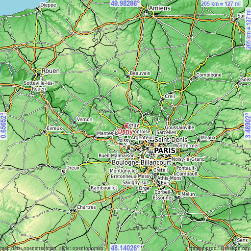
| Width | 6.4 km = 4 mi | 12.8 km = 8 mi | 204.9 km = 127.3 mi |
| Height | 6.4 km = 4 mi | 12.8 km = 8 mi | 204.9 km = 127.3 mi |
| ↑Max Latitude | 49.098882° | 49.127647° | 49.98286° |
| Latitude at center | 49.0701° | 49.0701° | 49.0701° |
| ↓Min Latitude | 49.041302° | 49.012486° | 48.14026° |
| ← Min Longitude | 2.018825° | 1.974879° | 0.65652° |
| Longitude center | 2.06277° | 2.06277° | 2.06277° |
| →Max Longitude | 2.106715° | 2.150661° | 3.46902° |
Nearby cities:
Cities around Osny sort by population:
• Cergy-Pontoise elevation 54 m
3.6 km,  162°
162°
• Cergy 47 m
3.9 km,  165°
165°
• Pontoise 46 m
3.5 km,  129°
129°
• Saint-Ouen-l’Aumône 30 m
5.2 km,  124°
124°
• Vauréal 41 m
4.6 km,  207°
207°
• Jouy-le-Moutier 88 m
6.8 km,  193°
193°
• Éragny 54 m
6.5 km, 155°
• Courdimanche 156 m
6 km,  229°
229°
• Menucourt 102 m
7.6 km, 232°
• Ennery 94 m
3.2 km,  80°
80°
• Neuville-sur-Oise 48 m
5.9 km,  177°
177°
• Ableiges 54 m
6.3 km,  289°
289°
Multilingual:
 En español:
Osny elevación 91 m.
 En France:
Osny élévation 91 m.


Sources and notes:
- [note 1] Map square and city borders are not equal. Map elevation data is calculated only from area inside that square.
- [src 1] Elevation data from geonames database provided with same terms of usage.
- [src 2] The elevation map of Osny is generated using elevation data from NASA's 3 arcsec (90m) resolution SRTM data.
- [src 3] Base (background) map © OpenStreetMap contributors tiles are generated by Geofabrik and OpenTopoMap.
Copyright & License:
This Osny Elevation Map is licensed under CC BY-SA. You may reuse any part from this page, if you give a proper credit by linking to this URL:
 More info on terms of use page.