Osséja elevation
Osséja (Occitanie, Département des Pyrénées-Orientales), France elevation is 1251 meters and Osséja elevation in feet is 4104 ft above sea level [src 1]. Osséja is a populated place (feature code) with elevation that is 1077 meters (3533 ft) bigger than average city elevation in France.
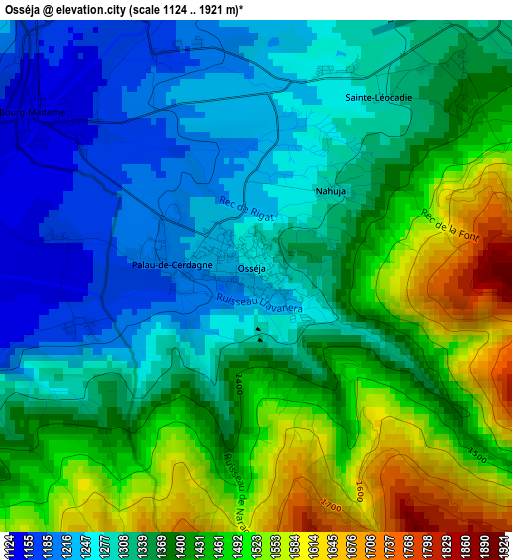
Below is the Elevation map of Osséja, which displays elevation range with different colors. Scale of the first map is from 1124 to 1921 m (3688 to 6302 ft) with average elevation of 1374.2 meters (=4509 ft) [note 1]
These maps also provides idea of topography and contour of this city, they are displayed at different zoom levels. More info about maps, scale and edge coordinates you can find below images.
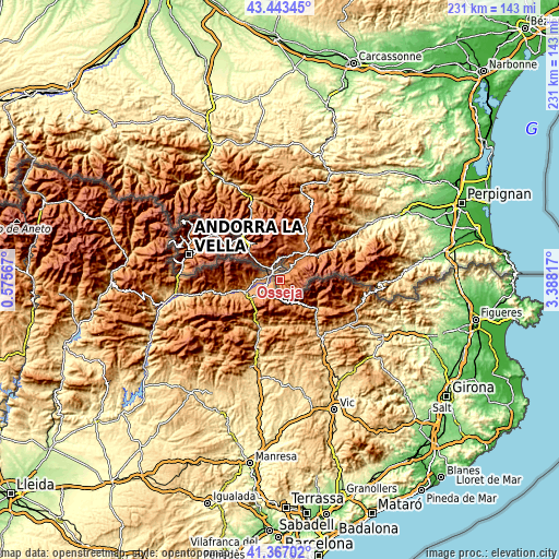
| \ | Map #1 | Topo.Map |
| Scale [m] | 1124..1921 m | × |
| Scale [ft] | 3688..6302 ft | × |
| Average | 1374.2 m = 4509 ft | × |
| Width | 7.21 km = 4.5 mi | 230.9 km = 143.5 mi |
| Height | 7.21 km = 4.5 mi | 230.9 km = 143.5 mi |
| ↑Max Latitude | 42.446266° | 43.44345° |
| Latitude at center | 42.41383° | 42.41383° |
| ↓Min Latitude | 42.381377° | 41.36702° |
| ← Min Longitude | 1.937975° | 0.57567° |
| Longitude center | 1.98192° | 1.98192° |
| →Max Longitude | 2.025865° | 3.38817° |
Nearby cities:
Cities around Osséja sort by population:
• Prades elevation 343 m
42.6 km,  57°
57°
• Quillan 291 m
53.9 km,  17°
17°
• Arles 291 m
53.8 km,  84°
84°
• Font-Romeu-Odeillo-Via 1776 m
11.3 km,  25°
25°
• Vinça 270 m
51.6 km, 60°
• Ax-les-Thermes 722 m
36 km,  340°
340°
• Vernet-les-Bains 657 m
36.4 km,  65°
65°
• Sant Llorenç de Cerdans 692 m
51.9 km,  93°
93°
• Ria-Sirach 459 m
41 km, 56°
• Bélesta 500 m
54.5 km,  355°
355°
• la Guingueta d'Ix 1143 m
3.9 km,  305°
305°
• Prats de Molló 752 m
40.8 km, 91°
Multilingual:
 En español:
Osséja elevación 1251 m.
 En France:
Osséja élévation 1251 m.


Sources and notes:
- [note 1] Map square and city borders are not equal. Map elevation data is calculated only from area inside that square.
- [src 1] Elevation data from geonames database provided with same terms of usage.
- [src 2] The elevation map of Osséja is generated using elevation data from NASA's 3 arcsec (90m) resolution SRTM data.
- [src 3] Base (background) map © OpenStreetMap contributors tiles are generated by Geofabrik and OpenTopoMap.
Copyright & License:
This Osséja Elevation Map is licensed under CC BY-SA. You may reuse any part from this page, if you give a proper credit by linking to this URL:
 More info on terms of use page.