Palinges elevation
Palinges (Bourgogne-Franche-Comté, Département de Saône-et-Loire), France elevation is 274 meters and Palinges elevation in feet is 899 ft above sea level [src 1]. Palinges is a populated place (feature code) with elevation that is 100 meters (328 ft) bigger than average city elevation in France.
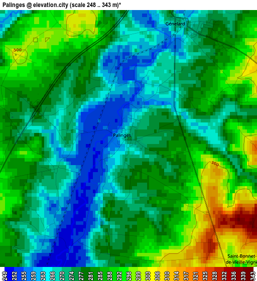
Below is the Elevation map of Palinges, which displays elevation range with different colors. Scale of the first map is from 248 to 343 m (814 to 1125 ft) with average elevation of 278.9 meters (=915 ft) [note 1]
These maps also provides idea of topography and contour of this city, they are displayed at different zoom levels. More info about maps, scale and edge coordinates you can find below images.
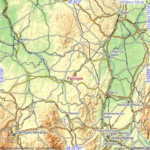
| \ | Map #1 | Topo.Map |
| Scale [m] | 248..343 m | × |
| Scale [ft] | 814..1125 ft | × |
| Average | 278.9 m = 915 ft | × |
| Width | 6.72 km = 4.2 mi | 215.1 km = 133.7 mi |
| Height | 6.72 km = 4.2 mi | 215 km = 133.6 mi |
| ↑Max Latitude | 46.583782° | 47.512° |
| Latitude at center | 46.55357° | 46.55357° |
| ↓Min Latitude | 46.523341° | 45.57791° |
| ← Min Longitude | 4.175695° | 2.81339° |
| Longitude center | 4.21964° | 4.21964° |
| →Max Longitude | 4.263585° | 5.62589° |
Nearby cities:
Cities around Palinges sort by population:
• Montceau-les-Mines elevation 312 m
16.9 km,  41°
41°
• Paray-le-Monial 244 m
13.6 km,  215°
215°
• Saint-Vallier 332 m
15.1 km,  49°
49°
• Digoin 236 m
20.1 km,  246°
246°
• Gueugnon 243 m
13.2 km,  294°
294°
• Sanvignes-les-Mines 336 m
13.5 km,  24°
24°
• Charolles 287 m
13.9 km,  162°
162°
• Ciry-le-Noble 280 m
8.4 km, 45°
• Perrecy-les-Forges 286 m
6.8 km,  356°
356°
• Toulon-sur-Arroux 264 m
16.7 km,  338°
338°
• Génelard 272 m
3.3 km, 22°
• Saint-Berain-sous-Sanvignes 322 m
18 km, 18°
Multilingual:
 En español:
Palinges elevación 274 m.
 En France:
Palinges élévation 274 m.
 Auf Deutsch:
Palinges höhe über dem Meeresspiegel ist 274 m.

Sources and notes:
- [note 1] Map square and city borders are not equal. Map elevation data is calculated only from area inside that square.
- [src 1] Elevation data from geonames database provided with same terms of usage.
- [src 2] The elevation map of Palinges is generated using elevation data from NASA's 3 arcsec (90m) resolution SRTM data.
- [src 3] Base (background) map © OpenStreetMap contributors tiles are generated by Geofabrik and OpenTopoMap.
Copyright & License:
This Palinges Elevation Map is licensed under CC BY-SA. You may reuse any part from this page, if you give a proper credit by linking to this URL:
 More info on terms of use page.