Périgueux elevation
Périgueux (Nouvelle-Aquitaine, Dordogne), France elevation is 103 meters and Périgueux elevation in feet is 338 ft above sea level [src 1]. Périgueux is a seat of a second-order administrative division (feature code) with elevation that is 71 meters (233 ft) smaller than average city elevation in France.
Below is the Elevation map of Périgueux, which displays elevation range with different colors. Scale of the first map is from 77 to 236 m (253 to 774 ft) with average elevation of 150 meters (=492 ft) [note 1]
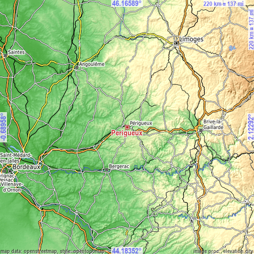
These maps also provides idea of topography and contour of this city, they are displayed at different zoom levels. More info about maps, scale and edge coordinates you can find below images.
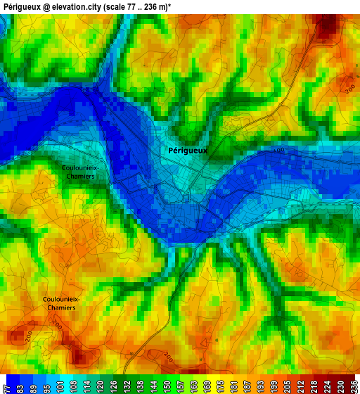
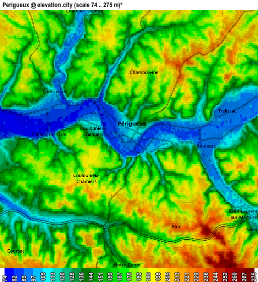
| \ | Map #1 | Map #2 | Topo.Map |
| Scale [m] | 77..236 m | 74..275 m | × |
| Scale [ft] | 253..774 ft | 243..902 ft | × |
| Average | 150 m = 492 ft | 159.4 m = 523 ft | × |
| Width | 6.89 km = 4.3 mi | 13.78 km = 8.6 mi | 220.4 km = 136.9 mi |
| Height | 6.89 km = 4.3 mi | 13.78 km = 8.6 mi | 220.4 km = 136.9 mi |
| ↑Max Latitude | 45.214296° | 45.245245° | 46.16589° |
| Latitude at center | 45.18333° | 45.18333° | 45.18333° |
| ↓Min Latitude | 45.152347° | 45.121347° | 44.18352° |
| ← Min Longitude | 0.672725° | 0.628779° | -0.68958° |
| Longitude center | 0.71667° | 0.71667° | 0.71667° |
| →Max Longitude | 0.760615° | 0.804561° | 2.12292° |
Nearby cities:
Cities around Périgueux sort by population:
• Coulounieix-Chamiers elevation 179 m
4 km,  213°
213°
• Trélissac 96 m
5.7 km,  73°
73°
• Boulazac 235 m
7.9 km,  160°
160°
• Chancelade 83 m
3.9 km,  298°
298°
• Notre-Dame-de-Sanilhac 169 m
6.9 km,  183°
183°
• Champcevinel 198 m
3.8 km,  13°
13°
• Razac-sur-l’Isle 90 m
9.3 km,  256°
256°
• Bassillac 106 m
7.8 km,  82°
82°
• Atur 231 m
5.3 km,  153°
153°
• Coursac 156 m
8.6 km,  225°
225°
• Antonne-et-Trigonant 109 m
9.5 km, 69°
• Montrem 156 m
11.3 km,  241°
241°
Multilingual:
 En español:
Périgueux elevación 103 m.
 En France:
Périgueux élévation 103 m.
 Auf Deutsch:
Périgueux höhe über dem Meeresspiegel ist 103 m.

Sources and notes:
- [note 1] Map square and city borders are not equal. Map elevation data is calculated only from area inside that square.
- [src 1] Elevation data from geonames database provided with same terms of usage.
- [src 2] The elevation map of Périgueux is generated using elevation data from NASA's 3 arcsec (90m) resolution SRTM data.
- [src 3] Base (background) map © OpenStreetMap contributors tiles are generated by Geofabrik and OpenTopoMap.
Copyright & License:
This Périgueux Elevation Map is licensed under CC BY-SA. You may reuse any part from this page, if you give a proper credit by linking to this URL:
 More info on terms of use page.