Pithiviers elevation
Pithiviers (Centre, Loiret), France elevation is 106 meters and Pithiviers elevation in feet is 348 ft above sea level [src 1]. Pithiviers is a seat of a third-order administrative division (feature code) with elevation that is 68 meters (223 ft) smaller than average city elevation in France.
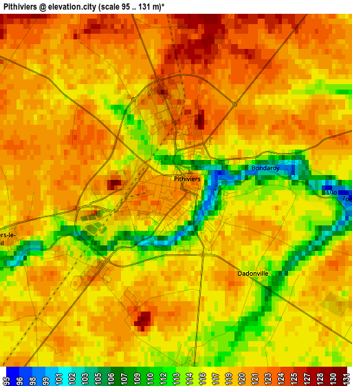
Below is the Elevation map of Pithiviers, which displays elevation range with different colors. Scale of the first map is from 95 to 131 m (312 to 430 ft) with average elevation of 118.1 meters (=387 ft) [note 1]
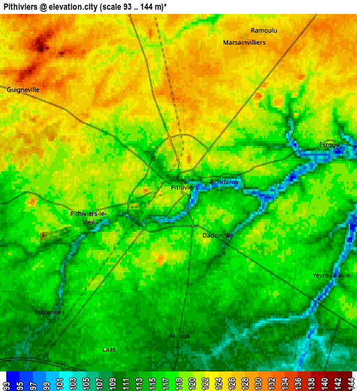
These maps also provides idea of topography and contour of this city, they are displayed at different zoom levels. More info about maps, scale and edge coordinates you can find below images.
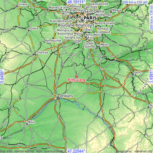
| \ | Map #1 | Map #2 | Topo.Map |
| Scale [m] | 95..131 m | 93..144 m | × |
| Scale [ft] | 312..430 ft | 305..472 ft | × |
| Average | 118.1 m = 387 ft | 118.4 m = 388 ft | × |
| Width | 6.52 km = 4.1 mi | 13.03 km = 8.1 mi | 208.6 km = 129.6 mi |
| Height | 6.52 km = 4.1 mi | 13.03 km = 8.1 mi | 208.5 km = 129.6 mi |
| ↑Max Latitude | 48.201149° | 48.230431° | 49.10111° |
| Latitude at center | 48.17185° | 48.17185° | 48.17185° |
| ↓Min Latitude | 48.142535° | 48.113202° | 47.22544° |
| ← Min Longitude | 2.207905° | 2.163959° | 0.8456° |
| Longitude center | 2.25185° | 2.25185° | 2.25185° |
| →Max Longitude | 2.295795° | 2.339741° | 3.6581° |
Nearby cities:
Cities around Pithiviers sort by population:
• Malesherbes elevation 111 m
18 km,  40°
40°
• Puiseaux 128 m
16.8 km,  238°
238°
• Beaune-la-Rolande 106 m
17.4 km,  130°
130°
• Dadonville 116 m
2.1 km,  137°
137°
• Pithiviers-le-Vieil 120 m
3.3 km,  252°
252°
• Chilleurs-aux-Bois 122 m
14.1 km,  217°
217°
• Sermaises 123 m
14.3 km,  346°
346°
• Outarville 133 m
17.7 km,  285°
285°
• Bazoches-les-Gallerandes 129 m
15.5 km,  267°
267°
• Boiscommun 137 m
18 km,  147°
147°
• Boynes 112 m
10 km, 126°
• Beaumont-du-Gâtinais 88 m
17.3 km,  102°
102°
Multilingual:
 En español:
Pithiviers elevación 106 m.
 En France:
Pithiviers élévation 106 m.
 Auf Deutsch:
Pithiviers höhe über dem Meeresspiegel ist 106 m.

Sources and notes:
- [note 1] Map square and city borders are not equal. Map elevation data is calculated only from area inside that square.
- [src 1] Elevation data from geonames database provided with same terms of usage.
- [src 2] The elevation map of Pithiviers is generated using elevation data from NASA's 3 arcsec (90m) resolution SRTM data.
- [src 3] Base (background) map © OpenStreetMap contributors tiles are generated by Geofabrik and OpenTopoMap.
Copyright & License:
This Pithiviers Elevation Map is licensed under CC BY-SA. You may reuse any part from this page, if you give a proper credit by linking to this URL:
 More info on terms of use page.