Plouzané elevation
Plouzané (Brittany, Département du Finistère), France elevation is 82 meters and Plouzané elevation in feet is 269 ft above sea level [src 1]. Plouzané is a populated place (feature code) with elevation that is 92 meters (302 ft) smaller than average city elevation in France.
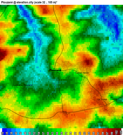
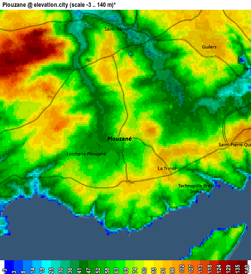
Below is the Elevation map of Plouzané, which displays elevation range with different colors. Scale of the first map is from 32 to 105 m (105 to 344 ft) with average elevation of 65.9 meters (=216 ft) [note 1]
These maps also provides idea of topography and contour of this city, they are displayed at different zoom levels. More info about maps, scale and edge coordinates you can find below images.
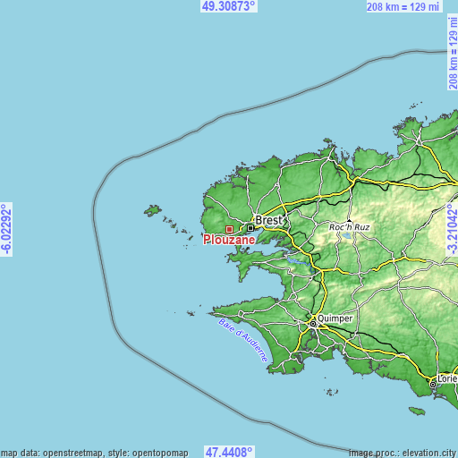
| \ | Map #1 | Map #2 | Topo.Map |
| Scale [m] | 32..105 m | -3..140 m | × |
| Scale [ft] | 105..344 ft | -10..459 ft | × |
| Average | 65.9 m = 216 ft | 67 m = 220 ft | × |
| Width | 6.49 km = 4 mi | 12.98 km = 8.1 mi | 207.7 km = 129.1 mi |
| Height | 6.49 km = 4 mi | 12.98 km = 8.1 mi | 207.7 km = 129.1 mi |
| ↑Max Latitude | 48.412508° | 48.441669° | 49.30873° |
| Latitude at center | 48.38333° | 48.38333° | 48.38333° |
| ↓Min Latitude | 48.354136° | 48.324925° | 47.4408° |
| ← Min Longitude | -4.660615° | -4.704561° | -6.02292° |
| Longitude center | -4.61667° | -4.61667° | -4.61667° |
| →Max Longitude | -4.572725° | -4.528779° | -3.21042° |
Nearby cities:
Cities around Plouzané sort by population:
• Brest elevation 49 m
9.7 km,  85°
85°
• Rd pt des Chataigniers, Rte de Milizac, Guilers, Finistère, France 90 m
6.7 km,  32°
32°
• Guilers 93 m
6.4 km,  42°
42°
• Saint-Renan 35 m
5.6 km,  0°
0°
• Bohars 71 m
9.2 km,  55°
55°
• Milizac 88 m
10 km,  21°
21°
• Plougonvelin 45 m
8.9 km,  237°
237°
• Plouarzel 74 m
10.2 km,  302°
302°
• Le Conquet 27 m
11.7 km,  257°
257°
• Ploumoguer 69 m
7.6 km,  284°
284°
• Lanrivoaré 90 m
10.1 km,  350°
350°
• Roscanvel 15 m
9.1 km,  146°
146°
Multilingual:
 En español:
Plouzané elevación 82 m.
 En France:
Plouzané élévation 82 m.


Sources and notes:
- [note 1] Map square and city borders are not equal. Map elevation data is calculated only from area inside that square.
- [src 1] Elevation data from geonames database provided with same terms of usage.
- [src 2] The elevation map of Plouzané is generated using elevation data from NASA's 3 arcsec (90m) resolution SRTM data.
- [src 3] Base (background) map © OpenStreetMap contributors tiles are generated by Geofabrik and OpenTopoMap.
Copyright & License:
This Plouzané Elevation Map is licensed under CC BY-SA. You may reuse any part from this page, if you give a proper credit by linking to this URL:
 More info on terms of use page.