Poitiers elevation
Poitiers (Nouvelle-Aquitaine, Vienne), France elevation is 85 meters and Poitiers elevation in feet is 279 ft above sea level [src 1]. Poitiers is a seat of a second-order administrative division (feature code) with elevation that is 89 meters (292 ft) smaller than average city elevation in France.
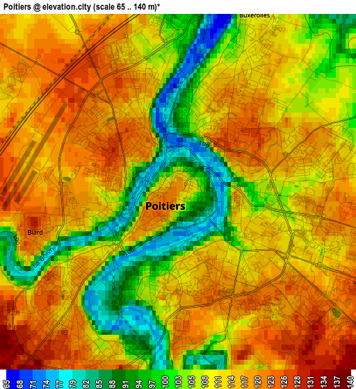
Below is the Elevation map of Poitiers, which displays elevation range with different colors. Scale of the first map is from 65 to 140 m (213 to 459 ft) with average elevation of 110.6 meters (=363 ft) [note 1]
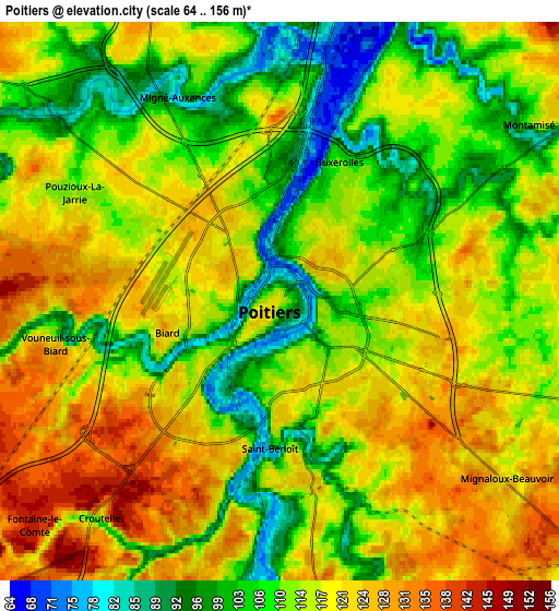
These maps also provides idea of topography and contour of this city, they are displayed at different zoom levels. More info about maps, scale and edge coordinates you can find below images.
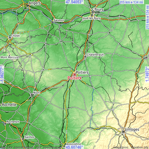
| \ | Map #1 | Map #2 | Topo.Map |
| Scale [m] | 65..140 m | 64..156 m | × |
| Scale [ft] | 213..459 ft | 210..512 ft | × |
| Average | 110.6 m = 363 ft | 114.2 m = 375 ft | × |
| Width | 6.72 km = 4.2 mi | 13.43 km = 8.3 mi | 214.9 km = 133.5 mi |
| Height | 6.72 km = 4.2 mi | 13.43 km = 8.3 mi | 214.9 km = 133.5 mi |
| ↑Max Latitude | 46.612806° | 46.642984° | 47.54053° |
| Latitude at center | 46.58261° | 46.58261° | 46.58261° |
| ↓Min Latitude | 46.552398° | 46.522168° | 45.60746° |
| ← Min Longitude | 0.299535° | 0.255589° | -1.06277° |
| Longitude center | 0.34348° | 0.34348° | 0.34348° |
| →Max Longitude | 0.387425° | 0.431371° | 1.74973° |
Nearby cities:
Cities around Poitiers sort by population:
• Saint-Benoît elevation 101 m
3.6 km,  182°
182°
• Migné 100 m
5.5 km,  336°
336°
• Vouneuil-sous-Biard 122 m
5.7 km,  259°
259°
• Chasseneuil-du-Poitou 77 m
8 km,  16°
16°
• Mignaloux-Beauvoir 121 m
7 km,  128°
128°
• Fontaine-le-Comte 143 m
8.4 km,  227°
227°
• Ligugé 124 m
7.1 km,  190°
190°
• Montamisé 116 m
7.6 km,  55°
55°
• Smarves 123 m
7.9 km, 176°
• Sèvres-Anxaumont 113 m
9.4 km,  99°
99°
• Biard 120 m
3 km, 258°
• Roman catholic diocese of Poitiers 85 m
0.5 km,  122°
122°
Multilingual:
 En español:
Poitiers elevación 85 m.
 En France:
Poitiers élévation 85 m.


Sources and notes:
- [note 1] Map square and city borders are not equal. Map elevation data is calculated only from area inside that square.
- [src 1] Elevation data from geonames database provided with same terms of usage.
- [src 2] The elevation map of Poitiers is generated using elevation data from NASA's 3 arcsec (90m) resolution SRTM data.
- [src 3] Base (background) map © OpenStreetMap contributors tiles are generated by Geofabrik and OpenTopoMap.
Copyright & License:
This Poitiers Elevation Map is licensed under CC BY-SA. You may reuse any part from this page, if you give a proper credit by linking to this URL:
 More info on terms of use page.