Pontorson elevation
Pontorson (Normandy, Manche), France elevation is 18 meters and Pontorson elevation in feet is 59 ft above sea level [src 1]. Pontorson is a populated place (feature code) with elevation that is 156 meters (512 ft) smaller than average city elevation in France.
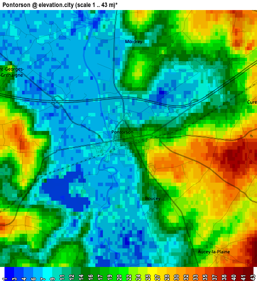
Below is the Elevation map of Pontorson, which displays elevation range with different colors. Scale of the first map is from 1 to 43 m (3 to 141 ft) with average elevation of 15.4 meters (=51 ft) [note 1]
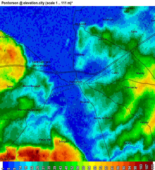
These maps also provides idea of topography and contour of this city, they are displayed at different zoom levels. More info about maps, scale and edge coordinates you can find below images.
| \ | Map #1 | Map #2 | Topo.Map |
| Scale [m] | 1..43 m | 1..111 m | × |
| Scale [ft] | 3..141 ft | 3..364 ft | × |
| Average | 15.4 m = 51 ft | 28 m = 92 ft | × |
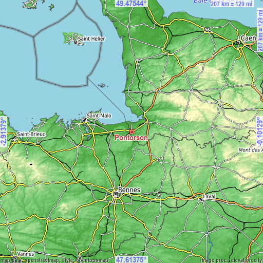
| Width | 6.47 km = 4 mi | 12.94 km = 8 mi | 207 km = 128.6 mi |
| Height | 6.47 km = 4 mi | 12.94 km = 8 mi | 207 km = 128.6 mi |
| ↑Max Latitude | 48.58224° | 48.611304° | 49.47544° |
| Latitude at center | 48.55316° | 48.55316° | 48.55316° |
| ↓Min Latitude | 48.524063° | 48.49495° | 47.61375° |
| ← Min Longitude | -1.551485° | -1.595431° | -2.91379° |
| Longitude center | -1.50754° | -1.50754° | -1.50754° |
| →Max Longitude | -1.463595° | -1.419649° | -0.10129° |
Nearby cities:
Cities around Pontorson sort by population:
• Saint-James elevation 124 m
13.8 km,  104°
104°
• Bazouges-la-Pérouse 105 m
15 km,  199°
199°
• Pleine-Fougères 39 m
4.8 km,  242°
242°
• Le Val-Saint-Père 13 m
15.4 km,  38°
38°
• Tremblay 81 m
14.8 km,  170°
170°
• Antrain 37 m
10.5 km, 170°
• Epiniac 88 m
15.4 km,  247°
247°
• Baguer-Pican 38 m
14 km,  269°
269°
• La Boussac 40 m
12.2 km, 248°
• Cherrueix 7 m
15.6 km,  292°
292°
• Roz-sur-Couesnon 61 m
7.4 km,  302°
302°
• Saint-Broladre 11 m
11.7 km, 288°
Multilingual:
 En español:
Pontorson elevación 18 m.
 En France:
Pontorson élévation 18 m.
 Auf Deutsch:
Pontorson höhe über dem Meeresspiegel ist 18 m.

Sources and notes:
- [note 1] Map square and city borders are not equal. Map elevation data is calculated only from area inside that square.
- [src 1] Elevation data from geonames database provided with same terms of usage.
- [src 2] The elevation map of Pontorson is generated using elevation data from NASA's 3 arcsec (90m) resolution SRTM data.
- [src 3] Base (background) map © OpenStreetMap contributors tiles are generated by Geofabrik and OpenTopoMap.
Copyright & License:
This Pontorson Elevation Map is licensed under CC BY-SA. You may reuse any part from this page, if you give a proper credit by linking to this URL:
 More info on terms of use page.