Rethel elevation
Rethel (Grand Est, Ardennes), France elevation is 105 meters and Rethel elevation in feet is 344 ft above sea level [src 1]. Rethel is a seat of a third-order administrative division (feature code) with elevation that is 69 meters (226 ft) smaller than average city elevation in France.
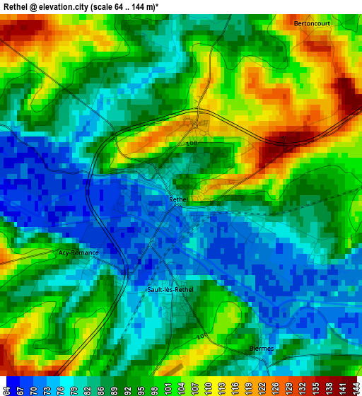
Below is the Elevation map of Rethel, which displays elevation range with different colors. Scale of the first map is from 64 to 144 m (210 to 472 ft) with average elevation of 92.5 meters (=303 ft) [note 1]
These maps also provides idea of topography and contour of this city, they are displayed at different zoom levels. More info about maps, scale and edge coordinates you can find below images.
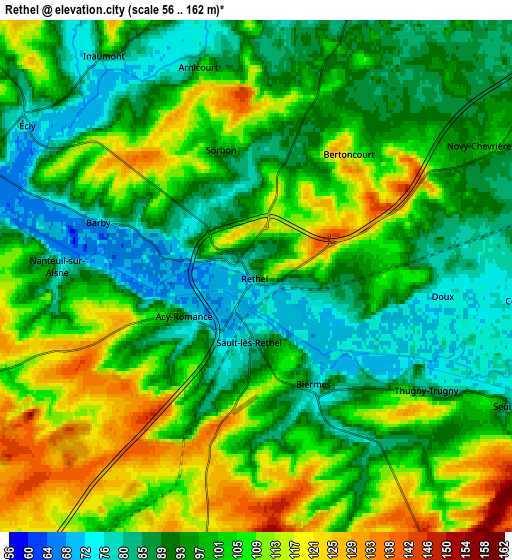
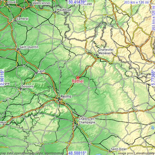
| \ | Map #1 | Map #2 | Topo.Map |
| Scale [m] | 64..144 m | 56..162 m | × |
| Scale [ft] | 210..472 ft | 184..531 ft | × |
| Average | 92.5 m = 303 ft | 99.1 m = 325 ft | × |
| Width | 6.35 km = 3.9 mi | 12.69 km = 7.9 mi | 203.1 km = 126.2 mi |
| Height | 6.35 km = 3.9 mi | 12.69 km = 7.9 mi | 203 km = 126.1 mi |
| ↑Max Latitude | 49.538316° | 49.566826° | 50.41439° |
| Latitude at center | 49.50979° | 49.50979° | 49.50979° |
| ↓Min Latitude | 49.481247° | 49.452688° | 48.58815° |
| ← Min Longitude | 4.323455° | 4.279509° | 2.96115° |
| Longitude center | 4.3674° | 4.3674° | 4.3674° |
| →Max Longitude | 4.411345° | 4.455291° | 5.77365° |
Nearby cities:
Cities around Rethel sort by population:
• Vouziers elevation 95 m
27.1 km,  117°
117°
• Witry-lès-Reims 130 m
30.2 km,  216°
216°
• Guignicourt 66 m
30 km,  254°
254°
• Warmeriville 80 m
20.5 km,  211°
211°
• Bazancourt 73 m
21.4 km, 221°
• Sault-lès-Rethel 72 m
1.2 km,  198°
198°
• Pontfaverger-Moronvilliers 103 m
23.9 km,  188°
188°
• Boult-sur-Suippe 71 m
22.2 km,  226°
226°
• Château-Porcien 67 m
9 km,  282°
282°
• Attigny 85 m
15.6 km,  102°
102°
• Rozoy-sur-Serre 154 m
28.1 km,  322°
322°
• Bourgogne 91 m
27.9 km, 230°
Multilingual:
 En español:
Rethel elevación 105 m.
 En France:
Rethel élévation 105 m.


Sources and notes:
- [note 1] Map square and city borders are not equal. Map elevation data is calculated only from area inside that square.
- [src 1] Elevation data from geonames database provided with same terms of usage.
- [src 2] The elevation map of Rethel is generated using elevation data from NASA's 3 arcsec (90m) resolution SRTM data.
- [src 3] Base (background) map © OpenStreetMap contributors tiles are generated by Geofabrik and OpenTopoMap.
Copyright & License:
This Rethel Elevation Map is licensed under CC BY-SA. You may reuse any part from this page, if you give a proper credit by linking to this URL:
 More info on terms of use page.