Roquettes elevation
Roquettes (Occitanie, Haute-Garonne), France elevation is 159 meters and Roquettes elevation in feet is 522 ft above sea level [src 1]. Roquettes is a populated place (feature code) with elevation that is 15 meters (49 ft) smaller than average city elevation in France.
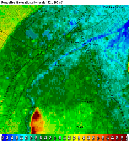
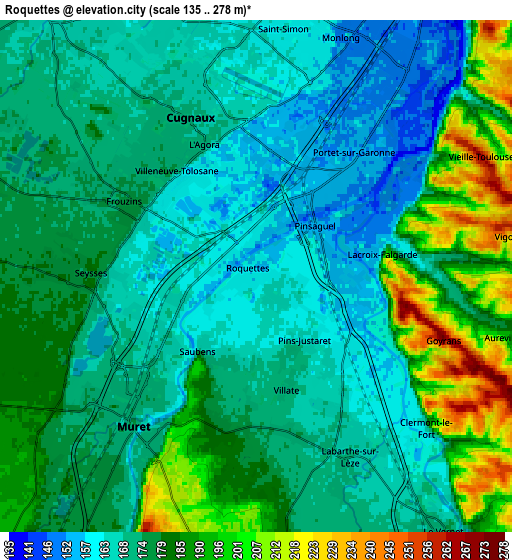
Below is the Elevation map of Roquettes, which displays elevation range with different colors. Scale of the first map is from 142 to 200 m (466 to 656 ft) with average elevation of 161.1 meters (=529 ft) [note 1]
These maps also provides idea of topography and contour of this city, they are displayed at different zoom levels. More info about maps, scale and edge coordinates you can find below images.
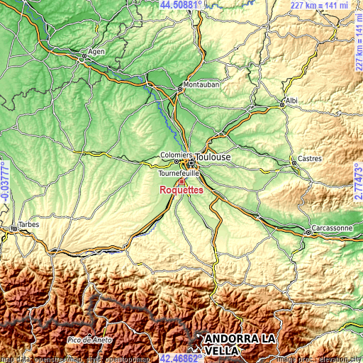
| \ | Map #1 | Map #2 | Topo.Map |
| Scale [m] | 142..200 m | 135..278 m | × |
| Scale [ft] | 466..656 ft | 443..912 ft | × |
| Average | 161.1 m = 529 ft | 175.7 m = 576 ft | × |
| Width | 7.09 km = 4.4 mi | 14.18 km = 8.8 mi | 226.8 km = 140.9 mi |
| Height | 7.09 km = 4.4 mi | 14.18 km = 8.8 mi | 226.8 km = 140.9 mi |
| ↑Max Latitude | 43.5292° | 43.561053° | 44.50881° |
| Latitude at center | 43.49733° | 43.49733° | 43.49733° |
| ↓Min Latitude | 43.465443° | 43.43354° | 42.46862° |
| ← Min Longitude | 1.324535° | 1.280589° | -0.03777° |
| Longitude center | 1.36848° | 1.36848° | 1.36848° |
| →Max Longitude | 1.412425° | 1.456371° | 2.77473° |
Nearby cities:
Cities around Roquettes sort by population:
• Muret elevation 163 m
5.4 km,  219°
219°
• Cugnaux 170 m
4.8 km,  335°
335°
• Portet-sur-Garonne 153 m
4.2 km,  46°
46°
• Villeneuve-Tolosane 173 m
3.6 km,  322°
322°
• Seysses 179 m
4.7 km,  270°
270°
• Frouzins 176 m
4 km,  299°
299°
• Labarthe-sur-Lèze 170 m
5.6 km,  153°
153°
• Pinsaguel 154 m
2.2 km, 47°
• Vernet 169 m
8.1 km, 151°
• Lacroix-Falgarde 157 m
3.3 km,  85°
85°
• Saubens 164 m
2.4 km,  214°
214°
• Vieille-Toulouse 220 m
6.6 km,  63°
63°
Multilingual:
 En español:
Roquettes elevación 159 m.
 En France:
Roquettes élévation 159 m.
 Auf Deutsch:
Roquettes höhe über dem Meeresspiegel ist 159 m.

Sources and notes:
- [note 1] Map square and city borders are not equal. Map elevation data is calculated only from area inside that square.
- [src 1] Elevation data from geonames database provided with same terms of usage.
- [src 2] The elevation map of Roquettes is generated using elevation data from NASA's 3 arcsec (90m) resolution SRTM data.
- [src 3] Base (background) map © OpenStreetMap contributors tiles are generated by Geofabrik and OpenTopoMap.
Copyright & License:
This Roquettes Elevation Map is licensed under CC BY-SA. You may reuse any part from this page, if you give a proper credit by linking to this URL:
 More info on terms of use page.