Roussay elevation
Roussay (Pays de la Loire, Département de Maine-et-Loire), France elevation is 88 meters and Roussay elevation in feet is 289 ft above sea level [src 1]. Roussay is a populated place (feature code) with elevation that is 86 meters (282 ft) smaller than average city elevation in France.
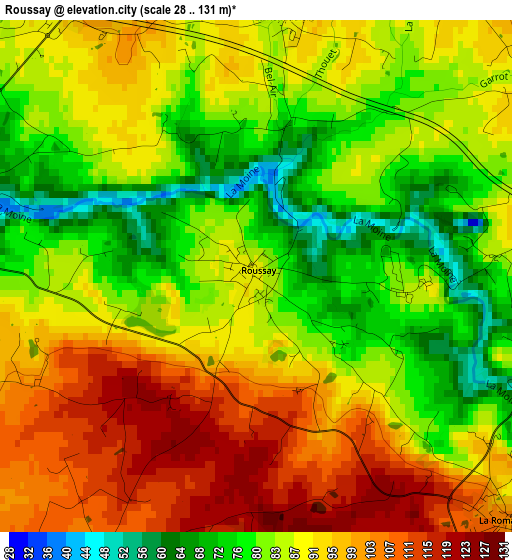
Below is the Elevation map of Roussay, which displays elevation range with different colors. Scale of the first map is from 28 to 131 m (92 to 430 ft) with average elevation of 88.6 meters (=291 ft) [note 1]
These maps also provides idea of topography and contour of this city, they are displayed at different zoom levels. More info about maps, scale and edge coordinates you can find below images.
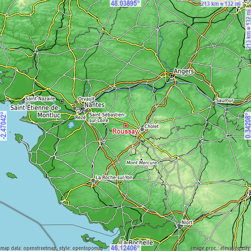
| \ | Map #1 | Topo.Map |
| Scale [m] | 28..131 m | × |
| Scale [ft] | 92..430 ft | × |
| Average | 88.6 m = 291 ft | × |
| Width | 6.65 km = 4.1 mi | 212.9 km = 132.3 mi |
| Height | 6.65 km = 4.1 mi | 212.9 km = 132.3 mi |
| ↑Max Latitude | 47.120022° | 48.03895° |
| Latitude at center | 47.09011° | 47.09011° |
| ↓Min Latitude | 47.060182° | 46.12406° |
| ← Min Longitude | -1.108115° | -2.47042° |
| Longitude center | -1.06417° | -1.06417° |
| →Max Longitude | -1.020225° | 0.34208° |
Nearby cities:
Cities around Roussay sort by population:
• Saint-Macaire-en-Mauges elevation 102 m
6.7 km,  56°
56°
• La Séguinière 80 m
10 km,  107°
107°
• Saint-André-de-la-Marche 94 m
5.4 km,  78°
78°
• Saint-Germain-sur-Moine 74 m
5.3 km,  304°
304°
• Villedieu-la-Blouère 97 m
6.4 km,  0°
0°
• Torfou 102 m
7.1 km,  213°
213°
• Le Longeron 121 m
8 km,  176°
176°
• Montfaucon-Montigné 48 m
4.1 km,  285°
285°
• La Romagne 97 m
4.6 km,  133°
133°
• Saint-Crespin-sur-Moine 75 m
9.3 km,  276°
276°
• Tiffauges 101 m
9.5 km,  201°
201°
• Tillières 76 m
9.6 km,  308°
308°
Multilingual:
 En español:
Roussay elevación 88 m.
 En France:
Roussay élévation 88 m.


Sources and notes:
- [note 1] Map square and city borders are not equal. Map elevation data is calculated only from area inside that square.
- [src 1] Elevation data from geonames database provided with same terms of usage.
- [src 2] The elevation map of Roussay is generated using elevation data from NASA's 3 arcsec (90m) resolution SRTM data.
- [src 3] Base (background) map © OpenStreetMap contributors tiles are generated by Geofabrik and OpenTopoMap.
Copyright & License:
This Roussay Elevation Map is licensed under CC BY-SA. You may reuse any part from this page, if you give a proper credit by linking to this URL:
 More info on terms of use page.