Roye elevation
Roye (Hauts-de-France, Somme), France elevation is 87 meters and Roye elevation in feet is 285 ft above sea level [src 1]. Roye is a populated place (feature code) with elevation that is 87 meters (285 ft) smaller than average city elevation in France.
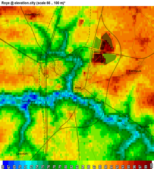
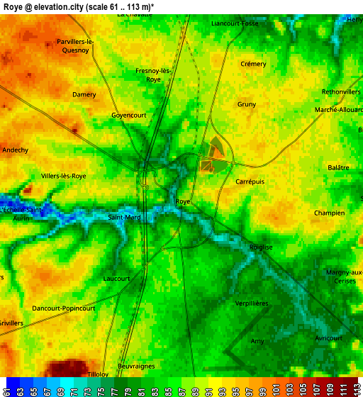
Below is the Elevation map of Roye, which displays elevation range with different colors. Scale of the first map is from 66 to 100 m (217 to 328 ft) with average elevation of 84.7 meters (=278 ft) [note 1]
These maps also provides idea of topography and contour of this city, they are displayed at different zoom levels. More info about maps, scale and edge coordinates you can find below images.
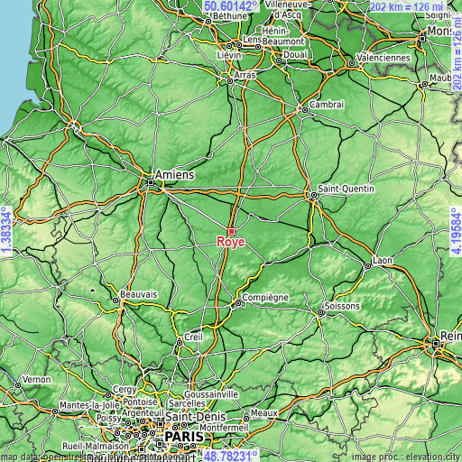
| \ | Map #1 | Map #2 | Topo.Map |
| Scale [m] | 66..100 m | 61..113 m | × |
| Scale [ft] | 217..328 ft | 200..371 ft | × |
| Average | 84.7 m = 278 ft | 86.9 m = 285 ft | × |
| Width | 6.32 km = 3.9 mi | 12.64 km = 7.9 mi | 202.3 km = 125.7 mi |
| Height | 6.32 km = 3.9 mi | 12.64 km = 7.9 mi | 202.3 km = 125.7 mi |
| ↑Max Latitude | 49.728795° | 49.757193° | 50.60142° |
| Latitude at center | 49.70038° | 49.70038° | 49.70038° |
| ↓Min Latitude | 49.671949° | 49.6435° | 48.78231° |
| ← Min Longitude | 2.745645° | 2.701699° | 1.38334° |
| Longitude center | 2.78959° | 2.78959° | 2.78959° |
| →Max Longitude | 2.833535° | 2.877481° | 4.19584° |
Nearby cities:
Cities around Roye sort by population:
• Noyon elevation 52 m
20 km,  130°
130°
• Montdidier 90 m
16.8 km,  249°
249°
• Rosières-en-Santerre 91 m
14.2 km,  333°
333°
• Nesle 78 m
10.9 km,  53°
53°
• Eppeville 63 m
19.3 km,  76°
76°
• Chaulnes 103 m
13 km,  3°
3°
• Guiscard 62 m
19.4 km,  104°
104°
• Ressons-sur-Matz 69 m
18.3 km,  190°
190°
• Harbonnières 89 m
18.7 km, 332°
• Lassigny 65 m
13 km,  162°
162°
• Hombleux 65 m
14.8 km,  72°
72°
• Crisolles 76 m
18.4 km,  118°
118°
Multilingual:
 En español:
Roye elevación 87 m.
 En France:
Roye élévation 87 m.


Sources and notes:
- [note 1] Map square and city borders are not equal. Map elevation data is calculated only from area inside that square.
- [src 1] Elevation data from geonames database provided with same terms of usage.
- [src 2] The elevation map of Roye is generated using elevation data from NASA's 3 arcsec (90m) resolution SRTM data.
- [src 3] Base (background) map © OpenStreetMap contributors tiles are generated by Geofabrik and OpenTopoMap.
Copyright & License:
This Roye Elevation Map is licensed under CC BY-SA. You may reuse any part from this page, if you give a proper credit by linking to this URL:
 More info on terms of use page.