Sablé-sur-Sarthe elevation
Sablé-sur-Sarthe (Pays de la Loire, Sarthe), France elevation is 39 meters and Sablé-sur-Sarthe elevation in feet is 128 ft above sea level [src 1]. Sablé-sur-Sarthe is a populated place (feature code) with elevation that is 135 meters (443 ft) smaller than average city elevation in France.
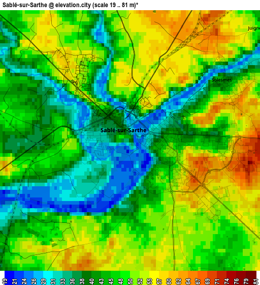
Below is the Elevation map of Sablé-sur-Sarthe, which displays elevation range with different colors. Scale of the first map is from 19 to 81 m (62 to 266 ft) with average elevation of 46.8 meters (=154 ft) [note 1]
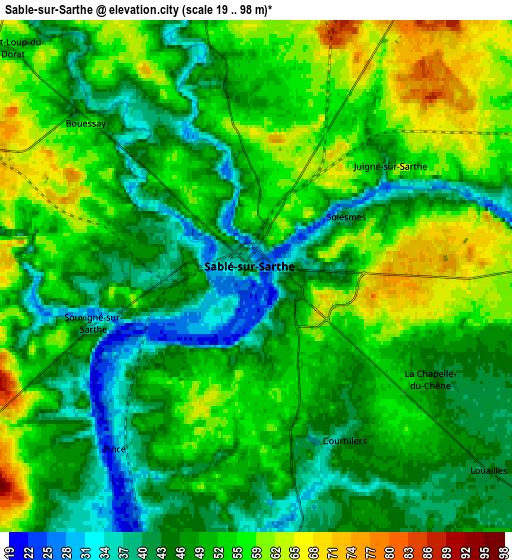
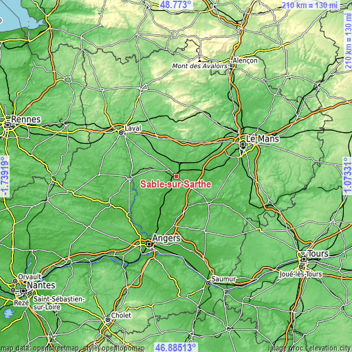
These maps also provides idea of topography and contour of this city, they are displayed at different zoom levels. More info about maps, scale and edge coordinates you can find below images.
| \ | Map #1 | Map #2 | Topo.Map |
| Scale [m] | 19..81 m | 19..98 m | × |
| Scale [ft] | 62..266 ft | 62..322 ft | × |
| Average | 46.8 m = 154 ft | 50.8 m = 167 ft | × |
| Width | 6.56 km = 4.1 mi | 13.12 km = 8.2 mi | 209.9 km = 130.4 mi |
| Height | 6.56 km = 4.1 mi | 13.12 km = 8.2 mi | 209.9 km = 130.4 mi |
| ↑Max Latitude | 47.867139° | 47.896612° | 48.773° |
| Latitude at center | 47.83765° | 47.83765° | 47.83765° |
| ↓Min Latitude | 47.808144° | 47.778621° | 46.88513° |
| ← Min Longitude | -0.376885° | -0.420831° | -1.73919° |
| Longitude center | -0.33294° | -0.33294° | -0.33294° |
| →Max Longitude | -0.288995° | -0.245049° | 1.07331° |
Nearby cities:
Cities around Sablé-sur-Sarthe sort by population:
• Juigné elevation 34 m
14 km,  199°
199°
• Précigné 36 m
7.9 km,  175°
175°
• Noyen-sur-Sarthe 39 m
17.9 km,  77°
77°
• Parcé-sur-Sarthe 44 m
9.9 km,  86°
86°
• Morannes 28 m
12.2 km,  210°
210°
• Auvers-le-Hamon 63 m
7.3 km,  349°
349°
• Brûlon 103 m
16.2 km,  27°
27°
• Daumeray 46 m
15.4 km,  187°
187°
• Solesmes 48 m
2.9 km,  62°
62°
• Juigné-sur-Sarthe 49 m
4.6 km,  48°
48°
• Vion 48 m
7.3 km,  106°
106°
• Miré 48 m
14.8 km,  233°
233°
Multilingual:
 En español:
Sable sobre Sarthe elevación 39 m.
 En France:
Sablé-sur-Sarthe élévation 39 m.
 Auf Deutsch:
Sablé-sur-Sarthe höhe über dem Meeresspiegel ist 39 m.

Sources and notes:
- [note 1] Map square and city borders are not equal. Map elevation data is calculated only from area inside that square.
- [src 1] Elevation data from geonames database provided with same terms of usage.
- [src 2] The elevation map of Sablé-sur-Sarthe is generated using elevation data from NASA's 3 arcsec (90m) resolution SRTM data.
- [src 3] Base (background) map © OpenStreetMap contributors tiles are generated by Geofabrik and OpenTopoMap.
Copyright & License:
This Sablé-sur-Sarthe Elevation Map is licensed under CC BY-SA. You may reuse any part from this page, if you give a proper credit by linking to this URL:
 More info on terms of use page.