Saint-Claude elevation
Saint-Claude (Bourgogne-Franche-Comté, Jura), France elevation is 442 meters and Saint-Claude elevation in feet is 1450 ft above sea level [src 1]. Saint-Claude is a seat of a third-order administrative division (feature code) with elevation that is 268 meters (879 ft) bigger than average city elevation in France.
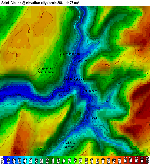
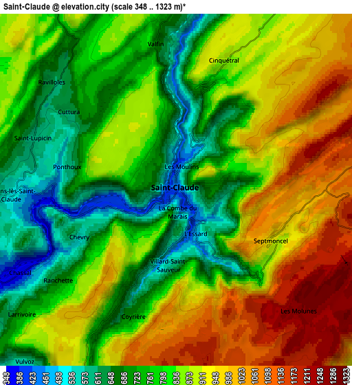
Below is the Elevation map of Saint-Claude, which displays elevation range with different colors. Scale of the first map is from 388 to 1127 m (1273 to 3698 ft) with average elevation of 712.2 meters (=2337 ft) [note 1]
These maps also provides idea of topography and contour of this city, they are displayed at different zoom levels. More info about maps, scale and edge coordinates you can find below images.
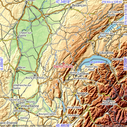
| \ | Map #1 | Map #2 | Topo.Map |
| Scale [m] | 388..1127 m | 348..1323 m | × |
| Scale [ft] | 1273..3698 ft | 1142..4341 ft | × |
| Average | 712.2 m = 2337 ft | 843 m = 2766 ft | × |
| Width | 6.74 km = 4.2 mi | 13.48 km = 8.4 mi | 215.7 km = 134 mi |
| Height | 6.74 km = 4.2 mi | 13.48 km = 8.4 mi | 215.7 km = 134 mi |
| ↑Max Latitude | 46.417094° | 46.447382° | 47.34819° |
| Latitude at center | 46.38679° | 46.38679° | 46.38679° |
| ↓Min Latitude | 46.356469° | 46.326131° | 45.40816° |
| ← Min Longitude | 5.820785° | 5.776839° | 4.45848° |
| Longitude center | 5.86473° | 5.86473° | 5.86473° |
| →Max Longitude | 5.908675° | 5.952621° | 7.27098° |
Nearby cities:
Cities around Saint-Claude sort by population:
• Valfin-lès-Saint-Claude elevation 683 m
5.7 km,  352°
352°
• Gex 575 m
16 km,  111°
111°
• Arbent 579 m
17.7 km,  233°
233°
• Cessy 533 m
17.7 km, 114°
• Dortan 316 m
17.4 km,  244°
244°
• Moirans-en-Montagne 620 m
11.8 km,  296°
296°
• Saint-Lupicin 589 m
5.8 km,  285°
285°
• Lavans-lès-Saint-Claude 530 m
6.4 km,  268°
268°
• Sergy 458 m
18.4 km,  145°
145°
• Échenevex 580 m
16 km,  122°
122°
• Longchaumois 894 m
9.8 km,  30°
30°
• Chevry 474 m
17.8 km,  131°
131°
Multilingual:
 En español:
Saint-Claude elevación 442 m.
 En France:
Saint-Claude élévation 442 m.
 Auf Deutsch:
Saint-Claude höhe über dem Meeresspiegel ist 442 m.

Sources and notes:
- [note 1] Map square and city borders are not equal. Map elevation data is calculated only from area inside that square.
- [src 1] Elevation data from geonames database provided with same terms of usage.
- [src 2] The elevation map of Saint-Claude is generated using elevation data from NASA's 3 arcsec (90m) resolution SRTM data.
- [src 3] Base (background) map © OpenStreetMap contributors tiles are generated by Geofabrik and OpenTopoMap.
Copyright & License:
This Saint-Claude Elevation Map is licensed under CC BY-SA. You may reuse any part from this page, if you give a proper credit by linking to this URL:
 More info on terms of use page.