Saint-Domineuc elevation
Saint-Domineuc (Brittany, Département d'Ille-et-Vilaine), France elevation is 37 meters and Saint-Domineuc elevation in feet is 121 ft above sea level [src 1]. Saint-Domineuc is a populated place (feature code) with elevation that is 137 meters (449 ft) smaller than average city elevation in France.
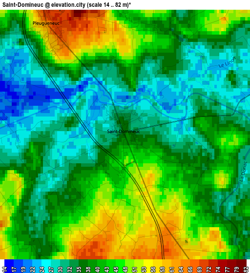
Below is the Elevation map of Saint-Domineuc, which displays elevation range with different colors. Scale of the first map is from 14 to 82 m (46 to 269 ft) with average elevation of 39.4 meters (=129 ft) [note 1]
These maps also provides idea of topography and contour of this city, they are displayed at different zoom levels. More info about maps, scale and edge coordinates you can find below images.
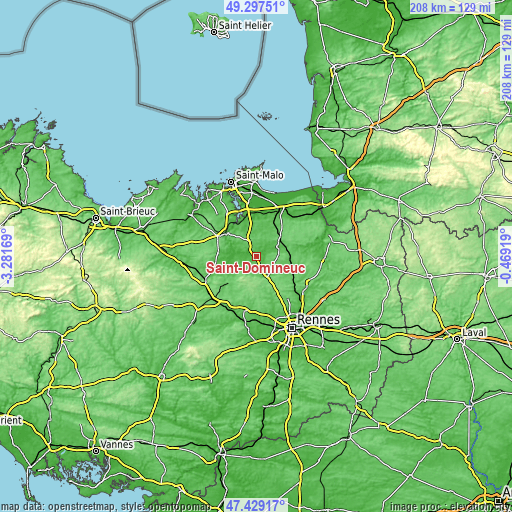
| \ | Map #1 | Topo.Map |
| Scale [m] | 14..82 m | × |
| Scale [ft] | 46..269 ft | × |
| Average | 39.4 m = 129 ft | × |
| Width | 6.49 km = 4 mi | 207.7 km = 129.1 mi |
| Height | 6.49 km = 4 mi | 207.7 km = 129.1 mi |
| ↑Max Latitude | 48.401094° | 49.29751° |
| Latitude at center | 48.37191° | 48.37191° |
| ↓Min Latitude | 48.342709° | 47.42917° |
| ← Min Longitude | -1.919385° | -3.28169° |
| Longitude center | -1.87544° | -1.87544° |
| →Max Longitude | -1.831495° | -0.46919° |
Nearby cities:
Cities around Saint-Domineuc sort by population:
• Combourg elevation 60 m
10.7 km,  64°
64°
• Tinténiac 56 m
5.6 km,  149°
149°
• Saint-Pierre-de-Plesguen 83 m
8.7 km,  341°
341°
• Hédé-Bazouges 52 m
9.7 km, 145°
• Évran 21 m
7.8 km,  276°
276°
• Meillac 43 m
6.4 km,  45°
45°
• Dingé 89 m
12 km,  97°
97°
• Plouasne 59 m
12.5 km,  230°
230°
• Pleugueneuc 64 m
3.5 km,  324°
324°
• Québriac 49 m
4.7 km,  130°
130°
• Saint-Hélen 70 m
12.5 km,  330°
330°
• Les Champs-Géraux 45 m
8.6 km,  305°
305°
Multilingual:
 En español:
Saint-Domineuc elevación 37 m.
 En France:
Saint-Domineuc élévation 37 m.
 Auf Deutsch:
Saint-Domineuc höhe über dem Meeresspiegel ist 37 m.

Sources and notes:
- [note 1] Map square and city borders are not equal. Map elevation data is calculated only from area inside that square.
- [src 1] Elevation data from geonames database provided with same terms of usage.
- [src 2] The elevation map of Saint-Domineuc is generated using elevation data from NASA's 3 arcsec (90m) resolution SRTM data.
- [src 3] Base (background) map © OpenStreetMap contributors tiles are generated by Geofabrik and OpenTopoMap.
Copyright & License:
This Saint-Domineuc Elevation Map is licensed under CC BY-SA. You may reuse any part from this page, if you give a proper credit by linking to this URL:
 More info on terms of use page.