Sainte-Marthe elevation
Sainte-Marthe (Provence-Alpes-Côte d'Azur, Département des Bouches-du-Rhône), France elevation is 67 meters and Sainte-Marthe elevation in feet is 220 ft above sea level [src 1]. Sainte-Marthe is a section of populated place (feature code) with elevation that is 107 meters (351 ft) smaller than average city elevation in France.
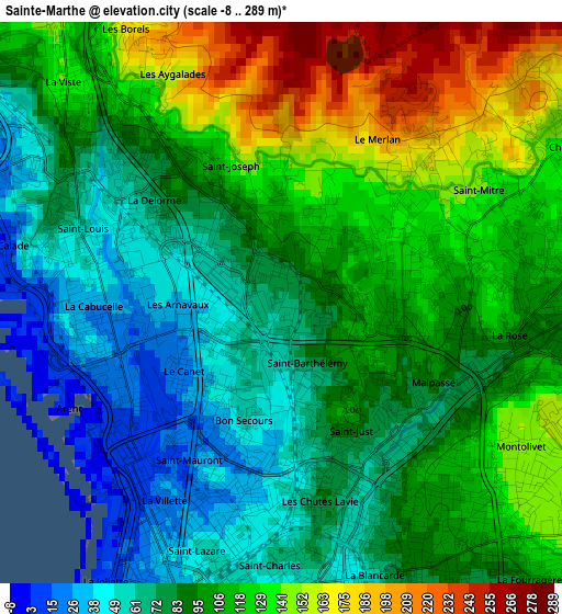
Below is the Elevation map of Sainte-Marthe, which displays elevation range with different colors. Scale of the first map is from -8 to 289 m (-26 to 948 ft) with average elevation of 101 meters (=331 ft) [note 1]
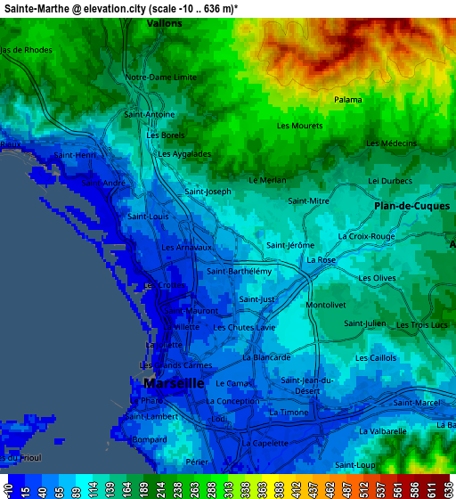
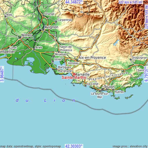
These maps also provides idea of topography and contour of this city, they are displayed at different zoom levels. More info about maps, scale and edge coordinates you can find below images.
| \ | Map #1 | Map #2 | Topo.Map |
| Scale [m] | -8..289 m | -10..636 m | × |
| Scale [ft] | -26..948 ft | -33..2087 ft | × |
| Average | 101 m = 331 ft | 156.3 m = 513 ft | × |
| Width | 7.11 km = 4.4 mi | 14.22 km = 8.8 mi | 227.5 km = 141.4 mi |
| Height | 7.11 km = 4.4 mi | 14.22 km = 8.8 mi | 227.4 km = 141.3 mi |
| ↑Max Latitude | 43.366446° | 43.398384° | 44.34872° |
| Latitude at center | 43.33449° | 43.33449° | 43.33449° |
| ↓Min Latitude | 43.302518° | 43.270528° | 42.30303° |
| ← Min Longitude | 5.347175° | 5.303229° | 3.98487° |
| Longitude center | 5.39112° | 5.39112° | 5.39112° |
| →Max Longitude | 5.435065° | 5.479011° | 6.79737° |
Nearby cities:
Cities around Sainte-Marthe sort by population:
• Marseille 13 elevation 64 m
2.3 km,  141°
141°
• Marseille 14 72 m
1.4 km,  321°
321°
• Saint-Barthélémy 95 m
1 km,  112°
112°
• Saint-Just 62 m
2.3 km,  148°
148°
• Bon-Secours 61 m
1.8 km,  198°
198°
• Saint-Jérôme 97 m
2.1 km,  91°
91°
• Le Merlan 113 m
1.4 km,  70°
70°
• Le Canet 14 m
1.8 km,  238°
238°
• La Delorme 79 m
1.8 km,  305°
305°
• Les Arnavaux 71 m
0.9 km,  273°
273°
• Saint-Joseph 104 m
1.6 km, 324°
• Les Crottes 20 m
2.3 km, 235°
Multilingual:
 En español:
Sainte-Marthe elevación 67 m.
 En France:
Sainte-Marthe élévation 67 m.
 Auf Deutsch:
Sainte-Marthe höhe über dem Meeresspiegel ist 67 m.

Sources and notes:
- [note 1] Map square and city borders are not equal. Map elevation data is calculated only from area inside that square.
- [src 1] Elevation data from geonames database provided with same terms of usage.
- [src 2] The elevation map of Sainte-Marthe is generated using elevation data from NASA's 3 arcsec (90m) resolution SRTM data.
- [src 3] Base (background) map © OpenStreetMap contributors tiles are generated by Geofabrik and OpenTopoMap.
Copyright & License:
This Sainte-Marthe Elevation Map is licensed under CC BY-SA. You may reuse any part from this page, if you give a proper credit by linking to this URL:
 More info on terms of use page.