Marseille 13 elevation
Marseille 13 (Provence-Alpes-Côte d'Azur, Département des Bouches-du-Rhône), France elevation is 64 meters and Marseille 13 elevation in feet is 210 ft above sea level [src 1]. Marseille 13 is a seat of a fifth-order administrative division (feature code) with elevation that is 110 meters (361 ft) smaller than average city elevation in France.
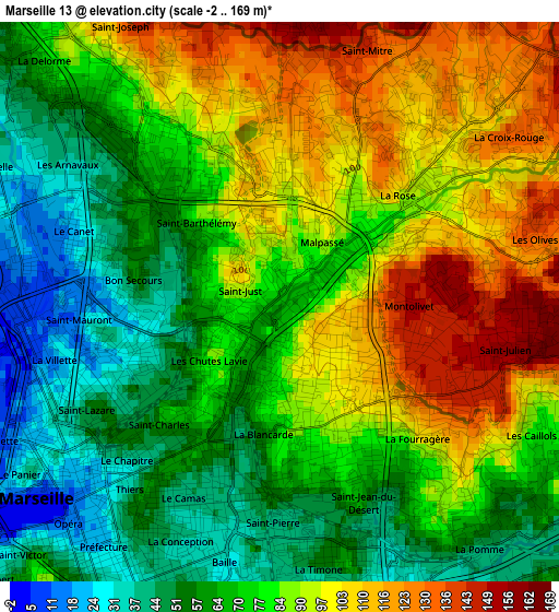
Below is the Elevation map of Marseille 13, which displays elevation range with different colors. Scale of the first map is from -2 to 169 m (-7 to 554 ft) with average elevation of 79.1 meters (=260 ft) [note 1]
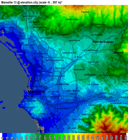
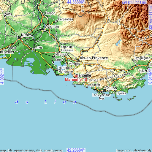
These maps also provides idea of topography and contour of this city, they are displayed at different zoom levels. More info about maps, scale and edge coordinates you can find below images.
| \ | Map #1 | Map #2 | Topo.Map |
| Scale [m] | -2..169 m | -8..597 m | × |
| Scale [ft] | -7..554 ft | -26..1959 ft | × |
| Average | 79.1 m = 260 ft | 139.7 m = 458 ft | × |
| Width | 7.11 km = 4.4 mi | 14.22 km = 8.8 mi | 227.5 km = 141.4 mi |
| Height | 7.11 km = 4.4 mi | 14.22 km = 8.8 mi | 227.5 km = 141.4 mi |
| ↑Max Latitude | 43.350524° | 43.382471° | 44.33306° |
| Latitude at center | 43.31856° | 43.31856° | 43.31856° |
| ↓Min Latitude | 43.286579° | 43.254581° | 42.28684° |
| ← Min Longitude | 5.364415° | 5.320469° | 4.00211° |
| Longitude center | 5.40836° | 5.40836° | 5.40836° |
| →Max Longitude | 5.452305° | 5.496251° | 6.81461° |
Nearby cities:
Cities around Marseille 13 sort by population:
• Marseille 04 elevation 49 m
1.9 km,  197°
197°
• Saint-Barthélémy 95 m
1.5 km,  340°
340°
• La Blancarde 80 m
2 km,  186°
186°
• Saint-Just 62 m
0.3 km,  229°
229°
• Belle de Mai 60 m
2 km,  248°
248°
• La Rose 102 m
2 km,  54°
54°
• Cinq Avenues 60 m
1.9 km,  207°
207°
• Montolivet 140 m
1.2 km,  97°
97°
• Malpassé 100 m
0.7 km,  58°
58°
• Saint-Jérôme 97 m
1.9 km,  22°
22°
• Chutes-Lavie 60 m
1.4 km, 229°
• Les Chartreux 97 m
0.9 km, 199°
Multilingual:
 En español:
Marseille 13 elevación 64 m.
 En France:
Marseille 13 élévation 64 m.
 Auf Deutsch:
Marseille 13 höhe über dem Meeresspiegel ist 64 m.

Sources and notes:
- [note 1] Map square and city borders are not equal. Map elevation data is calculated only from area inside that square.
- [src 1] Elevation data from geonames database provided with same terms of usage.
- [src 2] The elevation map of Marseille 13 is generated using elevation data from NASA's 3 arcsec (90m) resolution SRTM data.
- [src 3] Base (background) map © OpenStreetMap contributors tiles are generated by Geofabrik and OpenTopoMap.
Copyright & License:
This Marseille 13 Elevation Map is licensed under CC BY-SA. You may reuse any part from this page, if you give a proper credit by linking to this URL:
 More info on terms of use page.