Saint-Florentin elevation
Saint-Florentin (Bourgogne-Franche-Comté, Département de l'Yonne), France elevation is 129 meters and Saint-Florentin elevation in feet is 423 ft above sea level [src 1]. Saint-Florentin is a populated place (feature code) with elevation that is 45 meters (148 ft) smaller than average city elevation in France.
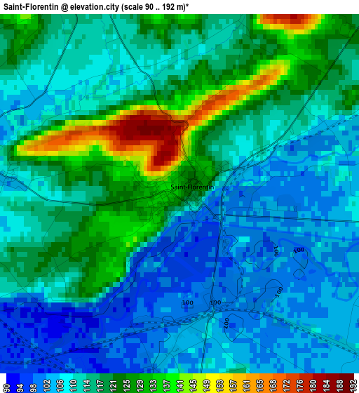
Below is the Elevation map of Saint-Florentin, which displays elevation range with different colors. Scale of the first map is from 90 to 192 m (295 to 630 ft) with average elevation of 114.4 meters (=375 ft) [note 1]
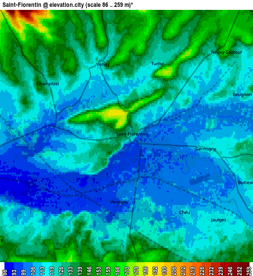
These maps also provides idea of topography and contour of this city, they are displayed at different zoom levels. More info about maps, scale and edge coordinates you can find below images.
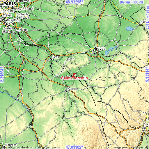
| \ | Map #1 | Map #2 | Topo.Map |
| Scale [m] | 90..192 m | 86..259 m | × |
| Scale [ft] | 295..630 ft | 282..850 ft | × |
| Average | 114.4 m = 375 ft | 122.6 m = 402 ft | × |
| Width | 6.54 km = 4.1 mi | 13.08 km = 8.1 mi | 209.3 km = 130.1 mi |
| Height | 6.54 km = 4.1 mi | 13.08 km = 8.1 mi | 209.2 km = 130 mi |
| ↑Max Latitude | 48.029966° | 48.059346° | 48.93295° |
| Latitude at center | 48.00057° | 48.00057° | 48.00057° |
| ↓Min Latitude | 47.971157° | 47.941727° | 47.05102° |
| ← Min Longitude | 3.680945° | 3.636999° | 2.31864° |
| Longitude center | 3.72489° | 3.72489° | 3.72489° |
| →Max Longitude | 3.768835° | 3.812781° | 5.13114° |
Nearby cities:
Cities around Saint-Florentin sort by population:
• Migennes elevation 86 m
15.9 km,  255°
255°
• Brienon-sur-Armançon 92 m
8.2 km, 261°
• Cheny 92 m
15.3 km,  249°
249°
• Héry 111 m
13.1 km,  213°
213°
• Gurgy 90 m
19.1 km,  219°
219°
• Seignelay 108 m
14 km, 221°
• Vergigny 99 m
3.4 km,  187°
187°
• Laroche-Saint-Cydroine 93 m
18.2 km, 258°
• Ligny-le-Châtel 125 m
11.4 km,  167°
167°
• Ervy-le-Châtel 156 m
14.5 km,  71°
71°
• Flogny-la-Chapelle 127 m
12 km,  118°
118°
• Neuvy-Sautour 165 m
6.9 km,  48°
48°
Multilingual:
 En español:
Saint-Florentin elevación 129 m.
 En France:
Saint-Florentin élévation 129 m.
 Auf Deutsch:
Saint-Florentin höhe über dem Meeresspiegel ist 129 m.

Sources and notes:
- [note 1] Map square and city borders are not equal. Map elevation data is calculated only from area inside that square.
- [src 1] Elevation data from geonames database provided with same terms of usage.
- [src 2] The elevation map of Saint-Florentin is generated using elevation data from NASA's 3 arcsec (90m) resolution SRTM data.
- [src 3] Base (background) map © OpenStreetMap contributors tiles are generated by Geofabrik and OpenTopoMap.
Copyright & License:
This Saint-Florentin Elevation Map is licensed under CC BY-SA. You may reuse any part from this page, if you give a proper credit by linking to this URL:
 More info on terms of use page.