Migennes elevation
Migennes (Bourgogne-Franche-Comté, Département de l'Yonne), France elevation is 86 meters and Migennes elevation in feet is 282 ft above sea level [src 1]. Migennes is a populated place (feature code) with elevation that is 88 meters (289 ft) smaller than average city elevation in France.
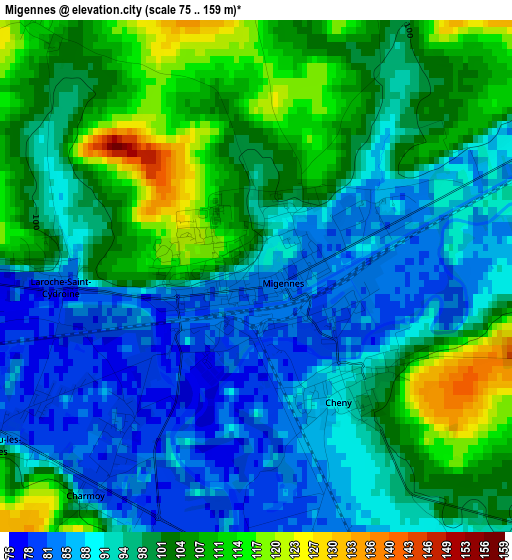
Below is the Elevation map of Migennes, which displays elevation range with different colors. Scale of the first map is from 75 to 159 m (246 to 522 ft) with average elevation of 97.1 meters (=319 ft) [note 1]
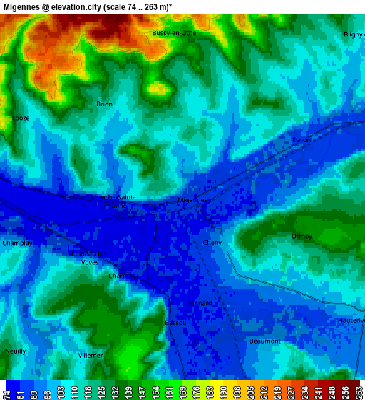
These maps also provides idea of topography and contour of this city, they are displayed at different zoom levels. More info about maps, scale and edge coordinates you can find below images.
| \ | Map #1 | Map #2 | Topo.Map |
| Scale [m] | 75..159 m | 74..263 m | × |
| Scale [ft] | 246..522 ft | 243..863 ft | × |
| Average | 97.1 m = 319 ft | 114.4 m = 375 ft | × |
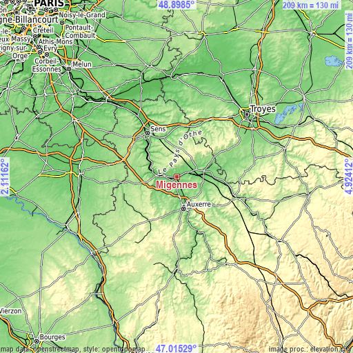
| Width | 6.54 km = 4.1 mi | 13.09 km = 8.1 mi | 209.4 km = 130.1 mi |
| Height | 6.54 km = 4.1 mi | 13.09 km = 8.1 mi | 209.4 km = 130.1 mi |
| ↑Max Latitude | 47.994896° | 48.024296° | 48.8985° |
| Latitude at center | 47.96548° | 47.96548° | 47.96548° |
| ↓Min Latitude | 47.936047° | 47.906597° | 47.01529° |
| ← Min Longitude | 3.473925° | 3.429979° | 2.11162° |
| Longitude center | 3.51787° | 3.51787° | 3.51787° |
| →Max Longitude | 3.561815° | 3.605761° | 4.92412° |
Nearby cities:
Cities around Migennes sort by population:
• Joigny elevation 107 m
8.9 km,  282°
282°
• Monéteau 107 m
13.8 km,  159°
159°
• Brienon-sur-Armançon 92 m
7.8 km,  69°
69°
• Appoigny 94 m
10.1 km,  176°
176°
• Cheny 92 m
1.9 km,  143°
143°
• Héry 111 m
10.9 km,  130°
130°
• Gurgy 90 m
11.5 km, 162°
• Seignelay 108 m
9.1 km, 137°
• Vergigny 99 m
15 km,  87°
87°
• Laroche-Saint-Cydroine 93 m
2.5 km, 276°
• Cézy 79 m
13.5 km, 282°
• Fleury-la-Vallée 137 m
12.1 km,  205°
205°
Multilingual:
 En español:
Migennes elevación 86 m.
 En France:
Migennes élévation 86 m.


Sources and notes:
- [note 1] Map square and city borders are not equal. Map elevation data is calculated only from area inside that square.
- [src 1] Elevation data from geonames database provided with same terms of usage.
- [src 2] The elevation map of Migennes is generated using elevation data from NASA's 3 arcsec (90m) resolution SRTM data.
- [src 3] Base (background) map © OpenStreetMap contributors tiles are generated by Geofabrik and OpenTopoMap.
Copyright & License:
This Migennes Elevation Map is licensed under CC BY-SA. You may reuse any part from this page, if you give a proper credit by linking to this URL:
 More info on terms of use page.