Saint-Laurent-sur-Sèvre elevation
Saint-Laurent-sur-Sèvre (Pays de la Loire, Département de la Vendée), France elevation is 130 meters and Saint-Laurent-sur-Sèvre elevation in feet is 427 ft above sea level [src 1]. Saint-Laurent-sur-Sèvre is a populated place (feature code) with elevation that is 44 meters (144 ft) smaller than average city elevation in France.
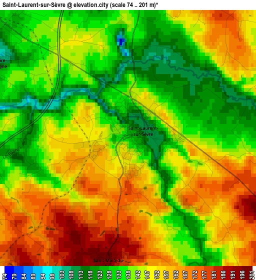
Below is the Elevation map of Saint-Laurent-sur-Sèvre, which displays elevation range with different colors. Scale of the first map is from 74 to 201 m (243 to 659 ft) with average elevation of 146 meters (=479 ft) [note 1]
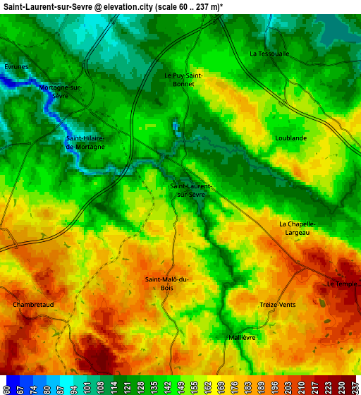
These maps also provides idea of topography and contour of this city, they are displayed at different zoom levels. More info about maps, scale and edge coordinates you can find below images.
| \ | Map #1 | Map #2 | Topo.Map |
| Scale [m] | 74..201 m | 60..237 m | × |
| Scale [ft] | 243..659 ft | 197..778 ft | × |
| Average | 146 m = 479 ft | 151.6 m = 497 ft | × |
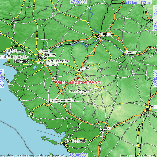
| Width | 6.67 km = 4.1 mi | 13.34 km = 8.3 mi | 213.4 km = 132.6 mi |
| Height | 6.67 km = 4.1 mi | 13.34 km = 8.3 mi | 213.4 km = 132.6 mi |
| ↑Max Latitude | 46.988076° | 47.018045° | 47.9093° |
| Latitude at center | 46.95809° | 46.95809° | 46.95809° |
| ↓Min Latitude | 46.928087° | 46.898068° | 45.98966° |
| ← Min Longitude | -0.937865° | -0.981811° | -2.30017° |
| Longitude center | -0.89392° | -0.89392° | -0.89392° |
| →Max Longitude | -0.849975° | -0.806029° | 0.51233° |
Nearby cities:
Cities around Saint-Laurent-sur-Sèvre sort by population:
• Cholet elevation 111 m
11.3 km,  5°
5°
• Mortagne-sur-Sèvre 121 m
5.5 km,  312°
312°
• La Séguinière 80 m
12.2 km,  343°
343°
• La Verrie 160 m
7.8 km,  272°
272°
• La Tessoualle 122 m
6.1 km,  31°
31°
• Saint-Christophe-du-Bois 86 m
8.9 km,  334°
334°
• Les Epesses 189 m
8.3 km,  183°
183°
• Chambretaud 205 m
6.7 km,  232°
232°
• Saint-Malô-du-Bois 193 m
2.8 km,  189°
189°
• Saint-Pierre-des-Échaubrognes 152 m
11.9 km,  73°
73°
• Saint-Aubin-des-Ormeaux 133 m
11.9 km,  288°
288°
• Mazières-en-Mauges 117 m
11.3 km, 31°
Multilingual:
 En español:
Saint-Laurent-sur-Sèvre elevación 130 m.
 En France:
Saint-Laurent-sur-Sèvre élévation 130 m.
 Auf Deutsch:
Saint-Laurent-sur-Sèvre höhe über dem Meeresspiegel ist 130 m.
 На русском:
Saint-Laurent-sur-Sèvre высота над уровнем моря 130 м
Sources and notes:
- [note 1] Map square and city borders are not equal. Map elevation data is calculated only from area inside that square.
- [src 1] Elevation data from geonames database provided with same terms of usage.
- [src 2] The elevation map of Saint-Laurent-sur-Sèvre is generated using elevation data from NASA's 3 arcsec (90m) resolution SRTM data.
- [src 3] Base (background) map © OpenStreetMap contributors tiles are generated by Geofabrik and OpenTopoMap.
Copyright & License:
This Saint-Laurent-sur-Sèvre Elevation Map is licensed under CC BY-SA. You may reuse any part from this page, if you give a proper credit by linking to this URL:
 More info on terms of use page.