Cholet elevation
Cholet (Pays de la Loire, Département de Maine-et-Loire), France elevation is 111 meters and Cholet elevation in feet is 364 ft above sea level [src 1]. Cholet is a seat of a third-order administrative division (feature code) with elevation that is 63 meters (207 ft) smaller than average city elevation in France.
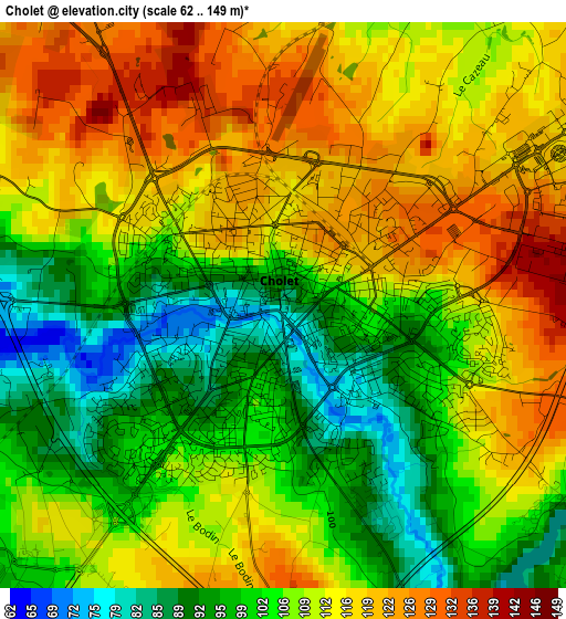
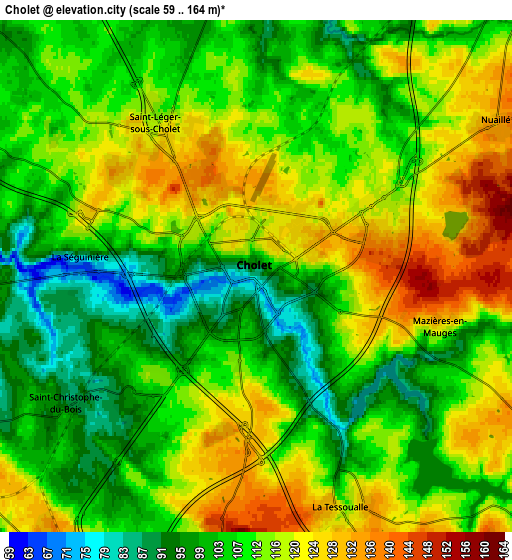
Below is the Elevation map of Cholet, which displays elevation range with different colors. Scale of the first map is from 62 to 149 m (203 to 489 ft) with average elevation of 108.7 meters (=357 ft) [note 1]
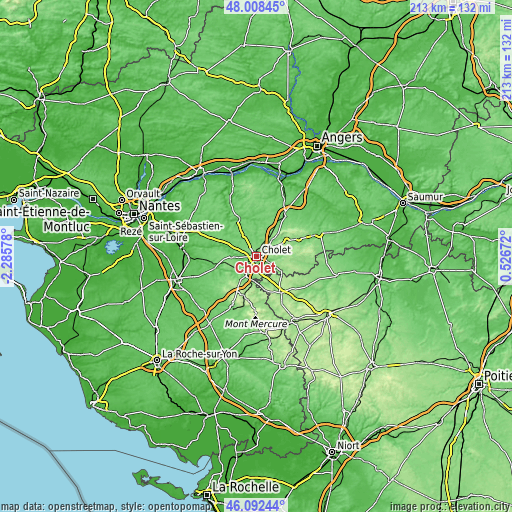
These maps also provides idea of topography and contour of this city, they are displayed at different zoom levels. More info about maps, scale and edge coordinates you can find below images.
| \ | Map #1 | Map #2 | Topo.Map |
| Scale [m] | 62..149 m | 59..164 m | × |
| Scale [ft] | 203..489 ft | 194..538 ft | × |
| Average | 108.7 m = 357 ft | 111.2 m = 365 ft | × |
| Width | 6.66 km = 4.1 mi | 13.32 km = 8.3 mi | 213 km = 132.4 mi |
| Height | 6.66 km = 4.1 mi | 13.31 km = 8.3 mi | 213 km = 132.4 mi |
| ↑Max Latitude | 47.088979° | 47.118891° | 48.00845° |
| Latitude at center | 47.05905° | 47.05905° | 47.05905° |
| ↓Min Latitude | 47.029104° | 46.999141° | 46.09244° |
| ← Min Longitude | -0.923475° | -0.967421° | -2.28578° |
| Longitude center | -0.87953° | -0.87953° | -0.87953° |
| →Max Longitude | -0.835585° | -0.791639° | 0.52672° |
Nearby cities:
Cities around Cholet sort by population:
• Mortagne-sur-Sèvre elevation 121 m
9.1 km,  214°
214°
• Le May-sur-Èvre 99 m
8.7 km,  353°
353°
• La Séguinière 80 m
4.5 km,  276°
276°
• La Tessoualle 122 m
6.4 km,  160°
160°
• Trémentines 133 m
10.1 km,  44°
44°
• Saint-Léger-sous-Cholet 123 m
4.5 km,  329°
329°
• Saint-André-de-la-Marche 94 m
9.8 km,  297°
297°
• Saint-Christophe-du-Bois 86 m
5.9 km,  236°
236°
• Bégrolles-en-Mauges 110 m
10.1 km, 333°
• Nuaillé 136 m
7.6 km,  57°
57°
• Toutlemonde 129 m
8.7 km,  93°
93°
• Mazières-en-Mauges 117 m
5 km,  107°
107°
Multilingual:
 En español:
Cholet elevación 111 m.
 En France:
Cholet élévation 111 m.


Sources and notes:
- [note 1] Map square and city borders are not equal. Map elevation data is calculated only from area inside that square.
- [src 1] Elevation data from geonames database provided with same terms of usage.
- [src 2] The elevation map of Cholet is generated using elevation data from NASA's 3 arcsec (90m) resolution SRTM data.
- [src 3] Base (background) map © OpenStreetMap contributors tiles are generated by Geofabrik and OpenTopoMap.
Copyright & License:
This Cholet Elevation Map is licensed under CC BY-SA. You may reuse any part from this page, if you give a proper credit by linking to this URL:
 More info on terms of use page.