Saint-Martin-en-Haut elevation
Saint-Martin-en-Haut (Auvergne-Rhône-Alpes, Département du Rhône), France elevation is 730 meters and Saint-Martin-en-Haut elevation in feet is 2395 ft above sea level [src 1]. Saint-Martin-en-Haut is a populated place (feature code) with elevation that is 556 meters (1824 ft) bigger than average city elevation in France.
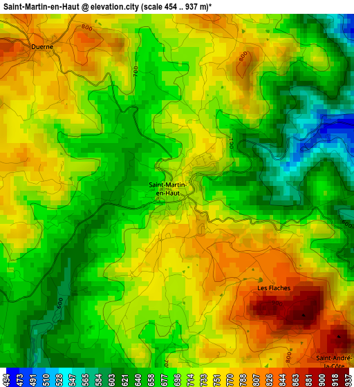
Below is the Elevation map of Saint-Martin-en-Haut, which displays elevation range with different colors. Scale of the first map is from 454 to 937 m (1490 to 3074 ft) with average elevation of 709.2 meters (=2327 ft) [note 1]
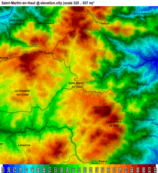
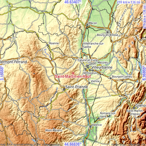
These maps also provides idea of topography and contour of this city, they are displayed at different zoom levels. More info about maps, scale and edge coordinates you can find below images.
| \ | Map #1 | Map #2 | Topo.Map |
| Scale [m] | 454..937 m | 325..937 m | × |
| Scale [ft] | 1490..3074 ft | 1066..3074 ft | × |
| Average | 709.2 m = 2327 ft | 655.8 m = 2152 ft | × |
| Width | 6.83 km = 4.2 mi | 13.66 km = 8.5 mi | 218.6 km = 135.8 mi |
| Height | 6.83 km = 4.2 mi | 13.66 km = 8.5 mi | 218.6 km = 135.8 mi |
| ↑Max Latitude | 45.690546° | 45.721235° | 46.63407° |
| Latitude at center | 45.65984° | 45.65984° | 45.65984° |
| ↓Min Latitude | 45.629117° | 45.598378° | 44.66836° |
| ← Min Longitude | 4.517855° | 4.473909° | 3.15555° |
| Longitude center | 4.5618° | 4.5618° | 4.5618° |
| →Max Longitude | 4.605745° | 4.649691° | 5.96805° |
Nearby cities:
Cities around Saint-Martin-en-Haut sort by population:
• Mornant elevation 363 m
9.7 km,  117°
117°
• Vaugneray 415 m
11.4 km,  40°
40°
• Soucieu-en-Jarrest 320 m
11.2 km,  79°
79°
• Saint-Symphorien-sur-Coise 588 m
8.7 km,  249°
249°
• Messimy 331 m
9.7 km,  64°
64°
• Thurins 347 m
6.6 km,  68°
68°
• Saint-Maurice-sur-Dargoire 413 m
10.2 km,  147°
147°
• Larajasse 724 m
6.9 km,  222°
222°
• Sainte-Foy-l’Argentière 466 m
8.9 km,  307°
307°
• Saint-Didier-sous-Riverie 517 m
7.9 km, 153°
• Courzieu 380 m
9.2 km,  4°
4°
• Aveize 792 m
7 km,  291°
291°
Multilingual:
 En español:
Saint-Martin-en-Haut elevación 730 m.
 En France:
Saint-Martin-en-Haut élévation 730 m.
 Auf Deutsch:
Saint-Martin-en-Haut höhe über dem Meeresspiegel ist 730 m.
 На русском:
Saint-Martin-en-Haut высота над уровнем моря 730 м
Sources and notes:
- [note 1] Map square and city borders are not equal. Map elevation data is calculated only from area inside that square.
- [src 1] Elevation data from geonames database provided with same terms of usage.
- [src 2] The elevation map of Saint-Martin-en-Haut is generated using elevation data from NASA's 3 arcsec (90m) resolution SRTM data.
- [src 3] Base (background) map © OpenStreetMap contributors tiles are generated by Geofabrik and OpenTopoMap.
Copyright & License:
This Saint-Martin-en-Haut Elevation Map is licensed under CC BY-SA. You may reuse any part from this page, if you give a proper credit by linking to this URL:
 More info on terms of use page.