Saintry-sur-Seine elevation
Saintry-sur-Seine (Île-de-France, Département de l'Essonne), France elevation is 60 meters and Saintry-sur-Seine elevation in feet is 197 ft above sea level [src 1]. Saintry-sur-Seine is a populated place (feature code) with elevation that is 114 meters (374 ft) smaller than average city elevation in France.
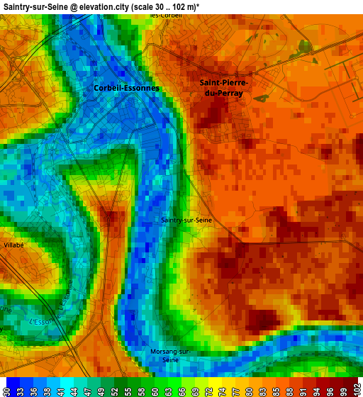
Below is the Elevation map of Saintry-sur-Seine, which displays elevation range with different colors. Scale of the first map is from 30 to 102 m (98 to 335 ft) with average elevation of 70.4 meters (=231 ft) [note 1]
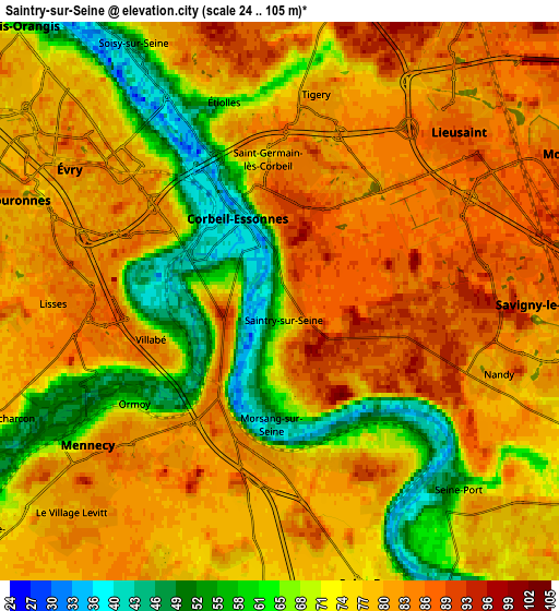
These maps also provides idea of topography and contour of this city, they are displayed at different zoom levels. More info about maps, scale and edge coordinates you can find below images.
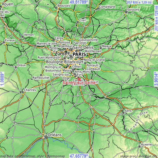
| \ | Map #1 | Map #2 | Topo.Map |
| Scale [m] | 30..102 m | 24..105 m | × |
| Scale [ft] | 98..335 ft | 79..344 ft | × |
| Average | 70.4 m = 231 ft | 76.1 m = 250 ft | × |
| Width | 6.46 km = 4 mi | 12.93 km = 8 mi | 206.8 km = 128.5 mi |
| Height | 6.46 km = 4 mi | 12.93 km = 8 mi | 206.8 km = 128.5 mi |
| ↑Max Latitude | 48.625455° | 48.654494° | 49.51789° |
| Latitude at center | 48.5964° | 48.5964° | 48.5964° |
| ↓Min Latitude | 48.567328° | 48.538239° | 47.65779° |
| ← Min Longitude | 2.451205° | 2.407259° | 1.0889° |
| Longitude center | 2.49515° | 2.49515° | 2.49515° |
| →Max Longitude | 2.539095° | 2.583041° | 3.9014° |
Nearby cities:
Cities around Saintry-sur-Seine sort by population:
• Corbeil-Essonnes elevation 36 m
1.2 km,  332°
332°
• Mennecy 82 m
4.8 km,  231°
231°
• Saint-Fargeau-Ponthierry 84 m
5 km,  150°
150°
• Lisses 82 m
5.4 km,  276°
276°
• Saint-Germain-lès-Corbeil 78 m
2.9 km,  349°
349°
• Nandy 82 m
5.2 km,  106°
106°
• Saint-Pierre-du-Perray 80 m
1.6 km,  357°
357°
• Villabé 84 m
3.3 km,  256°
256°
• Le Coudray-Montceaux 71 m
3.6 km,  174°
174°
• Étiolles 84 m
4.1 km, 346°
• Tigery 76 m
5.2 km,  10°
10°
• Ormoy 54 m
4 km, 232°
Multilingual:
 En español:
Saintry-sur-Seine elevación 60 m.
 En France:
Saintry-sur-Seine élévation 60 m.
 Auf Deutsch:
Saintry-sur-Seine höhe über dem Meeresspiegel ist 60 m.

Sources and notes:
- [note 1] Map square and city borders are not equal. Map elevation data is calculated only from area inside that square.
- [src 1] Elevation data from geonames database provided with same terms of usage.
- [src 2] The elevation map of Saintry-sur-Seine is generated using elevation data from NASA's 3 arcsec (90m) resolution SRTM data.
- [src 3] Base (background) map © OpenStreetMap contributors tiles are generated by Geofabrik and OpenTopoMap.
Copyright & License:
This Saintry-sur-Seine Elevation Map is licensed under CC BY-SA. You may reuse any part from this page, if you give a proper credit by linking to this URL:
 More info on terms of use page.