Saint-Sever-Calvados elevation
Saint-Sever-Calvados (Normandy, Calvados), France elevation is 212 meters and Saint-Sever-Calvados elevation in feet is 696 ft above sea level [src 1]. Saint-Sever-Calvados is a populated place (feature code) with elevation that is 38 meters (125 ft) bigger than average city elevation in France.
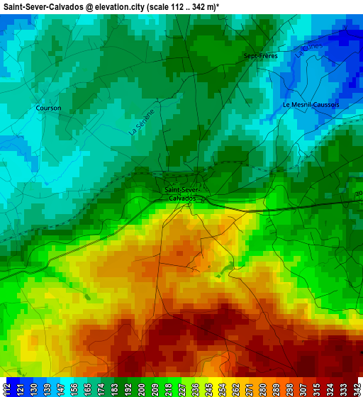
Below is the Elevation map of Saint-Sever-Calvados, which displays elevation range with different colors. Scale of the first map is from 112 to 342 m (367 to 1122 ft) with average elevation of 210.9 meters (=692 ft) [note 1]
These maps also provides idea of topography and contour of this city, they are displayed at different zoom levels. More info about maps, scale and edge coordinates you can find below images.
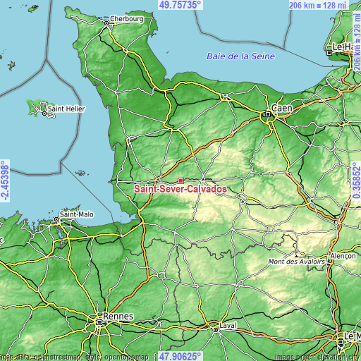
| \ | Map #1 | Topo.Map |
| Scale [m] | 112..342 m | × |
| Scale [ft] | 367..1122 ft | × |
| Average | 210.9 m = 692 ft | × |
| Width | 6.43 km = 4 mi | 205.8 km = 127.9 mi |
| Height | 6.43 km = 4 mi | 205.8 km = 127.9 mi |
| ↑Max Latitude | 48.869265° | 49.75735° |
| Latitude at center | 48.84035° | 48.84035° |
| ↓Min Latitude | 48.811419° | 47.90625° |
| ← Min Longitude | -1.091675° | -2.45398° |
| Longitude center | -1.04773° | -1.04773° |
| →Max Longitude | -1.003785° | 0.35852° |
Nearby cities:
Cities around Saint-Sever-Calvados sort by population:
• Vire elevation 200 m
11.6 km,  91°
91°
• Villedieu-les-Poêles 124 m
12.4 km,  266°
266°
• Sourdeval 213 m
16 km,  144°
144°
• Condé-sur-Vire 27 m
23.3 km,  2°
2°
• Torigni-sur-Vire 74 m
22.4 km,  12°
12°
• Mortain 236 m
22.8 km,  159°
159°
• Brécey 68 m
15.6 km,  213°
213°
• Percy 125 m
13.4 km,  309°
309°
• Vaudry 226 m
14.2 km, 89°
• Tessy-sur-Vire 60 m
14.9 km,  356°
356°
• Hambye 91 m
19.8 km, 307°
• Romagny 153 m
23.1 km,  165°
165°
Multilingual:
 En español:
Saint-Sever-Calvados elevación 212 m.
 En France:
Saint-Sever-Calvados élévation 212 m.
 Auf Deutsch:
Saint-Sever-Calvados höhe über dem Meeresspiegel ist 212 m.
 На русском:
Сен-Севе-Кальвадос высота над уровнем моря 212 м
Sources and notes:
- [note 1] Map square and city borders are not equal. Map elevation data is calculated only from area inside that square.
- [src 1] Elevation data from geonames database provided with same terms of usage.
- [src 2] The elevation map of Saint-Sever-Calvados is generated using elevation data from NASA's 3 arcsec (90m) resolution SRTM data.
- [src 3] Base (background) map © OpenStreetMap contributors tiles are generated by Geofabrik and OpenTopoMap.
Copyright & License:
This Saint-Sever-Calvados Elevation Map is licensed under CC BY-SA. You may reuse any part from this page, if you give a proper credit by linking to this URL:
 More info on terms of use page.