Saint-Vallier elevation
Saint-Vallier (Auvergne-Rhône-Alpes, Département de la Drôme), France elevation is 220 meters and Saint-Vallier elevation in feet is 722 ft above sea level [src 1]. Saint-Vallier is a populated place (feature code) with elevation that is 46 meters (151 ft) bigger than average city elevation in France.
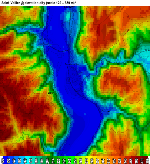
Below is the Elevation map of Saint-Vallier, which displays elevation range with different colors. Scale of the first map is from 122 to 389 m (400 to 1276 ft) with average elevation of 252 meters (=827 ft) [note 1]
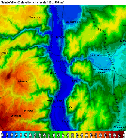
These maps also provides idea of topography and contour of this city, they are displayed at different zoom levels. More info about maps, scale and edge coordinates you can find below images.
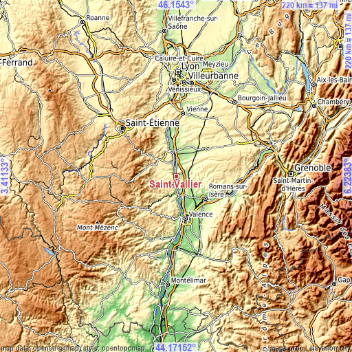
| \ | Map #1 | Map #2 | Topo.Map |
| Scale [m] | 122..389 m | 118..516 m | × |
| Scale [ft] | 400..1276 ft | 387..1693 ft | × |
| Average | 252 m = 827 ft | 282.5 m = 927 ft | × |
| Width | 6.89 km = 4.3 mi | 13.78 km = 8.6 mi | 220.5 km = 137 mi |
| Height | 6.89 km = 4.3 mi | 13.78 km = 8.6 mi | 220.5 km = 137 mi |
| ↑Max Latitude | 45.202512° | 45.233468° | 46.1543° |
| Latitude at center | 45.17154° | 45.17154° | 45.17154° |
| ↓Min Latitude | 45.140551° | 45.109545° | 44.17152° |
| ← Min Longitude | 4.773635° | 4.729689° | 3.41133° |
| Longitude center | 4.81758° | 4.81758° | 4.81758° |
| →Max Longitude | 4.861525° | 4.905471° | 6.22383° |
Nearby cities:
Cities around Saint-Vallier sort by population:
• Tournon-sur-Rhône elevation 130 m
11.7 km,  173°
173°
• Tain-l’Hermitage 132 m
12 km, 165°
• Saint-Jean-de-Muzols 122 m
10 km,  181°
181°
• Sarras 134 m
2.2 km,  320°
320°
• Vernosc-lès-Annonay 330 m
9.6 km,  301°
301°
• Saint-Barthélemy-de-Vals 176 m
4.2 km,  93°
93°
• Saint-Uze 211 m
3.6 km,  67°
67°
• Quintenas 397 m
10.4 km,  280°
280°
• Beausemblant 159 m
5.2 km,  12°
12°
• Andancette 147 m
8.6 km,  355°
355°
• Saint-Cyr 393 m
11.2 km, 322°
• Andance 143 m
7.8 km,  349°
349°
Multilingual:
 En español:
Saint-Vallier elevación 220 m.
 En France:
Saint-Vallier élévation 220 m.
 Auf Deutsch:
Saint-Vallier höhe über dem Meeresspiegel ist 220 m.

Sources and notes:
- [note 1] Map square and city borders are not equal. Map elevation data is calculated only from area inside that square.
- [src 1] Elevation data from geonames database provided with same terms of usage.
- [src 2] The elevation map of Saint-Vallier is generated using elevation data from NASA's 3 arcsec (90m) resolution SRTM data.
- [src 3] Base (background) map © OpenStreetMap contributors tiles are generated by Geofabrik and OpenTopoMap.
Copyright & License:
This Saint-Vallier Elevation Map is licensed under CC BY-SA. You may reuse any part from this page, if you give a proper credit by linking to this URL:
 More info on terms of use page.