Sallebœuf elevation
Sallebœuf (Nouvelle-Aquitaine, Gironde), France elevation is 91 meters and Sallebœuf elevation in feet is 299 ft above sea level [src 1]. Sallebœuf is a populated place (feature code) with elevation that is 83 meters (272 ft) smaller than average city elevation in France.
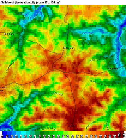
Below is the Elevation map of Sallebœuf, which displays elevation range with different colors. Scale of the first map is from 17 to 106 m (56 to 348 ft) with average elevation of 66.1 meters (=217 ft) [note 1]
These maps also provides idea of topography and contour of this city, they are displayed at different zoom levels. More info about maps, scale and edge coordinates you can find below images.
| \ | Map #1 | Topo.Map |
| Scale [m] | 17..106 m | × |
| Scale [ft] | 56..348 ft | × |
| Average | 66.1 m = 217 ft | × |
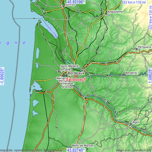
| Width | 6.93 km = 4.3 mi | 221.8 km = 137.8 mi |
| Height | 6.93 km = 4.3 mi | 221.8 km = 137.8 mi |
| ↑Max Latitude | 44.864486° | 45.82196° |
| Latitude at center | 44.83333° | 44.83333° |
| ↓Min Latitude | 44.802157° | 43.82745° |
| ← Min Longitude | -0.443945° | -1.80625° |
| Longitude center | -0.4° | -0.4° |
| →Max Longitude | -0.356055° | 1.00625° |
Nearby cities:
Cities around Sallebœuf sort by population:
• Tresses elevation 59 m
5.2 km,  287°
287°
• Bouliac 69 m
8.3 km,  257°
257°
• Carignan-de-Bordeaux 62 m
7.5 km,  240°
240°
• Sadirac 60 m
5.8 km,  190°
190°
• Créon 104 m
7.7 km,  147°
147°
• Pompignac 66 m
3.5 km,  304°
304°
• Montussan 29 m
5.5 km,  341°
341°
• Yvrac 70 m
6.8 km,  316°
316°
• Saint-Germain-du-Puch 47 m
6.8 km,  74°
74°
• Beychac-et-Caillau 52 m
4.9 km,  358°
358°
• Cénac 67 m
7.6 km,  218°
218°
• Fargues-Saint-Hilaire 84 m
3.9 km,  252°
252°
Multilingual:
 En español:
Sallebœuf elevación 91 m.
 En France:
Sallebœuf élévation 91 m.
 Auf Deutsch:
Sallebœuf höhe über dem Meeresspiegel ist 91 m.

Sources and notes:
- [note 1] Map square and city borders are not equal. Map elevation data is calculated only from area inside that square.
- [src 1] Elevation data from geonames database provided with same terms of usage.
- [src 2] The elevation map of Sallebœuf is generated using elevation data from NASA's 3 arcsec (90m) resolution SRTM data.
- [src 3] Base (background) map © OpenStreetMap contributors tiles are generated by Geofabrik and OpenTopoMap.
Copyright & License:
This Sallebœuf Elevation Map is licensed under CC BY-SA. You may reuse any part from this page, if you give a proper credit by linking to this URL:
 More info on terms of use page.