Tresses elevation
Tresses (Nouvelle-Aquitaine, Gironde), France elevation is 59 meters and Tresses elevation in feet is 194 ft above sea level [src 1]. Tresses is a populated place (feature code) with elevation that is 115 meters (377 ft) smaller than average city elevation in France.
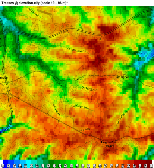
Below is the Elevation map of Tresses, which displays elevation range with different colors. Scale of the first map is from 19 to 96 m (62 to 315 ft) with average elevation of 67.3 meters (=221 ft) [note 1]
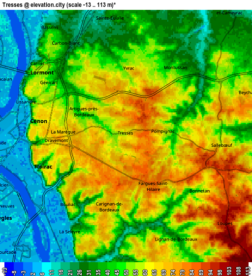
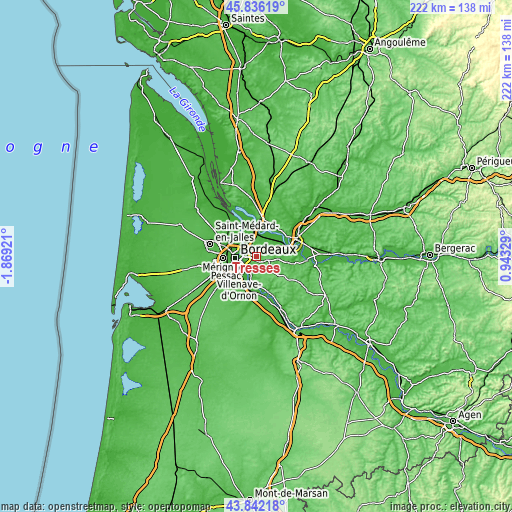
These maps also provides idea of topography and contour of this city, they are displayed at different zoom levels. More info about maps, scale and edge coordinates you can find below images.
| \ | Map #1 | Map #2 | Topo.Map |
| Scale [m] | 19..96 m | -13..113 m | × |
| Scale [ft] | 62..315 ft | -43..371 ft | × |
| Average | 67.3 m = 221 ft | 47.7 m = 156 ft | × |
| Width | 6.93 km = 4.3 mi | 13.86 km = 8.6 mi | 221.7 km = 137.8 mi |
| Height | 6.93 km = 4.3 mi | 13.86 km = 8.6 mi | 221.7 km = 137.8 mi |
| ↑Max Latitude | 44.878958° | 44.910089° | 45.83619° |
| Latitude at center | 44.84781° | 44.84781° | 44.84781° |
| ↓Min Latitude | 44.816645° | 44.785463° | 43.84218° |
| ← Min Longitude | -0.506905° | -0.550851° | -1.86921° |
| Longitude center | -0.46296° | -0.46296° | -0.46296° |
| →Max Longitude | -0.419015° | -0.375069° | 0.94329° |
Nearby cities:
Cities around Tresses sort by population:
• Lormont elevation 47 m
5.3 km,  304°
304°
• Cenon 64 m
4.5 km,  281°
281°
• Floirac 65 m
4.4 km,  246°
246°
• Artigues-près-Bordeaux 72 m
4.2 km,  273°
273°
• Bouliac 69 m
4.6 km,  222°
222°
• Carignan-de-Bordeaux 62 m
5.6 km,  196°
196°
• Pompignac 66 m
2.1 km,  79°
79°
• Montussan 29 m
4.9 km,  41°
41°
• Yvrac 70 m
3.4 km,  5°
5°
• Sallebœuf 91 m
5.2 km,  107°
107°
• Beychac-et-Caillau 52 m
5.8 km,  55°
55°
• Fargues-Saint-Hilaire 84 m
3 km,  155°
155°
Multilingual:
 En español:
Tresses elevación 59 m.
 En France:
Tresses élévation 59 m.


Sources and notes:
- [note 1] Map square and city borders are not equal. Map elevation data is calculated only from area inside that square.
- [src 1] Elevation data from geonames database provided with same terms of usage.
- [src 2] The elevation map of Tresses is generated using elevation data from NASA's 3 arcsec (90m) resolution SRTM data.
- [src 3] Base (background) map © OpenStreetMap contributors tiles are generated by Geofabrik and OpenTopoMap.
Copyright & License:
This Tresses Elevation Map is licensed under CC BY-SA. You may reuse any part from this page, if you give a proper credit by linking to this URL:
 More info on terms of use page.