Sées elevation
Sées (Normandy, Département de l'Orne), France elevation is 186 meters and Sées elevation in feet is 610 ft above sea level [src 1]. Sées is a populated place (feature code) with elevation that is 12 meters (39 ft) bigger than average city elevation in France.
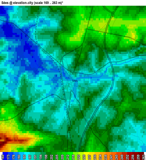
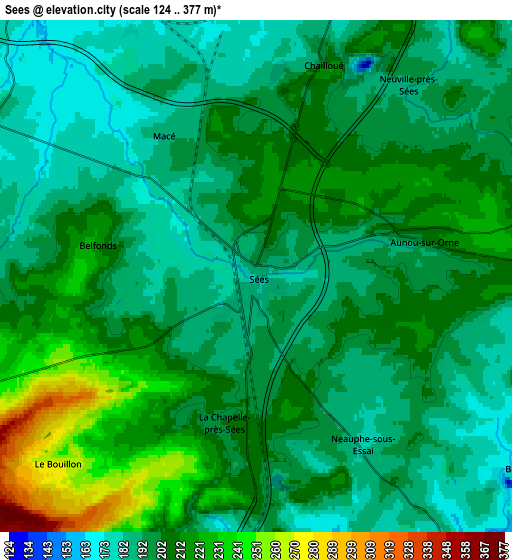
Below is the Elevation map of Sées, which displays elevation range with different colors. Scale of the first map is from 169 to 263 m (554 to 863 ft) with average elevation of 196 meters (=643 ft) [note 1]
These maps also provides idea of topography and contour of this city, they are displayed at different zoom levels. More info about maps, scale and edge coordinates you can find below images.
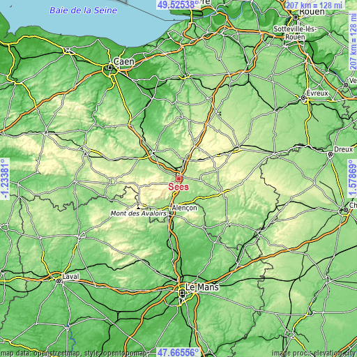
| \ | Map #1 | Map #2 | Topo.Map |
| Scale [m] | 169..263 m | 124..377 m | × |
| Scale [ft] | 554..863 ft | 407..1237 ft | × |
| Average | 196 m = 643 ft | 202.7 m = 665 ft | × |
| Width | 6.46 km = 4 mi | 12.92 km = 8 mi | 206.8 km = 128.5 mi |
| Height | 6.46 km = 4 mi | 12.92 km = 8 mi | 206.8 km = 128.5 mi |
| ↑Max Latitude | 48.633081° | 48.662115° | 49.52538° |
| Latitude at center | 48.60403° | 48.60403° | 48.60403° |
| ↓Min Latitude | 48.574962° | 48.545878° | 47.66556° |
| ← Min Longitude | 0.128495° | 0.084549° | -1.23381° |
| Longitude center | 0.17244° | 0.17244° | 0.17244° |
| →Max Longitude | 0.216385° | 0.260331° | 1.57869° |
Nearby cities:
Cities around Sées sort by population:
• Alençon elevation 141 m
19.7 km,  197°
197°
• Argentan 159 m
21.1 km,  317°
317°
• Saint-Germain-du-Corbéis 134 m
21.8 km, 201°
• Damigny 147 m
18.8 km, 204°
• Condé-sur-Sarthe 141 m
21.7 km,  208°
208°
• Gacé 198 m
22.9 km,  23°
23°
• Saint-Paterne 135 m
21.3 km,  191°
191°
• Valframbert 146 m
16.2 km, 196°
• Sainte-Gauburge-Sainte-Colombe 237 m
22.8 km,  56°
56°
• Mortrée 176 m
7.9 km,  299°
299°
• Saint-Denis-sur-Sarthon 192 m
23.3 km,  223°
223°
• Radon 177 m
12.4 km, 204°
Multilingual:
 En español:
Sées elevación 186 m.
 En France:
Sées élévation 186 m.


Sources and notes:
- [note 1] Map square and city borders are not equal. Map elevation data is calculated only from area inside that square.
- [src 1] Elevation data from geonames database provided with same terms of usage.
- [src 2] The elevation map of Sées is generated using elevation data from NASA's 3 arcsec (90m) resolution SRTM data.
- [src 3] Base (background) map © OpenStreetMap contributors tiles are generated by Geofabrik and OpenTopoMap.
Copyright & License:
This Sées Elevation Map is licensed under CC BY-SA. You may reuse any part from this page, if you give a proper credit by linking to this URL:
 More info on terms of use page.