Senlis elevation
Senlis (Hauts-de-France, Département de l'Oise), France elevation is 67 meters and Senlis elevation in feet is 220 ft above sea level [src 1]. Senlis is a seat of a third-order administrative division (feature code) with elevation that is 107 meters (351 ft) smaller than average city elevation in France.
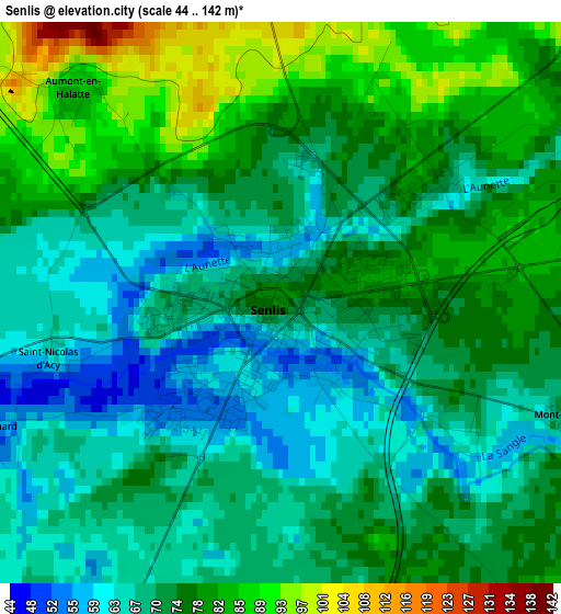
Below is the Elevation map of Senlis, which displays elevation range with different colors. Scale of the first map is from 44 to 142 m (144 to 466 ft) with average elevation of 73.1 meters (=240 ft) [note 1]
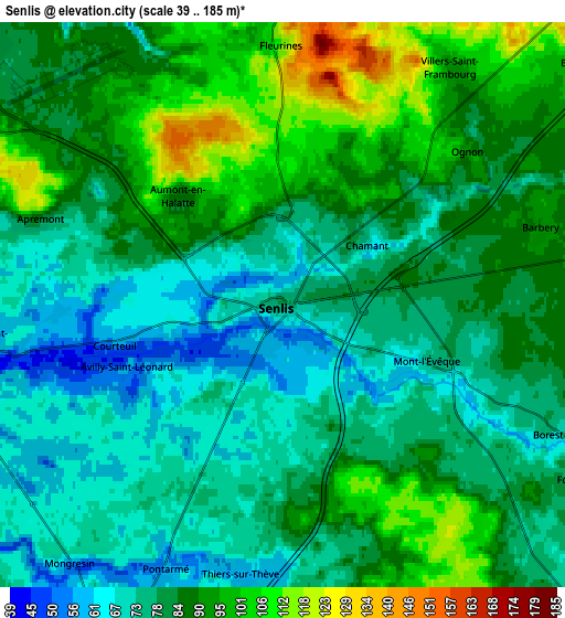
These maps also provides idea of topography and contour of this city, they are displayed at different zoom levels. More info about maps, scale and edge coordinates you can find below images.
| \ | Map #1 | Map #2 | Topo.Map |
| Scale [m] | 44..142 m | 39..185 m | × |
| Scale [ft] | 144..466 ft | 128..607 ft | × |
| Average | 73.1 m = 240 ft | 82.7 m = 271 ft | × |
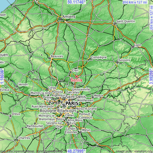
| Width | 6.38 km = 4 mi | 12.77 km = 7.9 mi | 204.3 km = 126.9 mi |
| Height | 6.38 km = 4 mi | 12.77 km = 7.9 mi | 204.3 km = 126.9 mi |
| ↑Max Latitude | 49.235942° | 49.264628° | 50.11746° |
| Latitude at center | 49.20724° | 49.20724° | 49.20724° |
| ↓Min Latitude | 49.178521° | 49.149786° | 48.27995° |
| ← Min Longitude | 2.542665° | 2.498719° | 1.18036° |
| Longitude center | 2.58661° | 2.58661° | 2.58661° |
| →Max Longitude | 2.630555° | 2.674501° | 3.99286° |
Nearby cities:
Cities around Senlis sort by population:
• Creil elevation 73 m
9.2 km,  306°
306°
• Pont-Sainte-Maxence 37 m
10.6 km,  7°
7°
• Chantilly 53 m
8.5 km,  260°
260°
• Verneuil-en-Halatte 38 m
9.2 km,  330°
330°
• Orry-la-Ville 75 m
9.9 km,  213°
213°
• Saint-Maximin 60 m
9.8 km,  279°
279°
• La Chapelle-en-Serval 68 m
9.6 km,  203°
203°
• Fleurines 111 m
5.8 km,  358°
358°
• Vineuil-Saint-Firmin 58 m
6.7 km, 263°
• Chamant 74 m
2.3 km,  52°
52°
• Thiers-sur-Thève 59 m
6.2 km,  190°
190°
• Avilly-Saint-Léonard 50 m
3.6 km,  246°
246°
Multilingual:
 En español:
Senlis elevación 67 m.
 En France:
Senlis élévation 67 m.


Sources and notes:
- [note 1] Map square and city borders are not equal. Map elevation data is calculated only from area inside that square.
- [src 1] Elevation data from geonames database provided with same terms of usage.
- [src 2] The elevation map of Senlis is generated using elevation data from NASA's 3 arcsec (90m) resolution SRTM data.
- [src 3] Base (background) map © OpenStreetMap contributors tiles are generated by Geofabrik and OpenTopoMap.
Copyright & License:
This Senlis Elevation Map is licensed under CC BY-SA. You may reuse any part from this page, if you give a proper credit by linking to this URL:
 More info on terms of use page.