Serqueux elevation
Serqueux (Normandy, Seine-Maritime), France elevation is 167 meters and Serqueux elevation in feet is 548 ft above sea level [src 1]. Serqueux is a populated place (feature code) with elevation that is 7 meters (23 ft) smaller than average city elevation in France.
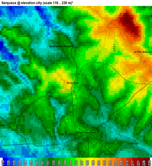
Below is the Elevation map of Serqueux, which displays elevation range with different colors. Scale of the first map is from 116 to 230 m (381 to 755 ft) with average elevation of 159.4 meters (=523 ft) [note 1]
These maps also provides idea of topography and contour of this city, they are displayed at different zoom levels. More info about maps, scale and edge coordinates you can find below images.
| \ | Map #1 | Topo.Map |
| Scale [m] | 116..230 m | × |
| Scale [ft] | 381..755 ft | × |
| Average | 159.4 m = 523 ft | × |
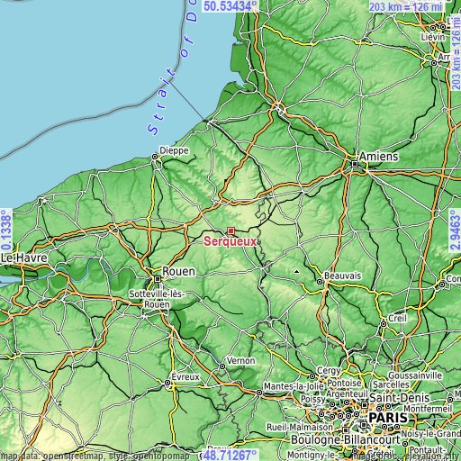
| Width | 6.33 km = 3.9 mi | 202.6 km = 125.9 mi |
| Height | 6.33 km = 3.9 mi | 202.5 km = 125.8 mi |
| ↑Max Latitude | 49.660475° | 50.53434° |
| Latitude at center | 49.63202° | 49.63202° |
| ↓Min Latitude | 49.603549° | 48.71267° |
| ← Min Longitude | 1.496105° | 0.1338° |
| Longitude center | 1.54005° | 1.54005° |
| →Max Longitude | 1.583995° | 2.9463° |
Nearby cities:
Cities around Serqueux sort by population:
• Gournay-en-Bray elevation 99 m
21.3 km,  141°
141°
• Neufchâtel-en-Bray 88 m
13.4 km,  327°
327°
• Forges-les-Eaux 167 m
2 km,  170°
170°
• Aumale 118 m
21.8 km,  45°
45°
• Saint-Saëns 111 m
18.9 km,  283°
283°
• Formerie 226 m
13.9 km,  82°
82°
• Feuquières 195 m
22.2 km,  85°
85°
• Gaillefontaine 170 m
5.9 km,  66°
66°
• Buchy 196 m
14.1 km,  248°
248°
• Mesnières-en-Bray 71 m
18.4 km,  321°
321°
• La Feuillie 178 m
18.8 km,  185°
185°
• Saint-Martin-Osmonville 172 m
17.3 km,  272°
272°
Multilingual:
 En español:
Serqueux elevación 167 m.
 En France:
Serqueux élévation 167 m.
 Auf Deutsch:
Serqueux höhe über dem Meeresspiegel ist 167 m.

Sources and notes:
- [note 1] Map square and city borders are not equal. Map elevation data is calculated only from area inside that square.
- [src 1] Elevation data from geonames database provided with same terms of usage.
- [src 2] The elevation map of Serqueux is generated using elevation data from NASA's 3 arcsec (90m) resolution SRTM data.
- [src 3] Base (background) map © OpenStreetMap contributors tiles are generated by Geofabrik and OpenTopoMap.
Copyright & License:
This Serqueux Elevation Map is licensed under CC BY-SA. You may reuse any part from this page, if you give a proper credit by linking to this URL:
 More info on terms of use page.